A flat 4 km loop around the Huay Tung Tao reservoir at the foot of Doi Suthep, 20 minutes from the Chiang Mai Old City. Easy walking on dirt and grass, three swim spots, raft restaurants serving Northern Thai food on the eastern shore, and the only family-friendly hike near the city where strollers and small children manage the whole circuit. Year-round, ninety minutes door-to-door, 50 baht entry.
Updated
Overview and why hike it
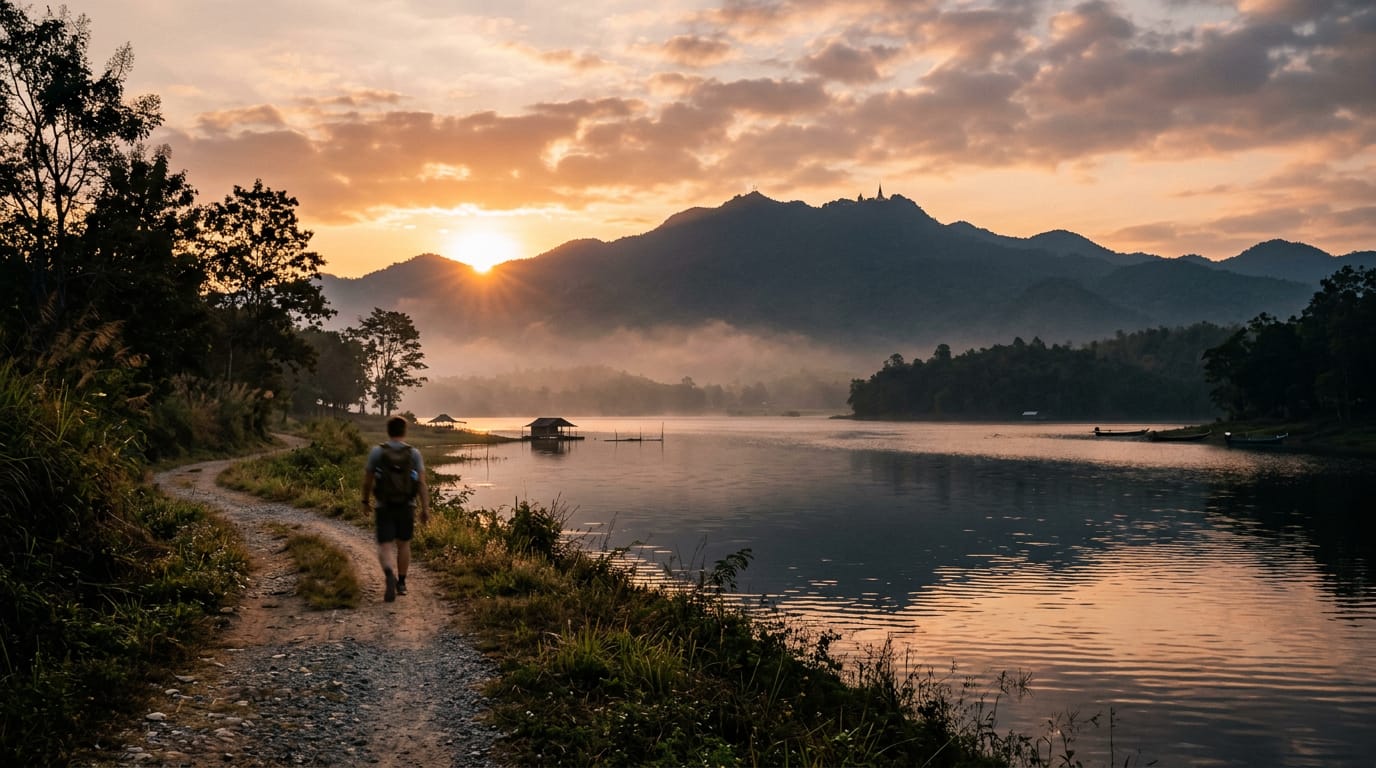
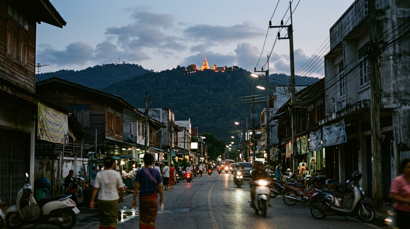
Huay Tung Tao (huay is Thai for stream) is the easiest hike in this guide and the one I recommend most often to visitors arriving in Chiang Mai with families, jet lag, or a single free afternoon. It is a 4 km flat loop around a man-made reservoir built in 1979 for irrigation of the na (rice paddy) plain north of the city. The reservoir sits at 350 m at the foot of doi Suthep (doi is the northern Thai word for mountain), and the loop circuits the water at the level of the dam wall.
You pay 50 baht (the Thai currency, written THB) at a small wooden ticket office at the south-east entrance, park inside the grounds for another 10 to 20 THB, and walk. Total elevation gain is 80 m, almost all on the dam wall. The path is hard-packed dirt and grass for most of its length, with one short cobble section and one small wooden bridge. Strollers and confident beginners manage the whole circuit without trouble.
What you get for the modest effort is the best foot of doi Suthep view from any flat point near the city, three swim spots in clean reservoir water, twenty bamboo raft restaurants strung along the eastern shore serving grilled tilapia and som tam (green papaya salad), and a complete circuit in 90 minutes door-to-door. It is the only walk on this list where you can include lunch, a swim and a small child without compromise.
Locals use Huay Tung Tao as a daily walking and jogging loop and an evening picnic spot. On Sundays it is a lunch venue, with family parties filling the rafts from 10:00. International visitors often skip it on the assumption that it is too easy to bother with. They are usually wrong. It does not replace a real mountain day, but as a half-day in the heat or a recovery walk between bigger hikes, it is hard to better. Treat it as a feature, not a stepping stone.
Getting to the trailhead
The reservoir is at 18.8895 N, 98.9180 E in Don Kaeo subdistrict of Mae Rim, about 12 km north-west of the Chiang Mai Old City moat. By road it is a 20 minute drive on weekdays and 25 to 30 minutes at weekends.
Red songthaews (shared pick-up truck taxis) running the regular Mae Rim service can drop you at the reservoir for around 50 THB shared per person. Going to Mae Rim, ask for “Huay Tung Tao” (pronounced roughly hoo-eye toong tao). A private charter from Tha Phae Gate runs 150 to 200 THB one way and 350 to 450 THB return. If you take the shared songthaew out, you will likely need to charter the return because the shared route does not stop reliably at the reservoir on the way back; alternatively walk 600 m back to the main road and flag down anything heading south.
Grab works reliably from the Old City and quotes 90 to 140 THB depending on day and traffic. Return Grab from the reservoir is usually available within five minutes from the eastern car park.
A rented scooter is the easiest option for a confident rider. The road from the Old City uses Canal Road north and a short stretch of Highway 107 before turning west at the Mae Rim junction. Quiet roads, two sets of traffic lights, signed parking inside the reservoir grounds for 10 THB. Allow 25 minutes outbound at a relaxed pace.
The reservoir entrance gate is on the south-eastern corner. The ticket office is a small wooden hut on the right of the road; pay your 50 THB per person and 10 to 20 THB for parking, and continue 200 m to the main car park area beside the raft restaurants. You can pick up the loop from anywhere along the eastern shore, but starting from the southern end of the raft restaurants and walking clockwise is the most common direction.
Toilets are at the southern and eastern car parks. The southern toilet block has a small fee of 5 THB; the eastern is free of charge but less well maintained. Showers are available at some of the raft restaurants for 20 THB if you have been swimming.
Turn-by-turn description
Southern car park to the dam wall (0 to 1 km, +60 m)
From the southern car park, walk west along the dirt track that leaves the parking apron beside the small police hut. The track runs along a low embankment with the reservoir on your right and a stand of mature eucalyptus on your left. The trees release a strong menthol smell in the morning sun. This is the most shaded section of the loop.
At 400 m the path turns sharp right and begins the only real climb of the day, the 60 m rise to the top of the dam wall. The slope is gentle, on a wide cobble path that takes any pace. Halfway up, a small wooden platform on the right gives a view back across the reservoir to the eastern shore. The full curve of Doi Suthep rises behind it, with the gold of the Wat Phra That Doi Suthep chedi (bell-shaped reliquary tower) visible on clear mornings.
The top of the dam wall is the high point of the loop at about 430 m. A modest stone monument commemorates the construction of the reservoir in 1979. The dam runs straight for about 300 m, with a clear path along the top.
Dam wall and the western shore (1 to 2.5 km, -30 m)
The far end of the dam wall drops gently onto the western shore. The path here is grass and broken laterite, slightly rougher than the eastern side but still flat. You leave the eucalyptus stand and enter open scrub with small acacia trees and patches of long grass. This is the quietest section of the loop and the one with the best swim spots.
The first swim inlet is at about 1.4 km, a small sand-bank where the shoreline drops gently into the water. Locals call it the children’s beach. The water is shallow for about 5 m and then drops away to about 2 m. Watch small children. There is no shade here, so plan a swim early in the morning or late in the afternoon.
The path continues north along the western shoreline for another 600 m, with occasional small trees and a single rough bench. There is a second swim spot at about 2 km, with deeper water and a small dock that locals use for fishing. Both spots are clean.
At 2.5 km the path crosses a small feeder stream on a wooden bridge with a 4 cm step at either end. The bridge is sound but the planks creak; one person at a time if you are nervous. Beyond the bridge the path bends right and begins to follow the northern shore of the reservoir.
Northern shore and the inlets (2.5 to 3.2 km, +20 m)
The northern shore is the most varied section of the loop. The path runs through patches of long grass and small thickets of bamboo, with two short detours around feeder streams that have been culverted under low wooden bridges. There are three small inlets along this stretch where you can sit at the water’s edge; the middle one is the prettiest, with reeds and water lilies and the occasional flash of kingfisher.
You can hear the cars on the main road faintly through the trees at the eastern end of this section. The reservoir narrows here and the eastern shore is visible across the water.
At 3.2 km the path joins a wider track that has been used by farm pickups in the past. This is the only section where you might share the loop with a vehicle, although traffic is rare and almost always slow-moving.
Eastern shore and the raft restaurants (3.2 to 4 km, -50 m)
The final section of the loop is the busiest. The path delivers you to the northern end of the strip of bamboo raft restaurants that line the eastern shore for about 600 m. There are around 20 individual rafts, each a small woven-bamboo platform over the water with a thatched roof and woven mat seating. You take your shoes off, sit cross-legged on the mat and order from a basic Thai-English menu.
The path runs behind the rafts along a paved walkway. There is no obstacle to continuing the loop, but the temptation to stop is strong. The smell of grilling fish and toasted sticky rice carries down the line.
The southern end of the raft strip returns you to the main car park and ticket office where you started.
Difficulty and safety
The hike is rated easy and is the only hike in this guide that I recommend without conditions for first-time visitors, small children, and anyone walking off a long flight. The risks come down to heat and water, plus the occasional stray dog near the car parks.
Heat is the main concern. The loop has very limited shade outside the eucalyptus grove on the southern shore. Daytime temperatures in March and April can hit 38 degrees on the dam wall and the western shoreline, and there is no place to refill water between the southern entrance and the raft restaurants. Walk early or late in the hot months.
Reservoir water is clean but not treated and should not be drunk. Cold drinks are available at the raft restaurants and at a small kiosk near the southern car park.
Children should be watched on the dam wall, which has no fence on the water side. The drop is about 8 m to the water surface, then a further 6 m to the reservoir floor. Most years see one or two minor incidents but no recent serious accidents.
Stray dogs gather near the southern car park and the entrance gate. They are usually friendly but a small pack occasionally forms around food scraps left by tourists. Walk steadily past them. There have been no recent rabies cases at the reservoir, but if bitten, seek vaccination within 24 hours at Chiang Mai Ram Hospital.
Mobile phone signal is reliable on the entire loop. AIS and TrueMove both work without interruption.
What to pack
- 1.5 litres of water per person
- Sun hat and sunscreen (limited shade on three quarters of the loop)
- Light long-sleeve shirt for sun cover
- Swim clothes and a small towel
- 200 THB cash for entry, drinks and a snack
- Insect repellent for the eucalyptus grove around dusk
- Phone with offline maps as a backup
- Light rain shell from May through October
- Snacks for small children, although the raft restaurants serve quick food
- Trainers or sandals; trekking boots are not needed
Permits and fees
The 50 THB per person entrance fee is collected at the south-eastern gate from 06:00 to 18:00. Cars pay 20 THB and motorbikes pay 10 THB on top. The fee covers maintenance of the path, the toilet blocks, and rubbish collection. No additional permit is required for the loop, for swimming, or for the raft restaurants. Outside operating hours the gate is open and unstaffed, and there is no entry charge for sunrise walks before 06:00 or after 18:00, although the raft restaurants and toilets are closed at those times. The fee is sub-district revenue, not national park revenue, so it does not stack with the Doi Suthep-Pui National Park ticket on the same day.
When to hike
The loop works year-round, which is its biggest single advantage over the longer hikes in this guide.
November to February is the cool season. Day temperatures of 22 to 28 degrees, low humidity, clear long views of Doi Suthep behind the reservoir. Mornings can be foggy until 09:00, which is its own kind of pretty. This is the prime season for the raft restaurants, and weekends can be busy.
March to May is the hot season. Day temperatures climb to 36 to 40 degrees and the loop is unpleasant after 09:30. Walk at sunrise or after 17:00. The swim spots become more important. April is also the worst smoke month from agricultural burning, although the city is more affected than the reservoir itself because Huay Tung Tao sits 100 m above the smoke layer on most days.
June to October is the wet season. Afternoon thunderstorms are routine and the path turns muddy in places. The reservoir level is at its highest, narrowing the swim inlets but improving the views. The raft restaurants stay open through the rain. Bring a light shell and accept the conditions.
Where to eat and refresh after
The raft restaurants are the obvious answer and the reason most local families come at all. Pick any of the twenty rafts on the eastern shore; standards are similar and prices are within 10 THB of each other. Raft 8 (numbered on a wooden sign) is the longest-established and has the most reliable kitchen, and Raft 14 specialises in salt-crust grilled fish. A whole tilapia is 200 to 250 THB and feeds two adults with a side of som tam papaya salad at 60 THB, sticky rice at 20 THB and a cold Chang beer at 80 THB. If you prefer to eat off the rafts, the Khao Soi Mae Sai food stall at the southern car park does a solid 50 THB bowl of khao soi (curried egg noodle soup), and the small kiosk beside the entrance gate sells fresh young coconuts at 70 THB and bags of cut pineapple at 30 THB.
A small note on the famous Sherwood Forest film set
About 800 m north of the reservoir, on the same side road, sits a small open-air film set built in 2014 for the Thai film “Krating Daeng Sherwood Forest”. The set consists of a cluster of stilted wooden cabins, a small wooden footbridge and a couple of artificial waterfalls running off a low cliff. It is not part of the reservoir loop and not part of the 50 THB ticket; entry to the film set is a separate 50 THB. The set is a popular photo stop for Thai weekend visitors but adds about an hour to the trip and is genuinely a film set rather than a piece of forest, so do not expect anything natural. The path between the reservoir and the film set is a flat 800 m dirt track that can be walked in 15 minutes. Combining the two is a common Sunday family itinerary. If you only have time for one, choose the reservoir loop; the film set is a curiosity but not the main attraction. The walk between the two is unremarkable but gives small children a sense of completing a longer outing.
A note on the army camp and the air force base nearby
The reservoir was originally built in 1979 to supply water for the rifle ranges of the Thai Royal Army’s 7th Infantry Battalion, whose camp sits about 1.5 km east of the reservoir entrance. The camp is fenced off and not open to the public, but the perimeter fence runs close to the access road. On weekdays you sometimes hear small-arms fire from the rifle range carrying across the water during the morning. It is not loud enough to be unpleasant and stops by mid-afternoon, but if you are unprepared the sound can be alarming. Local families ignore it. Visitors arriving from countries without an audible military presence sometimes ask the ticket office whether something is wrong; the staff are used to the question. A separate air force base sits 5 km south, but its flight path does not cross the reservoir at low altitude and noise from aircraft is rare.
A short note on Huay Tung Tao as a training loop
Many local hikers and trail runners use Huay Tung Tao as the regular training loop between bigger weekend mountain days. A single loop is 4 km, which makes counting easy. Two loops at a brisk pace gets you 8 km of flat in around an hour and a half, which is the standard low-effort recovery session on the Monday after a Doi Pui or Doi Lanka Noi weekend. Three loops is 12 km of flat in around two hours and twenty minutes, which is the standard build session for anyone training up to a long-day traverse. The 50 THB entry covers as many laps as you can manage in a day. The eastern raft restaurants form a natural water station between laps and the southern car park toilets work for a quick pit stop. None of this is on the standard tourist itinerary but it explains why you sometimes see the same lean runner pass you for the second or third time on a quiet weekday morning. If you are in Chiang Mai for a week and want a place to walk every morning before breakfast, this is the loop.
Nearby and related
Huay Tung Tao sits at the eastern foot of doi Suthep and pairs naturally with a half-day visit to the mountain. For the easy way up, the Doi Suthep mountain guide covers the road route, the cable car alternative, and the timing for visiting the chedi at the summit. For a more challenging hike on the same massif, the Doi Pui to Doi Suthep traverse is the obvious next step up. For another easy nature trail with less driving, see the Doi Inthanon nature trail guide, 60 km south. For the full picture of walking near the city, browse the hiking hub.
Photos


Frequently asked questions
Is the Huay Tung Tao loop suitable for small children?
Yes. The path is flat, mostly shaded, and has no traffic apart from the occasional maintenance pickup. A four-year-old can walk the whole circuit in about two and a half hours including stops; younger children fit in a stroller or carrier without issue. The eastern raft restaurants are a natural break point with cold drinks, toilets and grilled snacks. There is no fence between the path and the water in most places, so keep an eye on toddlers near the steeper banks on the dam wall. The reservoir water is generally clean and safe for paddling, although you should not drink it.
Can I swim in the reservoir?
Yes, and many locals do. The best swim spots are the gentle sand-bank inlet on the western shore about halfway round the loop, and the shallow shore in front of the raft restaurants on the eastern side. The middle of the reservoir is deep, around 8 metres at the dam end, and there are no lifeguards anywhere. The water is reservoir water, not treated, so it is clean enough to swim in but not safe to drink. There have been a small number of drowning incidents in the past decade, all involving non-swimmers in the deep central section. Stay near the shore and supervise children.
How do I get there from the Old City?
Red songthaews running the regular Mae Rim route will drop you at the reservoir for around 50 THB shared, or a private charter from Tha Phae Gate runs 150 to 200 THB one way. Grab works reliably and quotes 90 to 140 THB. A rented scooter is the easiest option for confident riders, 20 minutes on quiet roads, and parking inside the reservoir grounds is 10 THB. A taxi is unnecessary unless you want air-conditioning. Allow extra time on Saturday and Sunday mornings, when local families queue at the entrance gate from 09:00.
Are there mosquitos and other insects?
Some, but not enough to ruin the hike. Mosquitos are mostly an issue around dusk on the southern shoreline where the eucalyptus grove holds damp; carry repellent if you plan to stay for sunset. Sand flies appear in small numbers around the raft restaurants in May and June. There are no leeches at this elevation. Snakes are possible in the long grass on the western shore, especially in the wet season, but the path itself is wide enough that encounters are uncommon. The biggest insect nuisance is usually large ants on the picnic mats.
Can I do the loop with a stroller or wheelchair?
A robust stroller with off-road wheels handles the whole circuit. The southern half is the smoothest, running on hard-packed dirt that takes any wheel. The northern half includes about 200 m of broken track and one small wooden bridge with a 4 cm step that requires lifting. A standard wheelchair manages about 70 percent of the loop comfortably, but the western shoreline path has loose stones and uneven gradient and is hard going. An off-road wheelchair handles the full loop without issue, although the dam wall has a short cobble section that needs assistance.
Do I have to pay the 50 baht entry fee?
Yes, and it is enforced by a small ticket office at the south-east entrance. Cars also pay 20 THB and motorbikes pay 10 THB at the same gate. The fee funds basic maintenance of the path, toilets, and rubbish collection by the local sub-district administration. It is collected from 06:00 to 18:00; outside those hours the gate is open and unstaffed. Sunday morning at 06:30 you can walk the loop free of charge if you prefer, but local sentiment is that the small fee is fair and worth paying. Bring small notes; the ticket office is sometimes slow to make change.
What food is available at the raft restaurants?
Northern Thai standards at modest prices. Grilled tilapia salt-crust is the speciality at around 200 THB for a whole fish big enough for two. Som tam papaya salad is 60 to 80 THB. Kao niao sticky rice is 20 THB. Cold drinks include fresh young coconuts at 70 THB, Chang and Singha beer at 80 THB. The rafts are decorated for groups; you sit on the woven mat in a small open hut, take your shoes off and eat in the shade with your feet over the water. Avoid weekend midday in the cool season when the rafts are full and the wait for food can stretch to 45 minutes.
How does it compare to other hikes near Chiang Mai?
Huay Tung Tao is the gentle, accessible end of the spectrum. The Doi Pui to Doi Suthep traverse is a full mountain day at 13 km and 850 m of climb, and the Doi Lanka Noi loop is a 700 m climb to a 2,031 m summit. Huay Tung Tao is 4 km flat with a 50 baht gate fee and a raft restaurant at the end. It is the only hike on this list that small children, grandparents and beginning hikers all manage comfortably. It is also the only hike near the city where you can swim mid-route. Treat it as a recovery walk between bigger days, or as the standalone hike for a family afternoon.
Is it busy?
Quiet on weekday mornings, moderately busy on weekday afternoons, busy on weekends. Saturday and Sunday from 10:00 onwards the raft restaurants fill up and the loop sees a steady stream of local family parties. The path is wide enough that it never feels crowded, but the entrance car park can have over 200 vehicles on a Sunday in February. If you want the reservoir nearly to yourself, arrive by 07:00 on any weekday or at 06:30 on a Sunday. Sunset hours (16:30 to 18:00) are also pleasant and progressively quieter.
Can I cycle the loop?
Yes, on a mountain bike or hardtail. The trail is wide and flat enough for casual cycling, and several Chiang Mai bike rental shops list it as a beginner route. Road bikes struggle with the loose gravel sections on the northern shoreline. Bikes share the path with walkers without issue most of the year, but on busy weekends you should ride very slowly and dismount around the raft restaurants. A full loop on a mountain bike takes 25 to 35 minutes including a stop at the dam wall. The entry fee is the same 50 THB regardless of how you cover the loop.
Related guides
Hike
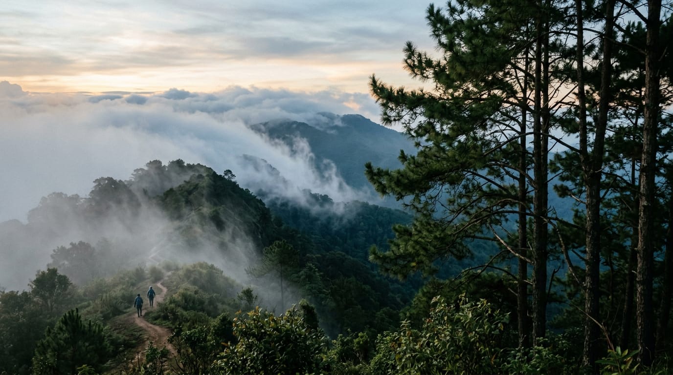
Doi Pui to Doi Suthep Traverse
A classic 13 km point-to-point traverse across the spine of Doi Suthep-Pui National Park, dropping from the Hmong village at Doi Pui (1,685 m) through pine and dipterocarp forest, past Wat Pha Lat, and finishing at the gilded chedi of Wat Phra That Doi Suthep. Six to eight hours, 850 m of climbing, 1,200 m of descent, a couple of springs, and one of the few hikes in northern Thailand where you finish at a working temple with songthaews waiting at the door.
Hike
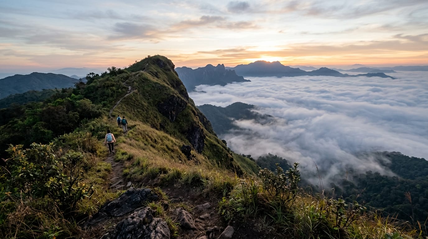
Doi Lanka Noi Loop
An 8 km loop on the southern shoulder of the Doi Lanka range inside Khun Chae National Park, two hours north-west of Chiang Mai. Five hours, 700 m of climb through evergreen montane forest to a 2,031 m summit ridge, with two streams to refill from and a high meadow that holds the last of the morning mist until almost 10:00. Quiet, properly remote, and the best summit day inside a half-day drive of the city.
Hike
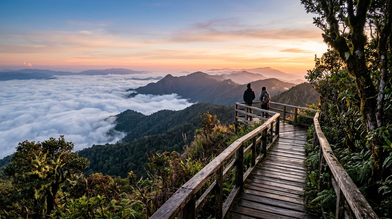
Doi Inthanon Nature Trail (Kew Mae Pan)
A 2.5 km loop at 2,200 m along the Kew Mae Pan ridge near the summit of Thailand's highest mountain, plus the easier 360 m Ang Ka Luang boardwalk through cloud forest. Ninety minutes for the main loop, no climb worth mentioning, but a local Karen guide is mandatory for Kew Mae Pan from November through May. Open seasonally; closed June through October for bird nesting.
Sight
Doi Suthep
Doi Suthep is the 1,676 m mountain that rises straight out of the western suburbs of Chiang Mai. The mountain holds the city's most photographed temple at 1,073 m, the king's winter palace, a Hmong village near the summit and several waterfalls — and is a separate destination from the temple of the same name, which sits on its flank.