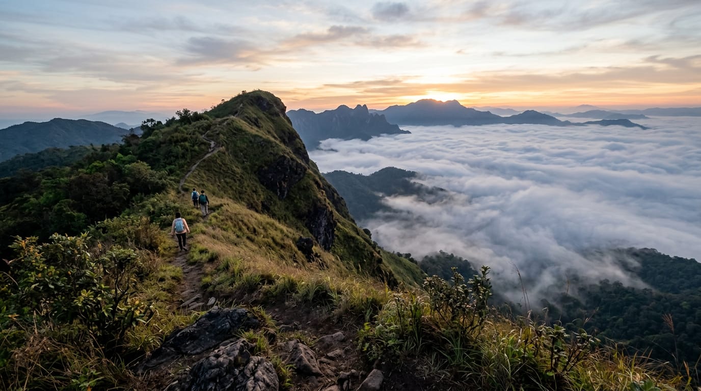
An 8 km loop on the southern shoulder of the Doi Lanka range inside Khun Chae National Park, two hours north-west of Chiang Mai. Five hours, 700 m of climb through evergreen montane forest to a 2,031 m summit ridge, with two streams to refill from and a high meadow that holds the last of the morning mist until almost 10:00. Quiet, properly remote, and the best summit day inside a half-day drive of the city.
Updated
Overview and why hike it
Doi Lanka Noi (doi is the northern Thai word for mountain) is the best summit-day hike inside three hours of Chiang Mai that almost nobody outside the local hiking community has heard of. The loop sits inside Khun Chae National Park, a 200 km² protected area on the eastern edge of Doi Lanka range, declared a park in 1995 but still operating with a single ranger station and Thai-only signage.
The route runs 8 km in a clockwise loop from the Mae Tho ranger car park. It climbs 700 m through three distinct forest bands, crosses a high meadow at 1,800 m that holds mist until mid-morning, summits a small rocky platform at 2,031 m, and descends through dwarf bamboo and laurel forest back to the start. Five hours for a reasonably fit walker including a 30-minute lunch on the summit, six hours if you stop often.
What you trade for the drive is a properly quiet day in real montane forest. The understory is dripping with epiphytes, the air at the top sits around 14 degrees even when Chiang Mai city hits 33, and you can hear individual birds rather than competing with songthaew (shared pick-up truck taxi) engines. On a good cool-season weekday you will see one or two other parties and a couple of park rangers. On a midweek hike outside Thai holidays you can have the entire summit to yourself for an hour.
It is rated hard for two reasons: the access (you must arrange your own transport and start the drive at 06:00) and the steep climb between the first stream and the high meadow, where the trail gains 400 m in 1.5 km on root-bound earth. Anyone fit enough for the Doi Pui traverse can manage Doi Lanka Noi. It is the natural next step.
Getting to the trailhead
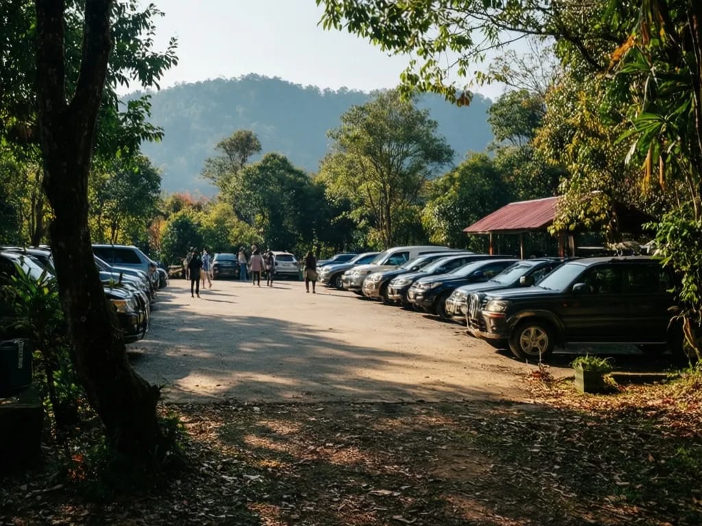
The trailhead is the Khun Chae National Park ranger station at Mae Tho, 18.5550 N, 98.1330 E. From the Chiang Mai Old City you have a 110 km drive that takes two hours in light traffic.
The most common route runs Highway 108 south for 70 km to Chom Thong, then west on Route 1099 for 35 km through Mae Tho district. Route 1099 is paved the entire way but narrow, twisting and unlit; on the return drive after dark you will be glad of fog lights and patience. Allow at least two and a half hours each way in either direction.
Self-driving is the simplest option. Most Chiang Mai car-hire firms charge 900 to 1,200 THB per day for a small automatic, plus around 250 THB of fuel for the round trip. Drives Asia, Budget and North Wheels all rent at the airport and in the Old City. A scooter is theoretically possible but a long, exposed, mostly highway ride that I do not recommend; if a tyre fails on Route 1099 there is no help for an hour in either direction.
Private drivers with cars from any Old City hotel cost 3,000 to 4,500 THB for the day depending on bargaining and how long you stay at the park. This is the best option for a group of two or three, because the per-person cost lands close to the hire car total and you do not lose two hours of attention to the driving.
There is no songthaew, no bus, no Grab. Do not plan this hike assuming public transport will appear.
The ranger station opens at 06:00 and the park gate at the bottom of the access road opens at 05:30. Pay your 200 THB foreigner entry fee at the ranger station, sign the trail register, and ask the duty ranger to confirm the current trail condition. They speak some English but a Thai phrasebook helps; the words sen thaang (trail) and kao (mountain) cover most of what you need.
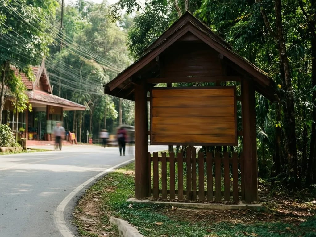
Park at the ranger station car park, a flat gravel area for about 20 vehicles. The trailhead is a small wooden arrow about 400 m up the access track, on the east side beside a stream culvert. There is no toilet at the trailhead; use the ranger block before you start.
Turn-by-turn description
Ranger station to the first stream (0 to 1.5 km, +120 m)
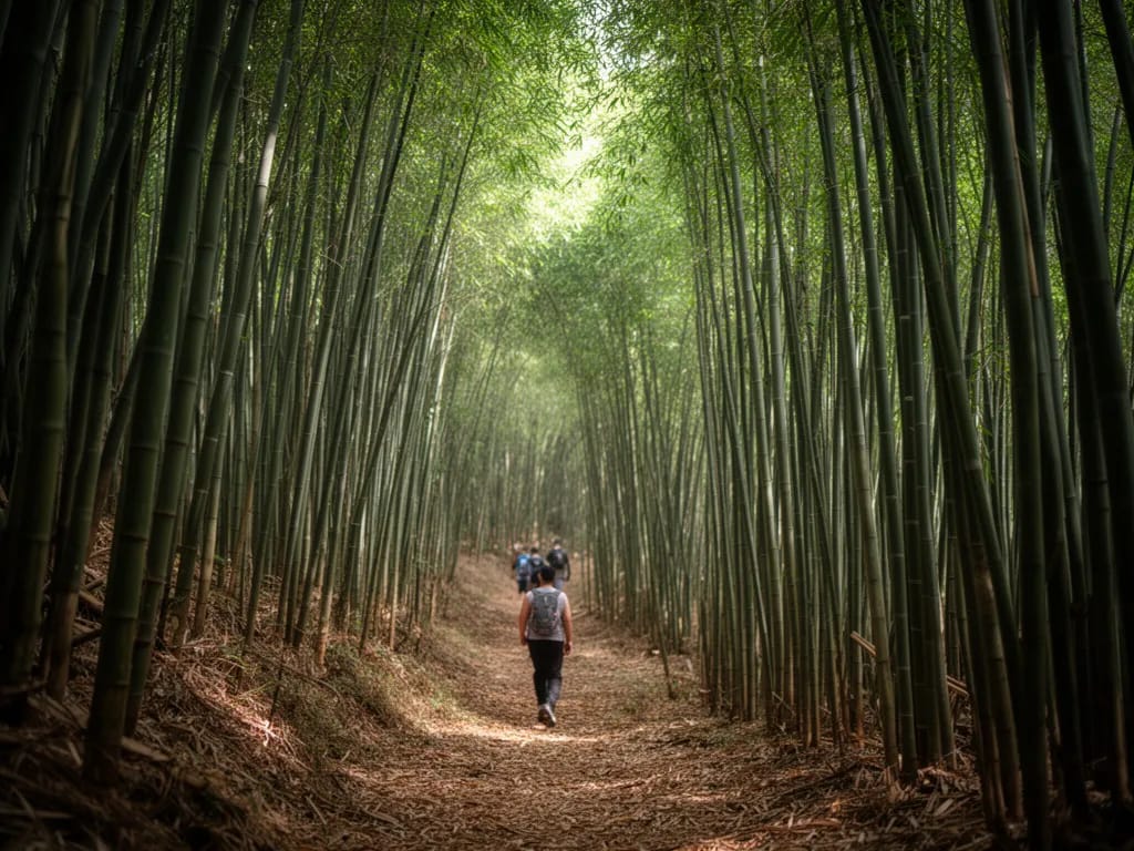
From the trailhead arrow, the path immediately drops 20 m to cross a small dry gully, then rises gently through secondary forest mixed with bamboo clumps. This first kilometre is the most leech-prone section in the wet season because the path holds damp from the gully on either side. In the cool season it is dry and unremarkable.
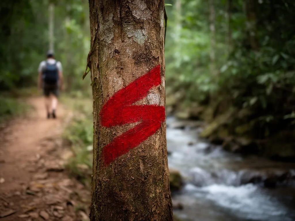
At 600 m the trail bends sharp left at a clear T-junction. A faint footpath continues straight on towards Hmong farmland; ignore it. Take the left turn and climb gently for another 800 m through a stand of mature dipterocarp with occasional Indian rosewood. Red painted blazes on tree trunks confirm you are on the route, although they fade quickly and a fresh repaint usually happens each November.
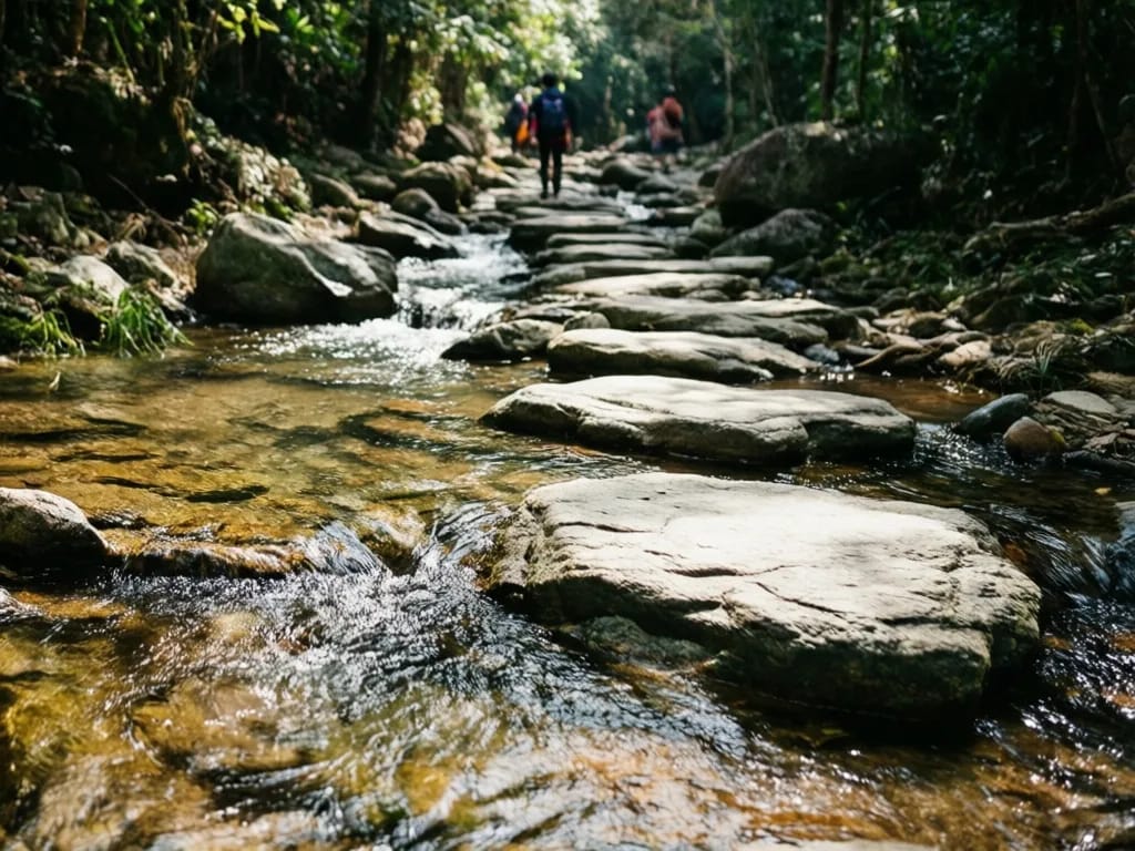
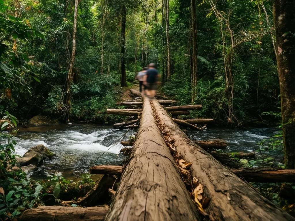
The path delivers you to a small open clearing on the bank of the first stream at about 1.5 km. The stream runs clear over flat stones, 2 metres wide and ankle-deep in the cool season, knee-deep after rain. There is a fallen log bridge if you do not want wet feet, but the log is moss-slick after rain and most people just wade. This is the first reliable water source on the route. Filter or treat the water if you intend to drink it.
Steep climb to the high meadow (1.5 to 3 km, +400 m)
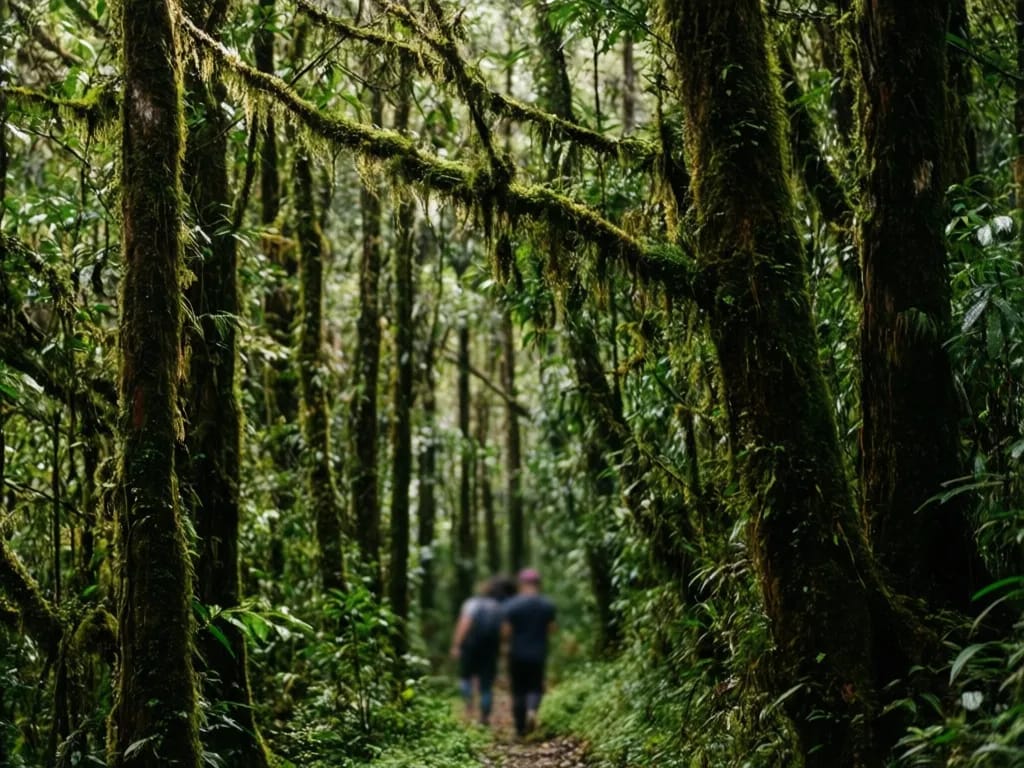
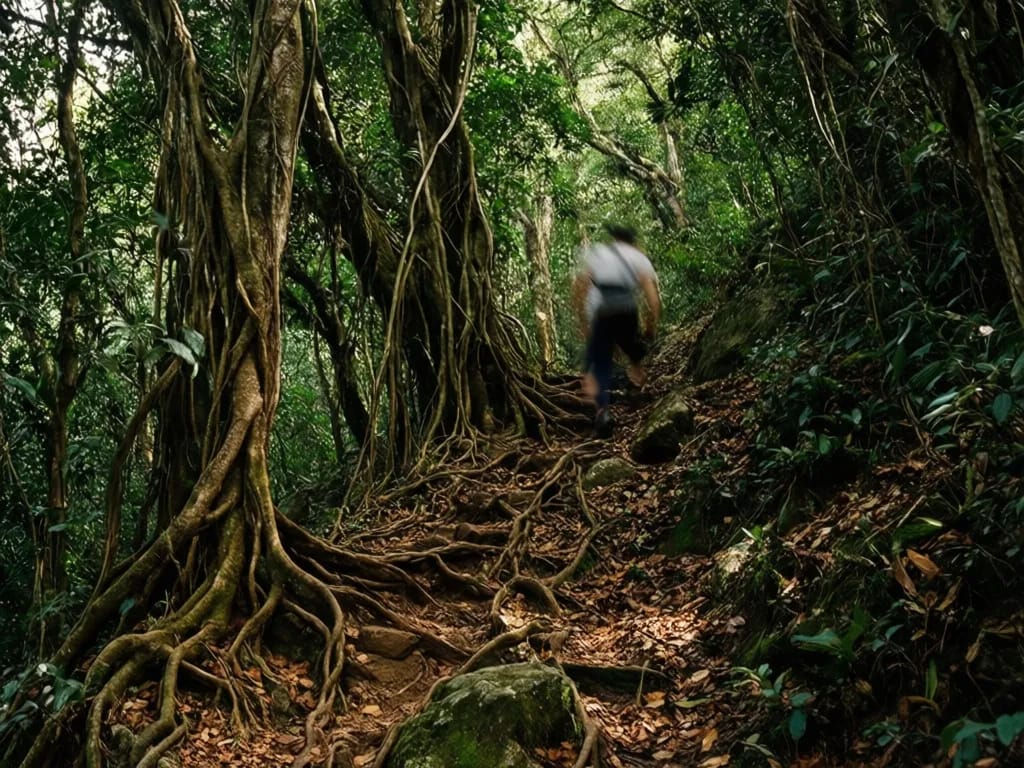
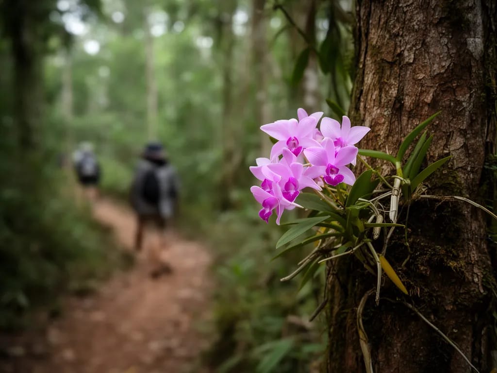
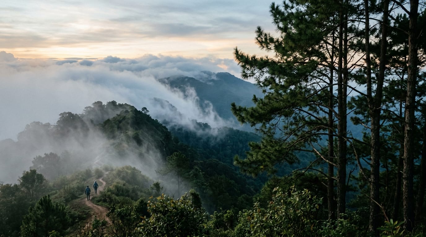
From the stream the trail turns hard up-slope and the real climb begins. The next 1.5 km gains 400 m, almost all on root-bound single-track that demands attention with every step. The trees change from dipterocarp to laurel and oak, with hanging mosses dropping in long curtains from the higher branches. This is the most beautiful section of the day and also the most tiring.
About halfway up, at around 1,500 m elevation, a small rest log marks a clear flat spot worth pausing on. The view here is into the canopy rather than out across the valley, but you can usually hear the distant high call of a great barbet that lives somewhere on the south face. Allow 50 to 70 minutes for this section without stopping for anything more than a drink.
The trail eases noticeably as the gradient relaxes near the top of the climb. You begin to see daylight ahead through the trees, and a stand of dwarf cherry on the right marks the last 100 m before the high meadow.
The high meadow and summit ridge (3 to 5 km, +150 m)
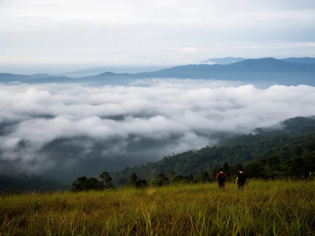
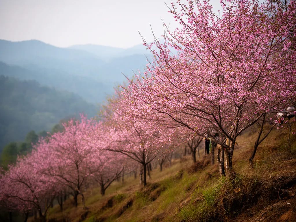
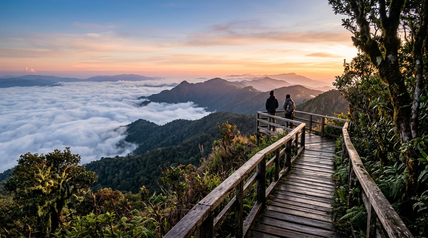
The high meadow at about 1,800 m is the geographical centre of the loop and the most photographed spot on the hike. In November and December it is short turf, in February it is wild-flowering with cherry blossom, and from June it grows up to shoulder-height grass that the rangers cut once a year. Mist sits in the meadow until mid-morning even in the dry season, then burns off in about 20 minutes.
A clear footpath crosses the meadow heading north-east towards the summit ridge. The trail is obvious in winter and harder to find in summer; if grass obscures the line, aim for the saddle between the two false summits visible at the head of the meadow.
From the meadow the route climbs gently along the ridge for 1.5 km, gaining a further 150 m. You pass a small wooden survey marker at about 1,920 m, used by the park rangers to monitor regeneration of the forest edge. The trail then drops 30 m into a shallow saddle and rises again to the false summit, a flat platform with a few stunted pines.
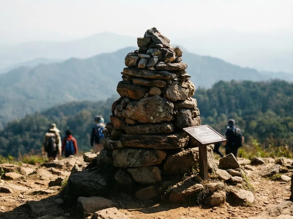
The true summit of Doi Lanka Noi is 300 m further on, separated from the false summit by a short rocky path that requires hands on knees for two steps and nothing more. The cairn at the top is a small stone pile beside a metal benchmark plate set into the rock. Sit down and look south: on a clear December day you can see the ridge line of Doi Inthanon and the long green valley of Mae Chaem.
Descent through dwarf bamboo (5 to 6.5 km, -400 m)
From the summit, follow the trail off the back of the cairn towards the north-east, which is the direction marked by a small red blaze on a tree trunk 10 m below the summit platform. The descent is steep but not technical, dropping 400 m in 1.5 km through a thick band of dwarf bamboo. The bamboo is shoulder-high in places and the path is sometimes hard to find; look for the faint line of trodden ground at your feet rather than gaps in the foliage.
About halfway down, a small spring seeps out from beneath a moss-covered rock on the left. This is a second water source if you need to refill, but it is not as clean as the first stream and should be filtered.
The bamboo gives way to mature laurel forest at about 1,500 m, with a sharp drop in temperature as you move out of the sun. The trail widens here and the going becomes much easier. Cicadas pick up again, which is your audio cue that you have left the high country.
Second stream and return (6.5 to 8 km, -200 m)
At 7 km the trail crosses a second stream on a fallen log bridge. The log is sound but treated as decorative; most people wade. Beyond the stream the trail joins a wider forest track that contours back around the south flank of the mountain.
The last 1 km is easy walking on a dirt track wide enough for two. You re-enter the lower forest band of dipterocarp and bamboo and pass the same red blazes you saw on the climb, this time from the back. At 7.8 km a small fork appears: the left fork drops to the ranger station via the access road, the right continues as a faint loop track back to your original starting arrow. Take the left to finish at the car park.
Difficulty and safety
The hike is rated hard because of the steep climb between the first stream and the high meadow, and because the access is committing: once you are at the trailhead you are two hours from the nearest hospital. A turned ankle on the descent through the bamboo is a serious problem, not a minor inconvenience.
Heat is less of an issue than on Doi Suthep because the canopy holds shade over almost the whole route and the high meadow is usually under 22 degrees even in April. The risk swings the other way: in December and January, sunrise temperatures on the summit can drop to 4 degrees, and a sudden afternoon thunderstorm in May can pull the meadow temperature down by 10 degrees in 20 minutes. Always carry a light insulating layer.
Leeches in the wet season are unavoidable but harmless. Snakes are uncommon in the high forest. The two of concern are king cobra, which has been seen on the lower trail in May, and the green pit viper, which sometimes coils on bamboo stems in the descent. Watch where you place hands.
Stray dogs do not reach the upper trail because the access is too remote. The rangers keep three working dogs at the station, all friendly. Wild boar passes through the high meadow occasionally; give it a wide berth, especially with piglets.
If you become lost between the high meadow and the summit, the safest course is to descend west towards the first stream you crossed, which will deliver you back to the climbing route within an hour. Do not push north or east, because the ridge falls into a steep forested basin with no clear exit.
Save the contact for the Khun Chae National Park ranger station: +66 53 248 491. Always sign the trail register on the way in and let the rangers know your expected finish time.
What to pack
- 3 litres of water per person in the cool season, 4 in the heat
- Water filter or chlorine tablets for the two streams
- Lunch and at least two snacks
- Sun hat and sunscreen for the meadow and summit ridge
- Light insulating layer for the summit, even in March
- Light rain shell from May through October
- Trekking poles for the descent through dwarf bamboo
- Headtorch with spare battery in case the descent takes longer than planned
- Long trousers and gaiters in leech season (June to October)
- Insect repellent with DEET or picaridin
- Paper map or offline GPS (Organic Maps OpenStreetMap layer is best)
- 400 THB cash: 200 for park entry, 200 for the unexpected
- Small first-aid kit with blister patches and antihistamine
- Binoculars if you care about the bird list
Permits and fees
No special climbing permit is required for the Doi Lanka Noi loop, but you must pay the standard Khun Chae National Park entry fee at the Mae Tho ranger station. The fee is 200 THB for foreigner adults, 100 THB for foreigner children, 40 THB for Thai adults and 20 THB for Thai children. The ranger station opens at 06:00 and accepts cash only. You must also sign the trail register, which records your name, nationality, planned route and expected return time. The register is the only formal record that you are on the mountain, so do not skip it. If you wish to camp at the ranger station tent platforms, pay an additional 60 THB per night per tent. Wild camping at the high meadow is not formally permitted but is tolerated for small low-impact parties in the cool season.
When to hike
November to early February is the prime season. Day temperatures in the lower forest sit at 22 to 26 degrees and the summit holds at 12 to 16 in the middle of the day. Mist clears from the high meadow by about 09:30. The trail is firm, the streams are clean, and the wild Himalayan cherry blossoms peak in the second week of February along the upper ridge.
Late February to mid-April is the burning season. Smoke from agricultural fires in the lowlands settles into the valleys and rises to 1,500 m on calm days. The summit usually stays clear above the smoke layer but the climb itself is unpleasant and views collapse. Some weeks of April the park closes the upper trail because of fire risk in the dwarf bamboo. Check at the ranger station before driving up.
May to September is the wet season. Afternoon thunderstorms are routine and the steep climb above the first stream becomes a stream itself. Leeches are at peak density. The high meadow is shoulder-deep in grass. Not recommended.
October is the bridge month. The monsoon retreats, the forest is at its greenest, the trail is quiet because Thai hikers have not yet returned. Leeches persist but are easing. A good month for the fit and the prepared.
Where to eat and refresh after
There is nothing at the trailhead, which is part of the appeal and part of the planning problem. Bring lunch with you. After the hike, the best stop on the drive back to Chiang Mai is Khao Soi Mae Tho, a roadside shop on Route 1099 about 8 km east of the park gate, recognisable by the blue tin roof and the line of pickup trucks at lunchtime. The khao soi (northern Thai curried noodle soup) here is 50 THB and runs out by 14:00. Failing that, drive on to Chom Thong town, where Por Sue Restaurant on the main highway does reliable Thai-Chinese for 100 to 200 THB per dish. In Chiang Mai city, the obvious finishing point after the long drive is a beer and a long shower at the hotel rather than another restaurant.
A short note on the Karen and Hmong villages around the park
The valleys around Khun Chae hold a small number of Karen and Hmong villages, mostly farming small plots of coffee, vegetables and dry-season strawberries. The villages are not formally on the tourist circuit and do not advertise homestays, but if you finish the loop early and have an hour to spare, a slow drive down the road back towards Mae Tho passes two villages that welcome casual visitors who buy a coffee at the small village shop. Do not photograph people without asking; the Karen are reserved with strangers, the Hmong less so but still expect a small courtesy first. The villages do not ask for money. A 20 THB tip in the shop or 50 THB for a bag of farm coffee is reasonable. None of this is essential to the hike but it provides a useful piece of context for what you have just walked through, and gives the rangers a chance to see you pass through twice, which is appreciated.
Nearby and related
Khun Chae National Park and Doi Inthanon National Park share the same long massif and many hikers tick both on consecutive weekends. For the lower-effort summit experience inside Doi Inthanon itself, see the Doi Inthanon nature trail guide, a 2.5 km loop in the cloud forest at the summit. For other long days near the city, the Doi Pui to Doi Suthep traverse is the obvious choice, and the easier Huay Tung Tao circular hike makes a good recovery day. To see how Doi Lanka Noi fits with the wider trail network of northern Thailand, browse the full hiking hub.
Photos
Frequently asked questions
Why is this hike less famous than Doi Suthep?
Three reasons. First, Khun Chae National Park sits two hours from Chiang Mai by road with no songthaew or bus service, which removes 90 percent of the tourist audience. Second, the trail signage is in Thai only and the trailhead is a 400 m walk from the ranger car park along an unmarked path. Third, the park has only existed as a protected area since 1995 and was rarely promoted by TAT in English. The route itself is at least as good as anything inside Doi Suthep-Pui and the summit, at 2,031 m, is 350 m higher than Doi Pui. The trade-off is that you must commit a full day, including the drive, and you must arrange your own car.
Can I do this hike without a car?
Not easily. There is no public transport into the park. The nearest scheduled route is the songthaew from Chom Thong town to Mae Chaem, which passes about 18 km south of the trailhead at its closest point. From there you would need to find a private pickup, which there is no infrastructure for. The realistic options are a self-driven hire car (around 900 THB per day plus fuel), a private driver with car (3,000 to 4,500 THB for the day), or a small-group hike booked through Chiang Mai Mountain Biking and Eco Tours, who run the route a few times each cool season.
How does the difficulty compare to Doi Pui to Doi Suthep?
Shorter but steeper. Doi Lanka Noi is 8 km against 13 km, but climbs 700 m without the long descent that breaks the second half of the Doi Suthep traverse. The steepest section, between the first stream and the high meadow, gains 400 m in just 1.5 km on a root-bound trail. If you have done one cool-season Doi Pui traverse, you can do Doi Lanka Noi the next weekend without trouble. If you have never hiked in northern Thailand before, start with the easier Huay Tung Tao loop and build up.
Are there leeches?
Yes, between June and October, and they are worse here than on Doi Suthep because the forest stays damp longer at the higher elevation. The first kilometre and the descent through dwarf bamboo are the worst patches. Wear long trousers tucked into socks, treat boots with permethrin, and check yourself at every break. In the cool season (November to February) leeches disappear and the loop can be walked in shorts. The park rangers maintain a small supply of salt at the ranger station for emergency leech removal, but bring your own.
What wildlife will I actually see?
Realistically: lots of birds, the odd troop of stump-tailed macaques on the descent, and tracks of muntjac deer in soft mud. The park officially holds Asian black bear, serow and clouded leopard, but these are rare and shy, and sightings on the main trail are almost unheard of. The bird list is excellent: hill blue flycatcher, great barbet, red-headed trogon and crested serpent eagle are all regular along the upper ridge. February brings flocks of grey-headed bullfinch into the cherry blossom on the summit ridge. Carry binoculars if you care.
Can I camp at the summit?
Officially no, although low-impact wild camps are tolerated in the high meadow about 300 m below the summit. There is one small flat clearing of about 6 by 4 metres on the south side of the meadow, sheltered from the north wind. No water source on the meadow itself, so carry enough up from the second stream. The ranger station offers basic tent platforms with toilet block for 60 THB per night if you prefer the legitimate route. Either option puts you on the ridge for sunrise, which is by some distance the best moment of the trip.
Is there mobile phone signal?
Patchy. AIS works at the ranger station and on the summit ridge with line of sight to the east. TrueMove H drops out as soon as you leave the car park. There is no signal at all in the dense forest of the climb, and a small dead zone in the saddle between the two false summits. Download an offline map (Organic Maps OpenStreetMap layer is best) before you leave the city and tell someone at home your planned finish time. The ranger station has a satellite phone for emergencies and the rangers will help you contact tourist police if needed.
How busy does the trail get?
Quiet. On a good cool-season Saturday you might pass 10 to 20 hikers, almost all Thai, and on a midweek day you may not see anyone at all between the trailhead and the summit. The car park usually has three to six vehicles. Compared to Doi Suthep, which sees several hundred hikers a day in peak season, Doi Lanka Noi is genuinely peaceful. Plan around Songkran (April 13–15) and the New Year long weekend, when local hikers from Chiang Mai head out in larger groups.
What is the trail surface like?
Mixed. The first kilometre from the ranger station is a vehicle track of compacted dirt. After the first stream the trail narrows to single-track soft earth with exposed roots for the steep climb. The high meadow is short turf in winter, knee-deep grass in summer. The descent through dwarf bamboo follows a faint footpath cut by rangers each November and tends to grow back during the monsoon. There is no rock scrambling and no exposure anywhere on the route, but the steep section after the first stream is slippery in any rain.
What about the summit itself?
Doi Lanka Noi sits at 2,031 m and is the southern of two peaks on the Lanka range; the higher Doi Lanka Luang at 2,175 m is off-limits to casual hikers because the ridge between the two crosses a wildlife protection zone. The summit of Doi Lanka Noi is a small flat platform with a stone cairn and a small painted ranger marker. View south on a clear day reaches the Mae Chaem valley and the high ridges of Doi Inthanon National Park. There is no shelter, no water, and no mobile signal directly on the summit; eat lunch a hundred metres back in the high meadow instead.
Related guides
Hike
Doi Inthanon Nature Trail (Kew Mae Pan)
A 2.5 km loop at 2,200 m along the Kew Mae Pan ridge near the summit of Thailand's highest mountain, plus the easier 360 m Ang Ka Luang boardwalk through cloud forest. Ninety minutes for the main loop, no climb worth mentioning, but a local Karen guide is mandatory for Kew Mae Pan from November through May. Open seasonally; closed June through October for bird nesting.
Hike
Doi Pui to Doi Suthep Traverse
A classic 13 km point-to-point traverse across the spine of Doi Suthep-Pui National Park, dropping from the Hmong village at Doi Pui (1,685 m) through pine and dipterocarp forest, past Wat Pha Lat, and finishing at the gilded chedi of Wat Phra That Doi Suthep. Six to eight hours, 850 m of climbing, 1,200 m of descent, a couple of springs, and one of the few hikes in northern Thailand where you finish at a working temple with songthaews waiting at the door.
Hike
Huay Tung Tao Circular Hike
A flat 4 km loop around the Huay Tung Tao reservoir at the foot of Doi Suthep, 20 minutes from the Chiang Mai Old City. Easy walking on dirt and grass, three swim spots, raft restaurants serving Northern Thai food on the eastern shore, and the only family-friendly hike near the city where strollers and small children manage the whole circuit. Year-round, ninety minutes door-to-door, 50 baht entry.