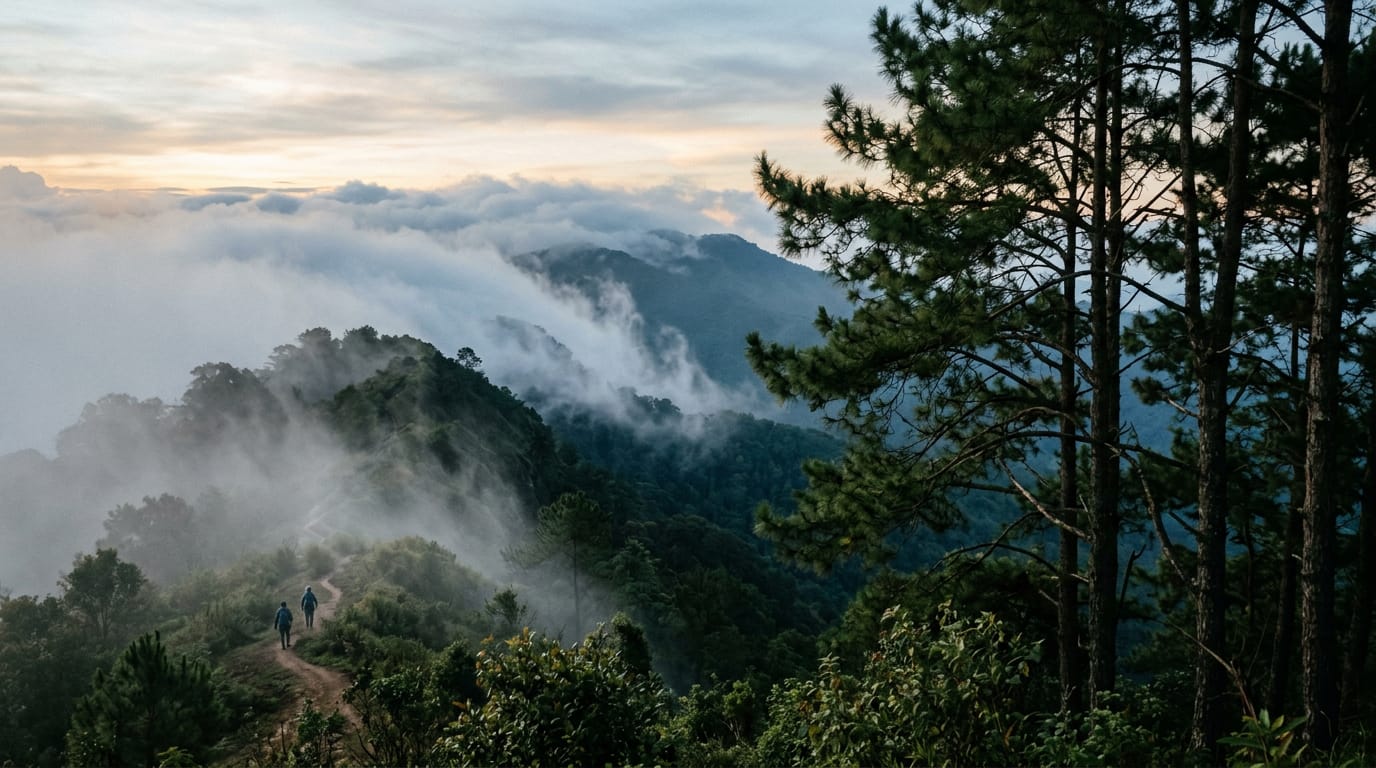
A classic 13 km point-to-point traverse across the spine of Doi Suthep-Pui National Park, dropping from the Hmong village at Doi Pui (1,685 m) through pine and dipterocarp forest, past Wat Pha Lat, and finishing at the gilded chedi of Wat Phra That Doi Suthep. Six to eight hours, 850 m of climbing, 1,200 m of descent, a couple of springs, and one of the few hikes in northern Thailand where you finish at a working temple with songthaews waiting at the door.
Updated
Overview and why hike it
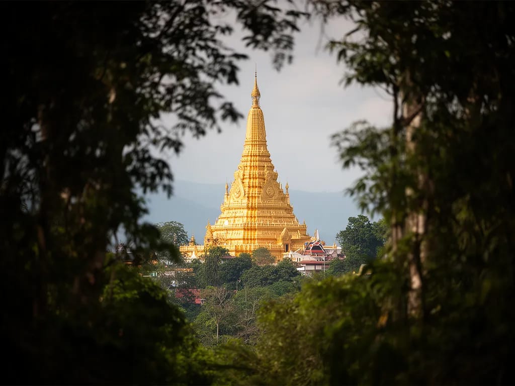
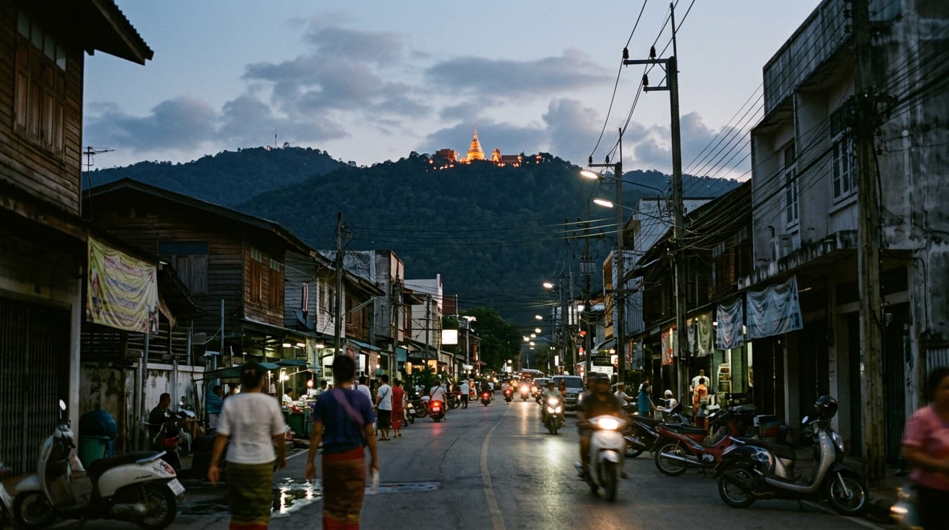
The traverse from Doi Pui to Doi Suthep (doi is the northern Thai word for mountain) is the best long day-hike inside an hour of Chiang Mai city, and after twenty years it remains the route locals send any visitor who asks for “a proper walk”. You start in a Hmong village at 1,685 m, climb a short shoulder onto the ridge of Doi Suthep-Pui National Park, then walk the spine of the park south through pine forest, drop through dipterocarp and bamboo to the working forest temple of Wat Pha Lat, and finish at the gilded chedi (the bell-shaped shrine that holds relics) of Wat Phra That Doi Suthep with a fresh coconut and a 50 baht ride back into town in a songthaew (shared pick-up truck taxi).
It is a hike about transitions. Cool montane pine smells like Scotland in summer. Two hours later you are sweating through tropical hardwood. The end of the trail is a working wat (Buddhist temple) with monks chanting through brass speakers and tourists climbing the 309-step naga (guardian serpent) staircase from the car park. The contrast is the point.
Distance is 13 km, total ascent 850 m, total descent 1,200 m. Six to eight hours for most walkers including breaks. The terrain is mostly soft forest track with a few rooty sections, one short rock scramble near the saddle, and a long laterite descent below Wat Pha Lat that turns to brake-skid clay in the wet season.
This is a hard hike because of the heat and the length, not because of any single difficult section. Anyone reasonably fit who has done a few full days in hill country will manage it. The reward is the route itself, which threads together a mountain, a half-overgrown waterfall temple, a famous summit pagoda, and a transport network that delivers you back to a beer in Nimman by sunset.
Getting to the trailhead
The start is at the Doi Pui Hmong Village car park, 18.8240 N, 98.8680 E. The village sits at 1,685 m and is the highest point reached by paved road inside Doi Suthep-Pui National Park.
From Chiang Mai Old City the most common way up is a private red songthaew chartered for the morning. Drivers wait at the north corner of Tha Phae Gate and along Suthep Road near the university. Going rate for a private morning charter to Doi Pui village is 600–800 THB depending on season and bargaining, and the driver will drop you and leave; you do not need a return because you finish on the other side of the mountain. Shared songthaews running the standard tourist route only go as far as Phu Ping Palace, so if you join one of those you pay 100 THB to Phu Ping and another 100–150 THB to negotiate the last 4 km up to Doi Pui.
Grab works for the climb but charges a premium and frequently times out because the road switchbacks confuse the dispatch system. Expect 450–550 THB if Grab accepts the booking at all. A morning rental scooter is the cheapest option at 250 THB per day plus 80 THB fuel, but you then have the problem of recovering it at the end of the day, and the climb on a 110cc scooter with two people is a slow and exposed business.
The drive from the Old City takes 60–80 minutes depending on traffic at the foot of the mountain. Allow longer on weekends and during festival days, when the road to Wat Phra That Doi Suthep backs up from 09:00.
Pay the national park entry fee, 200 THB for foreigner adults and 100 THB for children, at the gate beside Wat Phra That Doi Suthep on the way up. Keep the ticket. Rangers occasionally check tickets at trailheads and on the ridge.
Parking at Doi Pui village is on a wide dirt apron in front of the main shops. You will be approached immediately by Hmong vendors selling strawberry coffee, embroidery, and bags of fresh strawberries in the cool season. The trailhead itself is on the eastern side of the village, signed in Thai only with a small wooden arrow pointing along a dirt track between two tin-roofed houses. The track climbs gently for the first 800 m through cultivated strawberry and coffee plots before reaching the forest edge.
Finishing transport at Wat Phra That Doi Suthep is straightforward. Red songthaews queue at the foot of the 309-step staircase and run a shared rate of 50 THB per person down to the Old City. After 17:00 the rate switches to a private 400 THB charter and shared options dry up quickly. Grab works from the temple car park most days outside of festivals.
Turn-by-turn description
Doi Pui village to the ridge (0 to 2.5 km, +200 m)
From the wooden trailhead arrow on the east side of the village, follow the dirt track between two tin-roofed houses. The track climbs gently through cultivated na (rice paddy) terraces in their dry state, with Hmong farmhouses on the right and strawberry beds on the left in the cool season. After 400 m, ignore a tractor track that drops left towards a small orchard; stay on the higher path that contours into a stand of low scrub.
At 800 m a clear junction appears: a wide track continues straight on towards a viewpoint serving the village tour, and a narrower footpath cuts hard right uphill into pine forest. Take the narrow right-hand path. This is the only confusing junction at the start, and it is the place where most parties go astray. The viewpoint loop is pleasant but adds nothing useful, and forces you to backtrack.
The footpath climbs steeply for about 25 minutes through Khasi pine, which gives off a strong resin smell in the morning sun. Underfoot it is dry needles, easy walking but slippery in places. At around 1.7 km a small bench made from a sawn log marks the top of the initial climb. You are now on the ridge proper at about 1,800 m. The view east shows the curve of the Mae Ping valley, and on clear December mornings you can pick out the silhouette of Doi Inthanon 70 km away.
Ridge walk to the saddle (2.5 to 6 km, +150 m, -100 m)
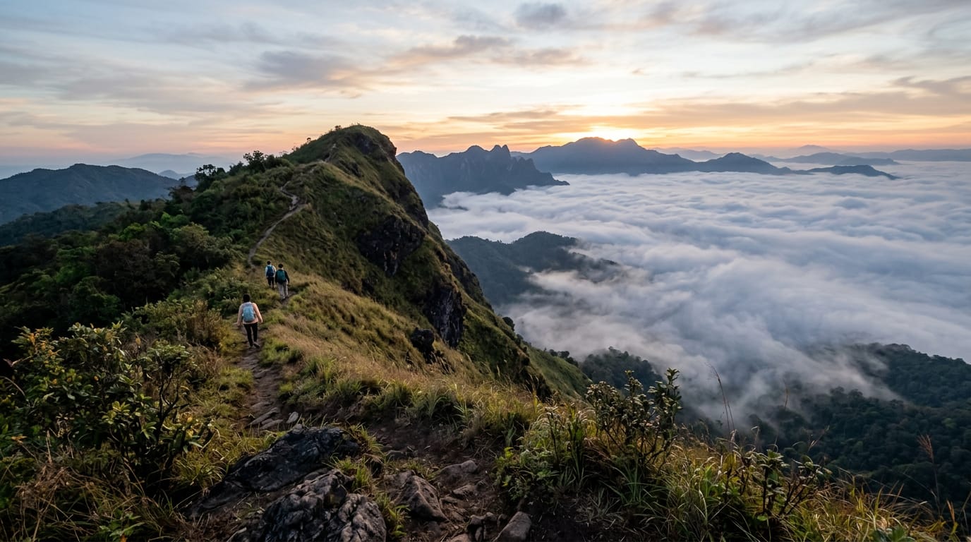
The next three and a half kilometres are the best walking of the day. The trail follows the spine of the ridge through alternating pine and oak forest, with occasional short rises and shallow saddles. The path is soft and well-trodden, broad enough to walk in pairs. Cicadas are deafening through midday. Around 4 km you cross a small open meadow where wild horses sometimes graze; do not approach them, as they kick when startled.
At the meadow’s south end, follow the rough cattle track that contours right around a knoll rather than going over the top. The over-the-top variant is shorter but ends in a thicket of bamboo that takes 20 minutes to push through. The contour adds 300 m of easy walking and saves the swearing.
A signpost in Thai script at about 5.5 km marks the boundary between two ranger sectors. Just past it, the trail begins to drop into the main saddle between Doi Pui (1,685 m) and the ridge leading up to Doi Suthep (1,676 m). The descent is about 100 m over 500 m of trail, on soft pine needles and one short rocky step.
Saddle and the spring (6 to 7 km, flat)
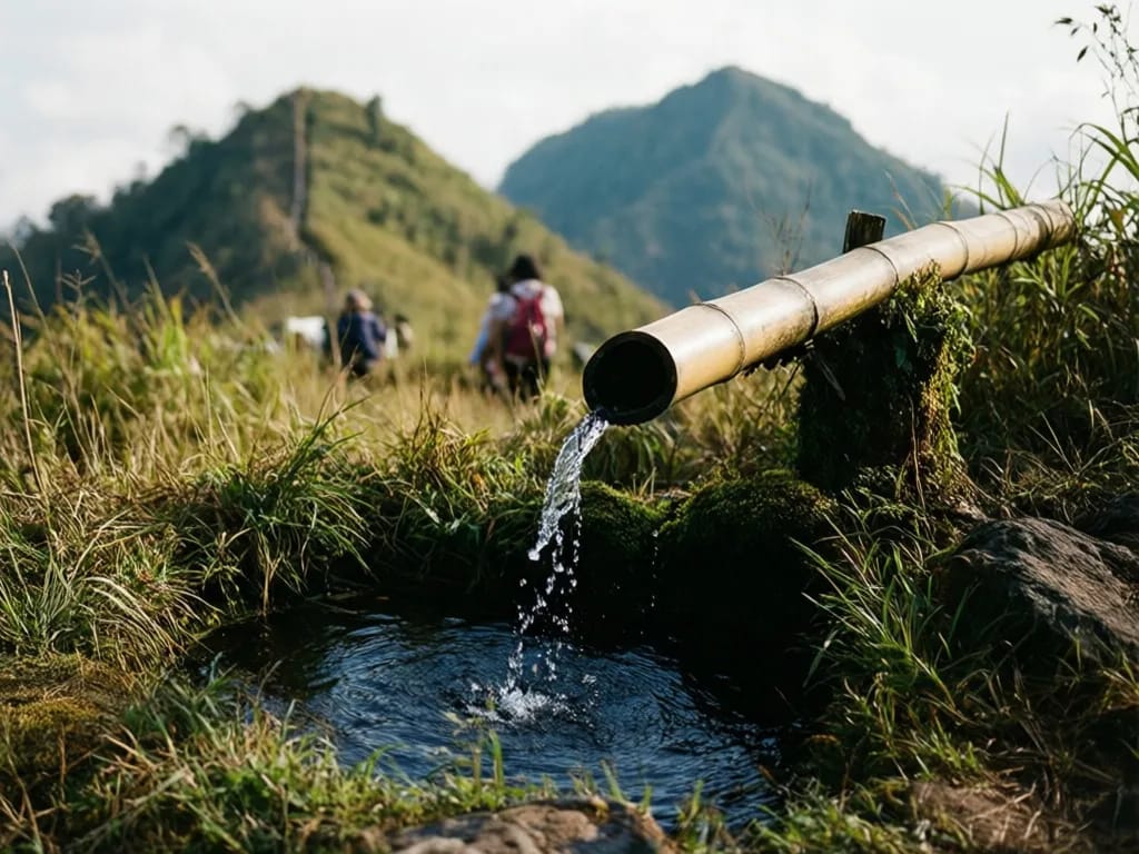
The saddle is a flat, sheltered clearing at about 1,560 m where most parties take a long lunch break. There is a fire-ring from past ranger patrols. Do not light a fire at any time of year. The main spring sits 80 m below the saddle on the west side, marked by a short bamboo pipe pushed into a mossy bank. Water flows year-round, slowing to a trickle in late April. Filter or treat it before drinking; cattle graze the slope above.
A second small spring is on the east side of the saddle, lower and harder to find, about 200 m down a faint side track. Use the first one unless you are camping.
This is the only spot on the ridge where the trail is genuinely confusing in poor weather. A faint footpath leaves the south end of the saddle and drops west into Hmong farmland, eventually reaching a road. This is the bail-out route if you have run out of time or water. The main route continues south on the rising track, marked by an old painted-stone trail marker now mostly buried in leaves.
Climb to the high point (7 to 8.5 km, +250 m)
From the saddle the trail climbs steadily for 250 m of ascent over 1.5 km. This is the steepest section of the day and on a hot afternoon it feels much longer than it is. The forest is denser here, mostly oak with occasional rhododendron in bloom from February through April. Birds are everywhere: drongos calling from the canopy and the constant tap of a great spotted woodpecker on the dead trunks.
At about 8.2 km the trail meets a broader fire-road that contours along the upper ridge of Doi Suthep. The fire-road is used by rangers and the occasional motorbike but sees almost no foot traffic. Turn left (east) onto it and follow it for 300 m to reach the high point of the day at about 1,650 m, marked by a small concrete survey pillar.
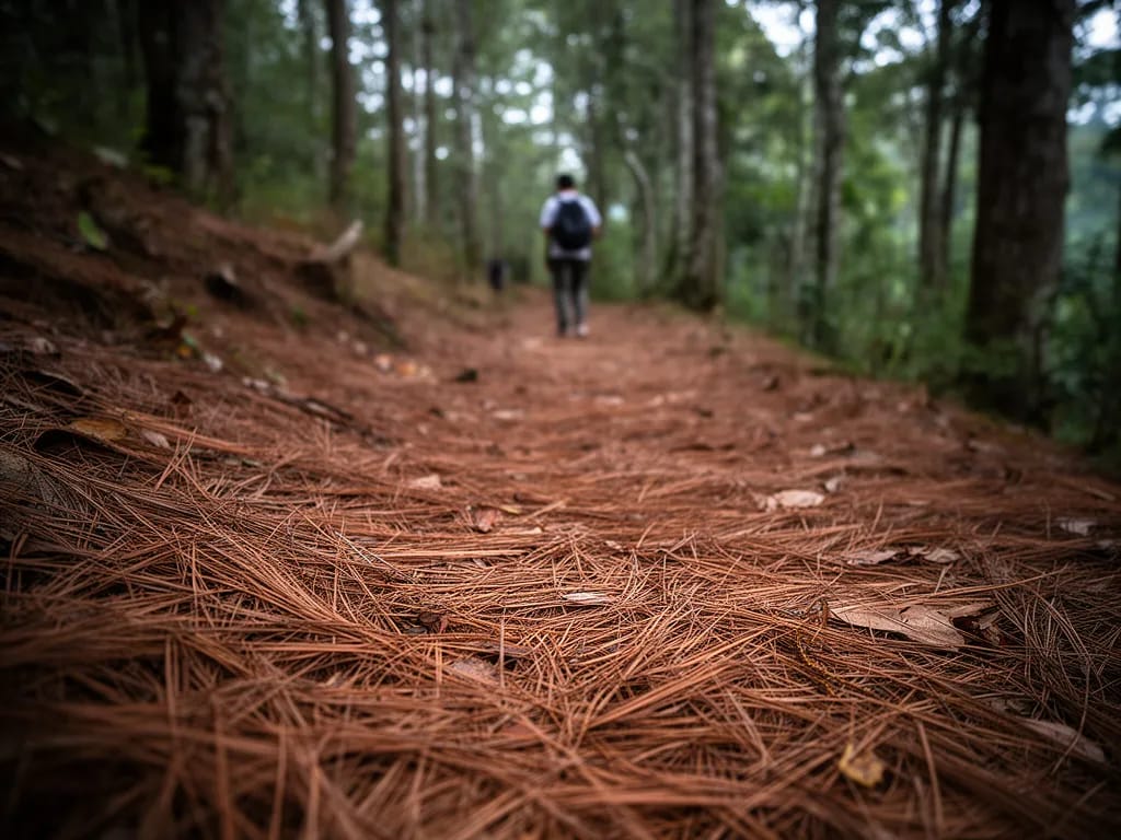
High point to Wat Pha Lat (8.5 to 11.5 km, -450 m)
This is where the descent really begins. From the survey pillar the trail leaves the fire-road on the right, dropping into dipterocarp forest on a narrow path braided with roots. The next 3 km loses 450 m of elevation. It is the section that hurts the knees and the section that the rain turns to clay.
About 1 km below the survey pillar the trail crosses an old logging track at a clear T-junction. Many parties get confused here. The correct route continues straight on, slightly to the right, dropping further into the forest. The logging track tempts you left towards a Hmong farm; do not take it.
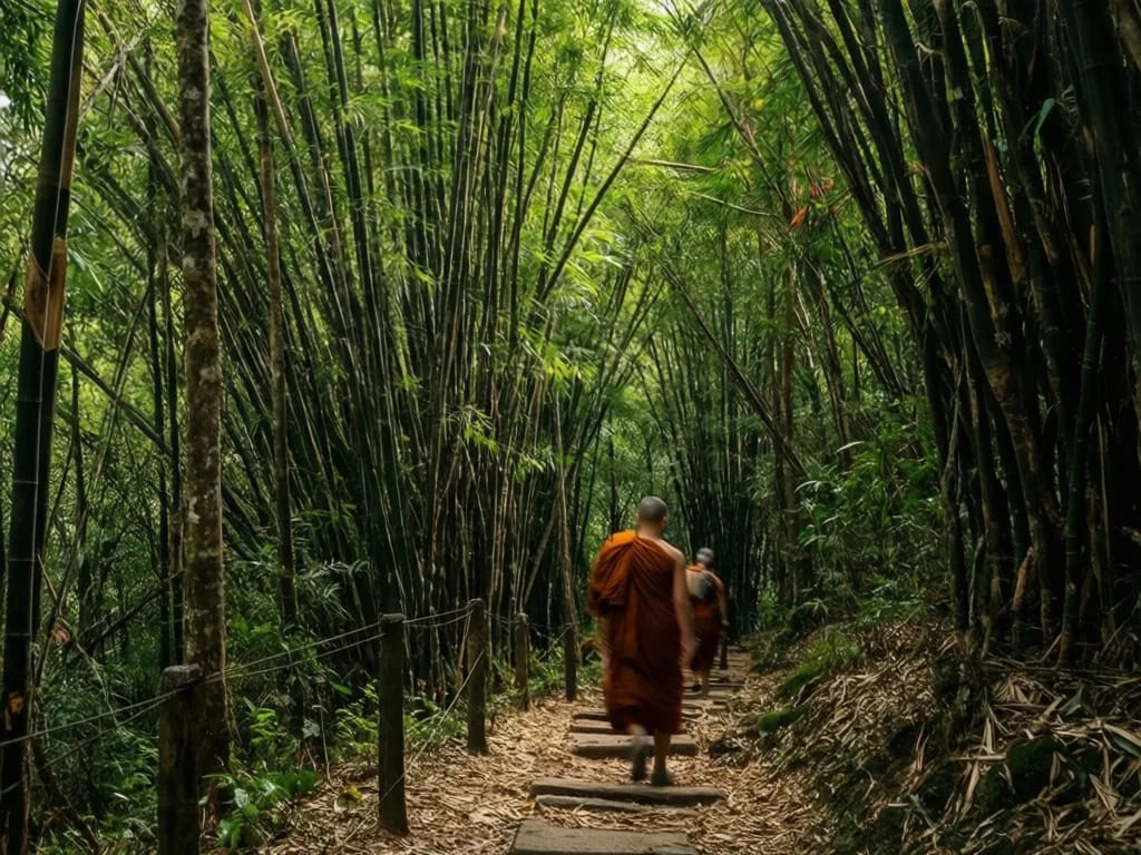
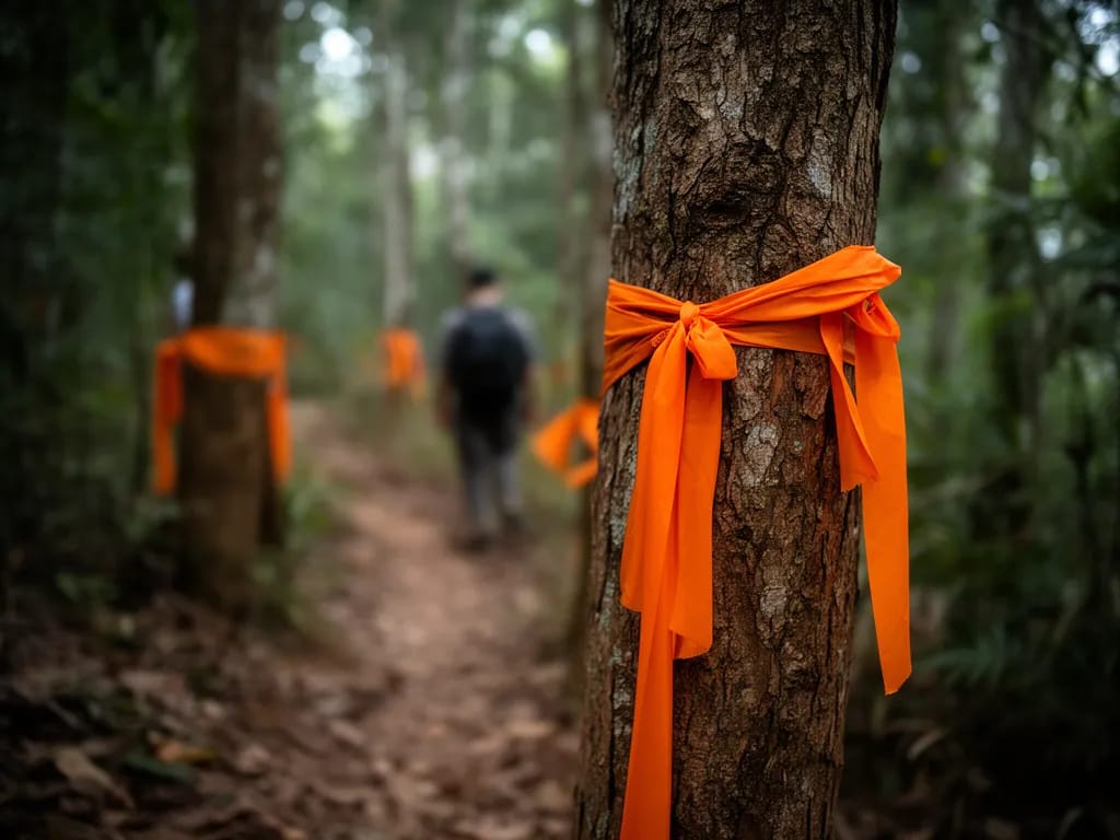
From here the trail is the famous Monks Trail that has been used by saffron-robed monks walking up to Wat Phra That Doi Suthep for over four hundred years. Look for the orange cloth strips tied to trees every 100 m or so; these were tied by the monks themselves and are kept fresh by the temple novices.
You begin to hear the temple before you see it. The thock of wooden bells and faint chanting carries through the forest on still afternoons. At about 11.3 km the trail emerges onto a stone-flagged path beside a small waterfall pool, and 100 m further on you reach the back gate of Wat Pha Lat.
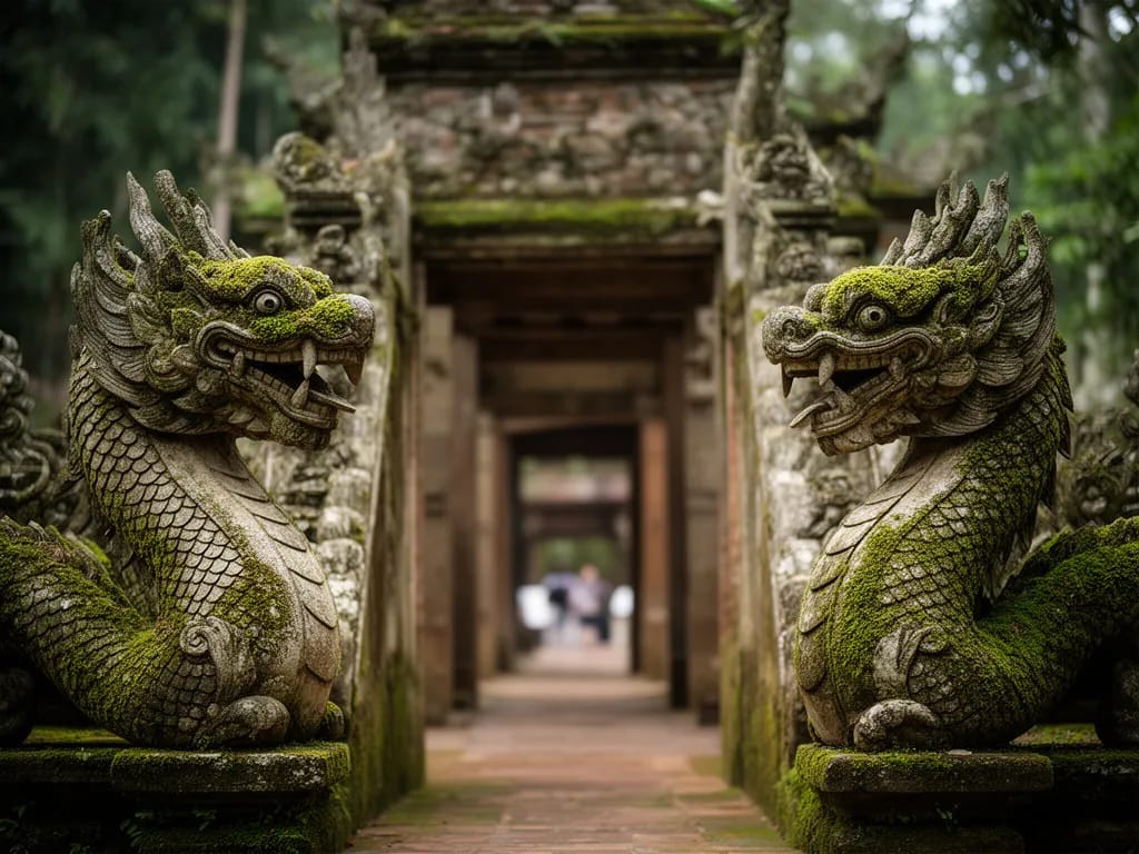
Wat Pha Lat is the secret pleasure of the trail. It is a working forest temple, half-overgrown with moss and trees, with stone nagas guarding the steps to a small bot (ordination hall) built directly over the cliff. Monks live here permanently. Tourists who reach the temple by the road below tend to stay only ten minutes and then leave. If you arrive at 14:00, the temple is often nearly empty. Sit on the rock platform behind the bot and watch the city far below. There is a small bathroom block on the east side, and a free water cooler intended for the monks but open to visitors.
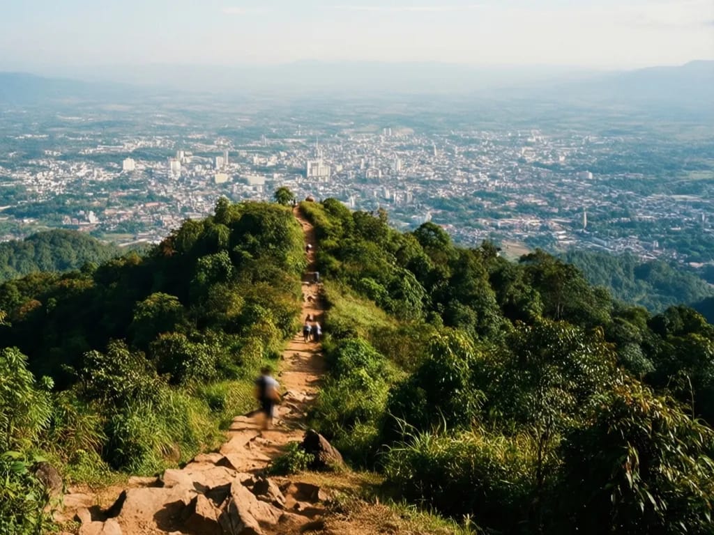
Wat Pha Lat to Wat Phra That Doi Suthep (11.5 to 13 km, +200 m)
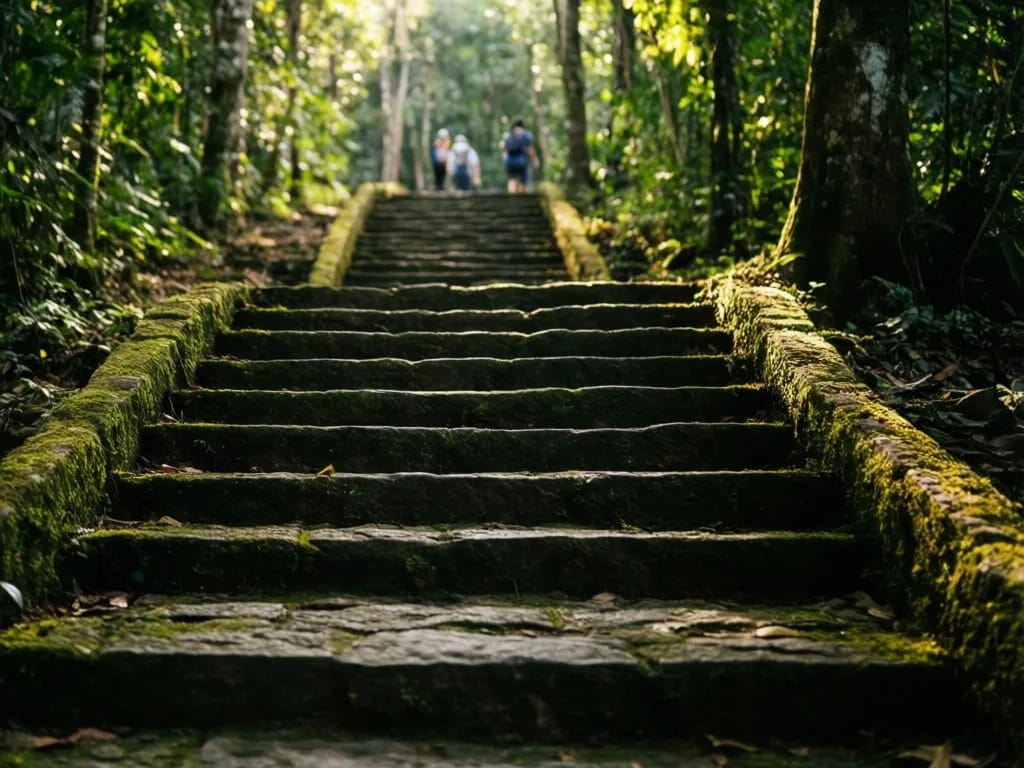
Leave Wat Pha Lat by the front gate beside the road, cross the road carefully, and pick up the continuation of the Monks Trail on the far side, marked by a small wooden sign in English and Thai. The final 1.5 km climbs 200 m up to the chedi at Wat Phra That Doi Suthep.
This last section is the busiest of the day. You will share it with tourists coming the other way down from the temple. The path is well-graded and wide, surfaced with broken stone in places. Halfway up, a small shrine to the white elephant that, legend has it, chose the location of the chedi sits beside the trail. It is worth a two-minute pause.
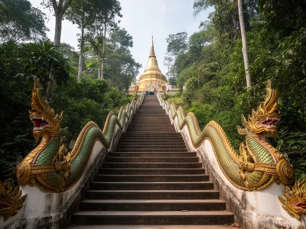
The trail emerges at the side of the upper temple car park. Walk around to the front, pay your respects at the chedi if you wish, and then descend the 309-step naga staircase to the lower car park to catch your songthaew. The staircase is the postcard image of Chiang Mai; you have earned the photo.
Difficulty and safety
Length and heat earn this hike its hard rating; there is no technical terrain to speak of. The biggest risk is dehydration. Daytime temperatures on the exposed sections of the ridge reach 32 to 36 degrees from March through May, and the descent below Wat Pha Lat reflects heat off the dry ground. Carry at least 2.5 litres in the cool season and 4 litres outside of it.
Stray dogs gather around Wat Pha Lat and Wat Phra That Doi Suthep. Most are quiet, but small packs occasionally form around food scraps. Walk steadily through them without making eye contact, and carry a single trekking pole if you are anxious. Rabies remains a real risk in northern Thailand; if bitten, seek vaccination within 24 hours at Chiang Mai Ram Hospital.
Snakes are present but rarely seen. The two of concern are the Malayan pit viper, sometimes found basking on warm laterite below Wat Pha Lat in the afternoon, and the king cobra, occasionally crossing the ridge trail in the morning. Both move away from human noise. Watch where you place hands and feet on rest breaks.
Leeches arrive in June and stay until late October. Wear long trousers tucked into socks and check yourself at breaks. Bites are itchy but harmless.
If you become lost between the saddle and Wat Pha Lat, the safest course is to bail west onto Hmong farmland; you will reach a road within an hour and can hitch back into the village. Do not push downhill through unmarked forest, because the slope steepens to cliff bands in several places.
Phone signal is patchy on the ridge but reliable at both ends. Save the contact for Doi Suthep-Pui National Park headquarters: +66 53 210 244. Tell someone in town your planned finish time.
What to pack
- 2.5 to 4 litres of water per person depending on season
- Filter or chlorine tablets if you plan to use the springs
- Lunch, two snacks, and a small bag of salty crackers for the descent
- Sun hat and high-SPF sunscreen
- Light long-sleeve shirt for sun and insect cover
- Trekking poles if your knees object to long descents
- Headtorch with spare battery (the last hour can be in twilight in December)
- Paper map or offline GPS (Organic Maps OpenStreetMap layer works)
- 300 THB cash for the park gate plus 100 THB for songthaew at the end
- Small first-aid kit including blister patches and antihistamine for insect bites
- Lightweight rain shell from May through October
- Insect repellent with DEET or picaridin
Permits and fees
No special permit is required for the traverse, but you must pay the standard Doi Suthep-Pui National Park entry fee. The fee is 200 THB for foreigner adults, 100 THB for foreigner children, 40 THB for Thai adults, and 20 THB for Thai children. It is collected at the main gate beside Wat Phra That Doi Suthep on the road up the mountain, and you should keep the printed ticket on you. Rangers occasionally check tickets on the ridge and at the Wat Pha Lat junction. The fee covers the same calendar day; if you stay overnight in a low-impact camp you should ideally re-pay the next day, although in practice this is rarely enforced.
When to hike
November to February is the only sensible season. Daytime temperatures of 22 to 28 degrees, low humidity, clear long views, and the springs flowing well. The forest is still green from the receding monsoon. Sunrise is around 06:30 and sunset around 17:45, which leaves enough light for a comfortable day.
March to early May is the burning season. Visibility from the ridge collapses to 200 m on the worst days, and the smell of smoke makes the long climb unpleasant. Some years the park closes the upper ridge entirely during the worst weeks of April. Even on a good day in this window, the heat is brutal and the trail dust gets into everything.
Mid-May to September is wet. The descent below Wat Pha Lat becomes slippery clay and leeches are at peak density. Strong afternoon thunderstorms can drop 50 mm of rain in two hours and turn the side streams into shoe-deep mud. Possible if you accept the conditions, but not recommended for first-time visitors.
October is the bridge month. The monsoon retreats, the forest is at its greenest, and the trail is quiet because the tourist season has not yet started. Still humid and still some leeches, but a fine month for the fit and curious.
Where to eat and refresh after
The lower car park at Wat Phra That Doi Suthep has half a dozen rough food stalls selling khao soi (northern Thai curried noodle soup), pad thai, fresh coconuts and sliced pineapple. Prices are tourist-rated, around 80 THB for noodles, but the cold drinks are non-negotiable after the descent. If you can wait until you reach the foot of the mountain, Nine Pillars Cafe on Soi Suthep is a popular spot for a long-form coffee and air conditioning, and the family-run Tee Suk Khao Soi in Suthep village serves the best khao soi in Chiang Mai, 60 THB a bowl. In the city itself the obvious finish point is a beer in Nimman; Beer Lab Chiang Mai has cold craft drafts and decent burgers and sits on the songthaew route from the mountain.
Nearby and related
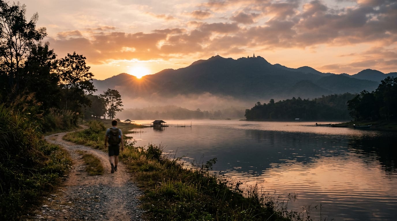
You finish the traverse on the doorstep of two of the most important sights in northern Thailand. Stop in at Wat Phra That Doi Suthep before catching your songthaew home; the chedi is open until 18:00 and the late-afternoon light on the gold is the best of the day. For more on the mountain itself, the geography, the legends of the white elephant, and the history of the road, see the Doi Suthep mountain guide. For a quieter family-friendly walk near the city, head to the Huay Tung Tao circular hike — 4 km on the flat, finishing at a raft restaurant. For other long days in the region, browse the full hiking hub for routes through Khun Chae National Park and around Doi Inthanon.
Photos


Frequently asked questions
How fit do I need to be to do the Doi Pui to Doi Suthep traverse?
Reasonably fit. The hike is 13 km with 850 m of climbing and 1,200 m of descent, taking six to eight hours for most walkers. You do not need to be a trail runner, but if you cannot comfortably walk for six hours on a hot day with a backpack, this is not the hike to start on. The descent is harder than the climb, especially below Wat Pha Lat, where loose laterite and tree roots batter the knees. Anyone with weak knees should bring trekking poles. People who finish without trouble are usually those who have done a few full-day hikes elsewhere in the past year. People who struggle are usually those who train mostly indoors or who have skipped the basic foot-care of trimming nails and breaking in their shoes.
Can I do the hike in the opposite direction, from Doi Suthep up to Doi Pui?
Yes, and many trail runners prefer it because the steepest sections become the climb rather than the punishing descent. Reverse direction adds about 350 m of net climbing and removes the easy-finish at the temple, which most walkers actually want. If you reverse, start at the Wat Pha Lat trailhead just below the Doi Suthep car park, follow the Monks Trail uphill to Wat Pha Lat, then continue up the ridge towards the saddle and on to Doi Pui village. Allow eight to nine hours and arrange a songthaew pickup at Doi Pui in advance, because the village empties of drivers by mid-afternoon and you will struggle to get a fair fare on the spot.
Are there water sources along the trail?
Yes, but treat them. There are two reliable springs: one below the saddle between Doi Pui and the ridge to Doi Suthep, marked by a short bamboo pipe coming out of a mossy bank, and a second smaller seep about two kilometres further on near a small wooden bench. Both run year-round but slow to a trickle in April. You should carry a filter or chlorine tablets, because cattle graze the upper meadows and dog faeces is common around the temples. As a rule, leave the trailhead with at least 2.5 litres per person in the cool season and 4 litres in the hot season.
Will I get lost?
The first half from Doi Pui is the most confusing because it crosses Hmong farmland with multiple tractor tracks. Stay on the highest, ridge-following path until you enter solid forest. Once on the ridge proper the route is obvious. The trickiest junction is about 7 km in, where a small unmarked path drops left towards Hmong farmland and the Monks Trail continues straight on. Look for orange cloth tied to trees, which marks the Monks Trail towards Wat Pha Lat. Below Wat Pha Lat, the trail braids into half a dozen variations that all reach the road, so do not panic if you lose the main line.
Are there leeches?
Yes, between June and October. The damp leaf litter on the descent below Wat Pha Lat is the worst patch, and during August you can pick up 10 to 20 small leeches on a single descent. Tuck trousers into socks, treat boots and gaiters with DEET or permethrin, and check yourself at every break. Leeches in northern Thailand carry no known disease and the bites bleed cleanly, but the itch lasts a week. In the cool season (November to February) leeches disappear entirely and you can wear shorts without worry.
Can I hike it solo?
Plenty of people do. The trail sees twenty to fifty hikers a day in peak season, mostly between Wat Pha Lat and Doi Suthep, so on the upper sections you may walk for two or three hours alone. Carry a paper map or download the offline OpenStreetMap layer in Organic Maps, share your route with someone in town, and start by 07:00 so you finish well before dusk. Mobile signal is patchy on the ridge but solid at both ends. Solo female hikers report few issues, but the small stray-dog packs around the upper temples can be intimidating; a single trekking pole resolves most encounters.
Is there a guide I can hire?
You can hire a guide through Chiang Mai Mountain Biking and Eco Tours or directly through the Pongyang Adventure Park office on the way up the mountain. Expect 1,500–2,500 THB for a private guide for the day. A guide is not necessary if you can read a map, but they are useful in March and April when the trail can be obscured by burned ground cover and ash, and in August when the lower descent below Wat Pha Lat turns to slick clay and you genuinely benefit from someone who has crossed it ten times before.
What time should I start?
Leave the city by 06:00 to reach Doi Pui village by 07:00. The first hour of light is the coolest, and you want to climb the small ridge above the village before the sun is overhead. A 07:00 start gives a comfortable 15:00 finish at Wat Phra That Doi Suthep with time for a long lunch break and a couple of detours. Starting later than 08:30 is a mistake in the hot season; the upper meadows have no shade and the temperature on the exposed ridge regularly hits 36 degrees by noon.
Can I camp on the trail?
Wild camping is technically not permitted inside the national park, but the park rangers tolerate small low-impact camps along the ridge between the two peaks, especially in the cool season. There is no designated campsite. The best informal pitch is in the small clearing about 1 km past the saddle spring, level and sheltered from wind. There are no facilities, no toilet, and no fire is allowed at any time of year. Pack out everything, including paper. Two-day traverses are uncommon but make a good cool-season trip if you want to watch the sunrise from the ridge.
How do I get back from Wat Phra That Doi Suthep?
Red songthaews at the foot of the staircase run a fixed shared rate to the Old City, usually 50 THB per person when they fill up. After 17:00 they switch to a private rate of around 400 THB. Grab does not always reach the temple because of the climb, but it works most days outside of festival traffic. If you finish very late and no songthaews are running, walk down to the Doi Suthep ranger station at the base of the mountain road and call for transport from there. Plan to finish by 16:00 to avoid the awkward last-songthaew negotiation.
Related guides
Temple
Wat Phra That Doi Suthep
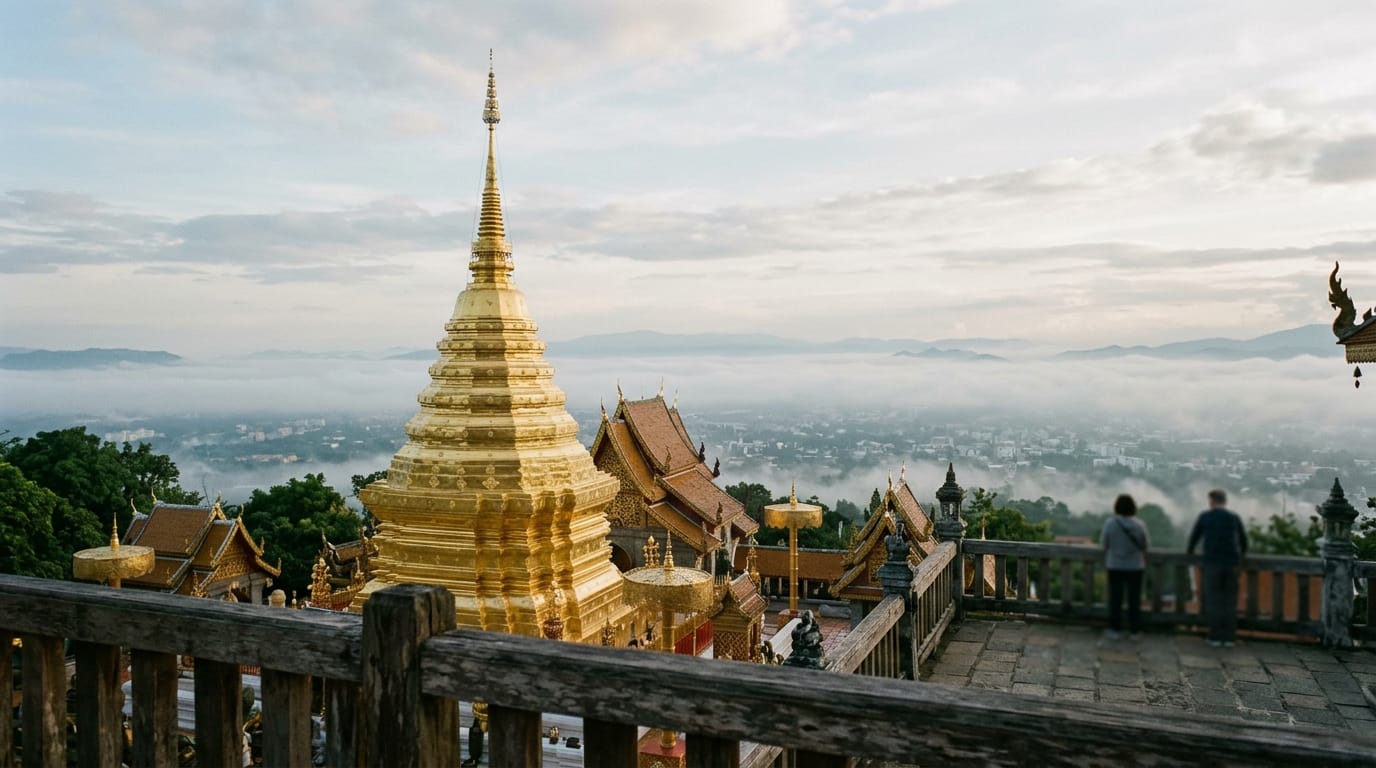
Wat Phra That Doi Suthep is the mountain temple that watches over Chiang Mai from a forested ridge 1,073 metres above the city. Founded in 1383 by King Kuena to enshrine a Buddha relic carried up the mountain on the back of a white elephant, its gilded chedi has been the spiritual centre of northern Thailand for six centuries. A 306-step naga-flanked staircase or a small cable car carries visitors to a courtyard with one of the great views of the Ping Valley.
Sight
Doi Suthep
Doi Suthep is the 1,676 m mountain that rises straight out of the western suburbs of Chiang Mai. The mountain holds the city's most photographed temple at 1,073 m, the king's winter palace, a Hmong village near the summit and several waterfalls — and is a separate destination from the temple of the same name, which sits on its flank.
Hike
Doi Lanka Noi Loop
An 8 km loop on the southern shoulder of the Doi Lanka range inside Khun Chae National Park, two hours north-west of Chiang Mai. Five hours, 700 m of climb through evergreen montane forest to a 2,031 m summit ridge, with two streams to refill from and a high meadow that holds the last of the morning mist until almost 10:00. Quiet, properly remote, and the best summit day inside a half-day drive of the city.
Hike
Huay Tung Tao Circular Hike
A flat 4 km loop around the Huay Tung Tao reservoir at the foot of Doi Suthep, 20 minutes from the Chiang Mai Old City. Easy walking on dirt and grass, three swim spots, raft restaurants serving Northern Thai food on the eastern shore, and the only family-friendly hike near the city where strollers and small children manage the whole circuit. Year-round, ninety minutes door-to-door, 50 baht entry.