A 2.5 km loop at 2,200 m along the Kew Mae Pan ridge near the summit of Thailand's highest mountain, plus the easier 360 m Ang Ka Luang boardwalk through cloud forest. Ninety minutes for the main loop, no climb worth mentioning, but a local Karen guide is mandatory for Kew Mae Pan from November through May. Open seasonally; closed June through October for bird nesting.
Updated
Overview and why hike it
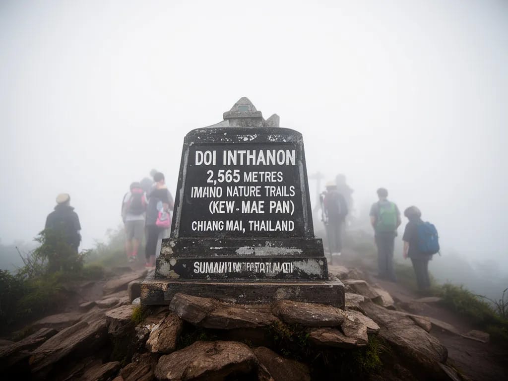
The nature trails at the summit of Doi Inthanon (doi is the northern Thai word for mountain) are not a “hike” in the sense of the long days described elsewhere in this guide. They are short engineered loops at high altitude, with handrails on the boardwalk sections and a paid local guide on the cliff-edge sections. What you trade for the lack of effort is height: 2,565 m at the summit, the highest ground in Thailand, with cool-forest vegetation and cliff-edge views that exist nowhere else in the country.
There are two trails worth walking and one summit photo stop:
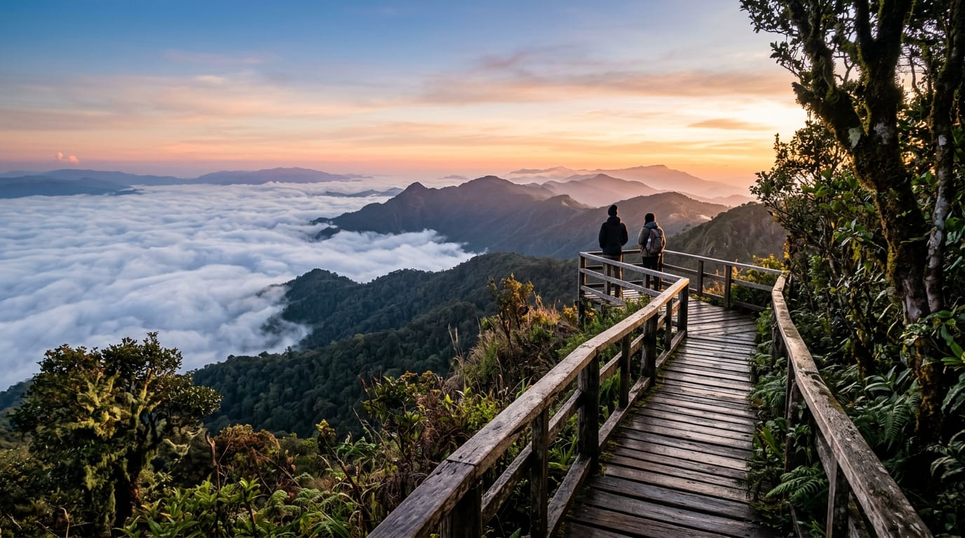
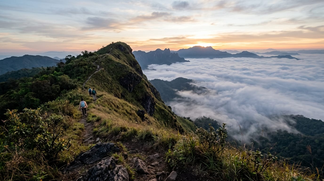
Kew Mae Pan is the headline trail. A 2.5 km loop at 2,200 m along the cliff edge of the Doi Inthanon ridge, looking west across the Mae Chaem valley. Ninety minutes of walking on graded earth with a single rocky section and one set of wooden steps. Total ascent 150 m. Open November through May only; closed June through October to protect nesting birds. A local Karen Pakanyaw guide is mandatory and costs 200 baht (THB, the Thai currency) per party of up to seven walkers.
Ang Ka Luang is the easier option. A 360 m wooden boardwalk through high-altitude cloud forest a few hundred metres from the summit, with railings the entire way. Open year-round, no guide required, accessible to most strollers. Twenty minutes of walking.
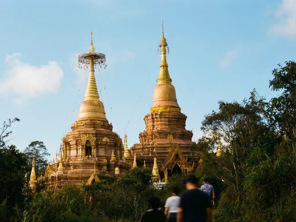
The summit marker at 2,565 m is a short walk from the car park, marked by a small concrete pillar and a shrine to King Inthawichayanon. Five minutes.
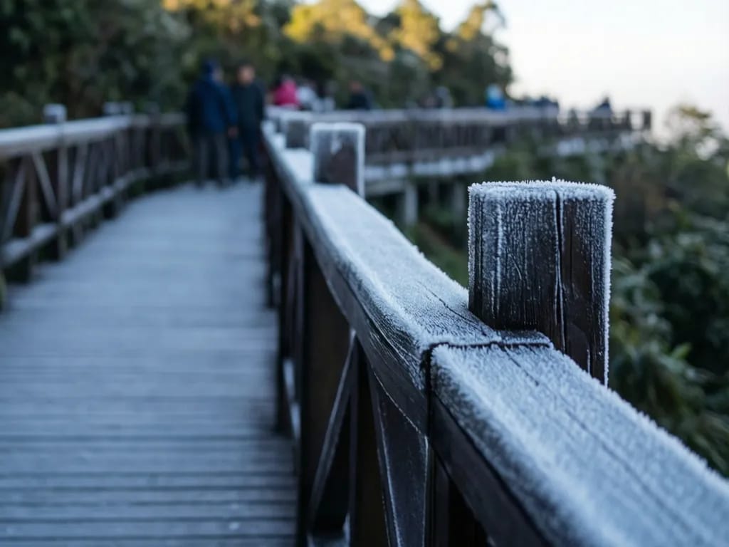
You can walk both trails plus the summit in about three hours, plus an hour at the twin royal chedis (bell-shaped Buddhist reliquary towers) lower down the mountain. The driving from Chiang Mai is the limiting factor: 100 km each way, two hours and 15 minutes on Highway 108 south and Route 1009 west. Plan a full day. The reward is the only high-altitude cloud forest in Thailand, with hoarfrost on the boardwalk railings most January mornings. No other trail this easy gets you into bird habitat this rich; the park holds more than 380 species, the largest count of any national park in the country.
Getting to the trailhead
The summit area is 100 km from the Chiang Mai Old City and the drive takes about two hours and 15 minutes in light traffic. Most visitors leave the city at 06:30 to arrive at the park gate at 09:00 and on the trail by 10:00.
The route runs Highway 108 south to Chom Thong town for 60 km, then Route 1009 west into the park and up the mountain for 40 km. Route 1009 is paved the whole way but climbs steeply on the upper sections with hairpins; first-time scooter riders should not attempt it. Even a small hire car needs to be in good condition; check the brakes and tyres at the rental desk.
Self-driving is the standard option. Most Chiang Mai hire firms charge 900 to 1,200 THB per day for a small automatic, plus around 280 THB of fuel for the round trip. Drives Asia, North Wheels and Budget all rent at the airport and in the Old City.
Private drivers with cars cost 3,000 to 4,500 THB for the day. A small-group day tour booked through any Old City agency costs 1,500 to 2,200 THB per person and typically includes park entry, lunch, and stops at the twin royal chedis and one waterfall. The tour does not include the Kew Mae Pan guide fee, which you pay separately at the trailhead.
There is no public bus service from Chiang Mai to the summit. Songthaews (shared pick-up truck taxis) running between Chom Thong town and lower park villages exist but do not climb the upper mountain road. Realistically you need your own transport or a tour.
Pay the park entry fee at the main gate near the base of Route 1009: 300 THB for foreigner adults and 150 THB for foreigner children. Keep the ticket; rangers check at the upper trailheads and at the bottom on the way out the same day. There is a separate car fee of 30 THB and a motorbike fee of 20 THB.
The Kew Mae Pan trailhead is at 18.5882 N, 98.5023 E, a marked turn-off from the upper summit road about 5 km below the summit itself. The car park is small (room for about 15 vehicles) and on weekends fills by 10:30. The check-in hut for guide booking is a wooden shelter immediately above the car park.
The Ang Ka Luang boardwalk trailhead is 200 m walk from the main summit car park. No guide check-in required. The boardwalk is signposted in English and Thai.
The summit marker is a 100 m walk on a paved path from the same car park as the Ang Ka Luang boardwalk.
Turn-by-turn description
Kew Mae Pan trailhead and check-in (0 to 100 m)
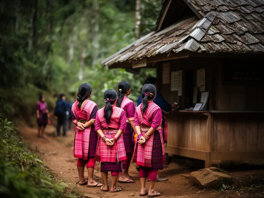
From the small car park, walk up the wooden steps to the check-in hut on the right. The hut is staffed from 06:00 to 14:30 by Karen Pakanyaw guides and a park ranger. Pay the 200 THB guide fee for your party, sign the trail register with your name, nationality and expected finish time, and wait briefly until a guide is free. On a quiet midweek morning you walk immediately; on a Saturday in January you may wait 20 to 40 minutes. There is a small toilet block behind the hut. No food or water for sale.
The trailhead itself is 50 m beyond the check-in hut. A small wooden arrow points right into the forest, and the guide goes first.
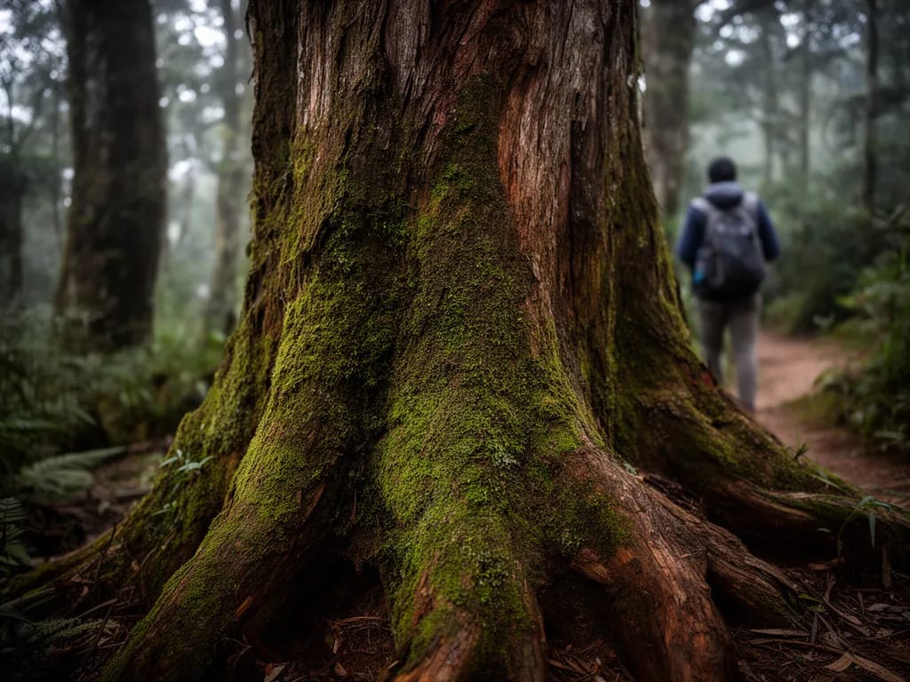
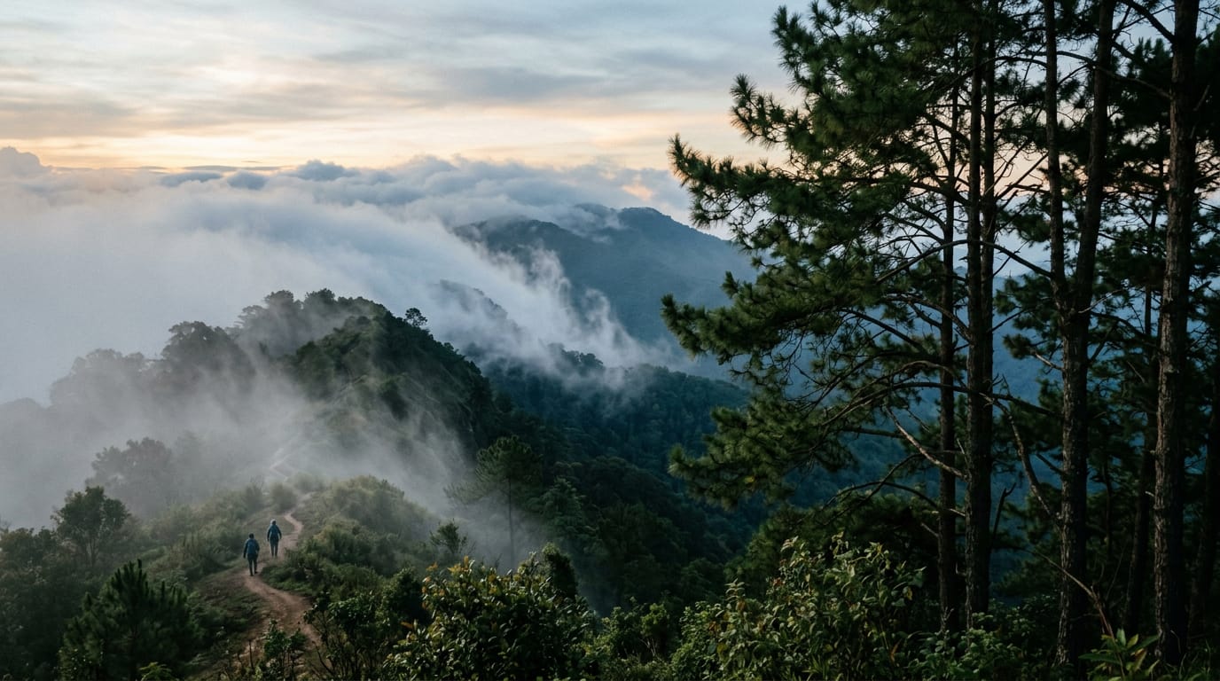
First section: the cloud forest entry (100 m to 800 m, +50 m)
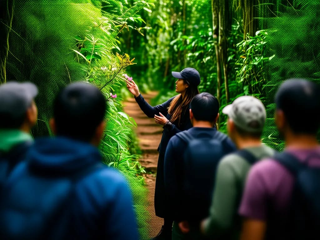
The first part of the loop runs through dense cloud forest on a flat earth path. The trees are oak and laurel covered in long curtains of moss, and the canopy is closed enough that the forest floor stays dim even at midday. This is the most consistently atmospheric section of the trail and where most of the best bird sightings occur. Walk slowly and let the guide point out the green-tailed sunbird and the chestnut-tailed minla on the lower branches.
The trail rises gently for the first 400 m, then flattens. At 600 m the path crosses a small wooden bridge over a seep, where the trail is sometimes wet under foot. Watch your footing on the planks, which can be slick with moss.
Climb to the high point (800 m to 1.2 km, +100 m)
A short section of wooden steps climbs about 30 m to a flat platform on the ridge edge. This is the only properly steep ground on the loop and takes about ten minutes. The steps are sound but unevenly spaced; trekking poles are not needed but help small children.
The platform at the top sits at about 2,250 m and gives the first long view west into the Mae Chaem valley. On a clear December day you can see the river and the patchwork of na (rice paddy) on the valley floor 1,500 m below. On a misty morning the cloud sits at platform level and you see nothing but white at the cliff edge, which is its own kind of pretty.
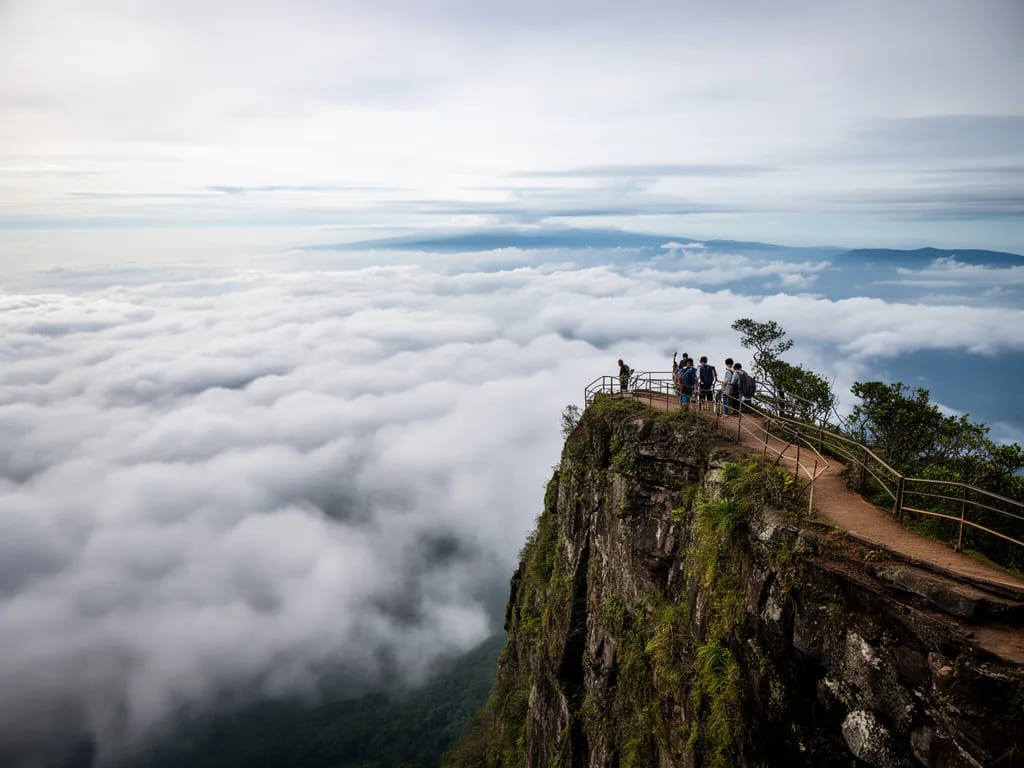
Cliff-edge traverse (1.2 km to 1.8 km, flat)
From the platform the trail turns south along the cliff edge for 600 m. This is the signature section of the loop. The cliff is fenced in three places where the drop is most direct, but elsewhere the path runs within a metre of the edge. Stay on the marked path and behind the guide, especially if walking with children.
The path passes a small wooden viewpoint at about 1.5 km, which is the spot for the postcard photo of the trail, with the cloud-filled Mae Chaem valley behind the railing. The viewpoint platform is about 4 m square and accommodates ten people comfortably; in peak season the guide will move groups through quickly.
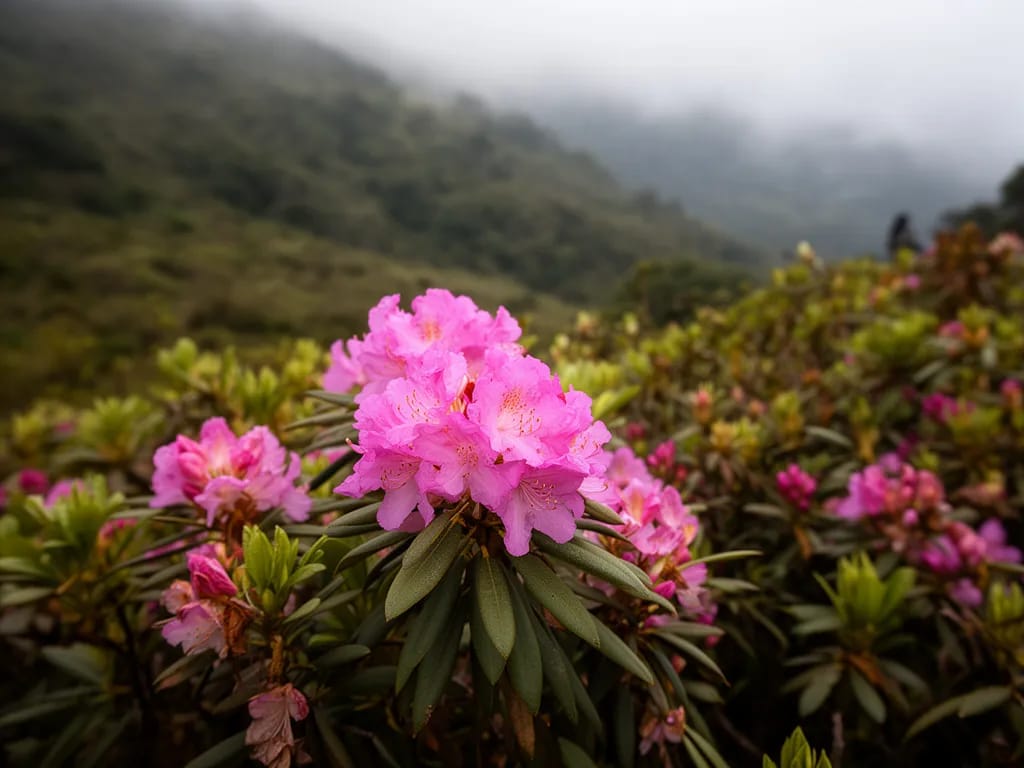
Just past the viewpoint, a stand of wild Himalayan cherry blooms in pink from mid-January through early March. Rhododendron in red and pink blooms on the same ridge from February through April.
Return through the forest (1.8 km to 2.5 km, -50 m)
The trail turns away from the cliff edge and re-enters dense cloud forest on a gently descending path. The forest here is mossier than the entry section because it sits on the lee side of the ridge and holds moisture longer. The understory is thick with epiphytic orchids and tree ferns.
At about 2.2 km the path crosses a small open clearing where the guides routinely stop for a planned break. This is the only point on the loop with seating, a small log bench and a small carved wooden sign with a brief history of the Karen Pakanyaw community’s role in protecting the trail.
The final 300 m descends gently back to the check-in hut. Sign out on the trail register on the way past. The loop has taken about 90 minutes including stops.
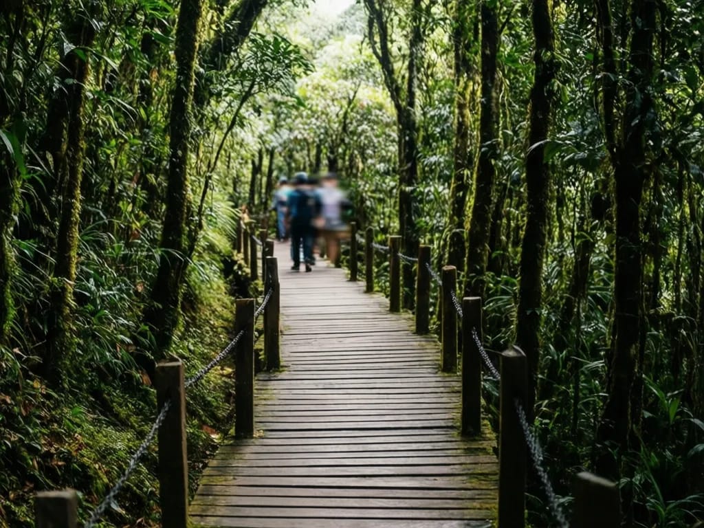
Ang Ka Luang boardwalk (separate trail, 360 m, no climb)
Drive 5 km up to the main summit car park and walk 200 m to the Ang Ka Luang boardwalk trailhead. The boardwalk is a 360 m wooden loop through the same cloud forest at slightly higher elevation, around 2,500 m, with handrails the entire way. No guide required. Twenty minutes at a slow pace.
The boardwalk is the only part of the summit area accessible to most strollers and standard wheelchairs. It is also the only loop open in the closed season (June to October), although on rainy days the boards are slippery and visitors should walk slowly.
The summit marker is a 100 m paved path from the same car park. Take the photo, look at the small shrine to King Inthawichayanon, and return.
Difficulty and safety
The trails are rated easy/moderate. The walking itself is straightforward. What catches people out is the altitude, the cold and the cliff edge.
Cold is the main concern. The summit area sits at 2,200 to 2,565 m and air temperatures drop to 0 to 4 degrees at dawn between mid-December and early February. Even at midday the wind on the ridge can drop the felt temperature into single digits. Carry a proper insulating jacket, a hat and gloves. Most visitors arrive in shorts and a T-shirt and regret it.
Altitude affects perhaps one in twenty visitors with mild headaches, shortness of breath on the wooden steps, or slight nausea. Drink water, walk slowly, avoid a heavy breakfast. Severe altitude sickness is essentially unheard of.
The cliff edge on the Kew Mae Pan loop drops 800 m at its sheerest point. The trail is fenced where the drop is most direct but not everywhere; supervise children, do not lean over the edge for photos, and never step off the marked path. The guide will keep groups moving.
Stray dogs are limited to the lower park villages and do not reach the summit area trails.
Wildlife encounters are unusual. The most likely is a flushed flock of birds from the forest understory, which is harmless. Serow and small barking deer pass through the high forest but are almost never seen by day-trippers.
Phone signal is reliable at the summit area on AIS and TrueMove H. The lower trail sections drop signal but the gap is brief.
Save the contact for the Doi Inthanon National Park headquarters: +66 53 286 730. The park has a small first-aid station at the visitor centre and a road ambulance on standby during peak season.
What to pack
- 1.5 litres of water per person (none available on the trail)
- Warm insulating jacket, hat and gloves November through February
- Light long-sleeve shirt for sun and wind cover in shoulder seasons
- Sun hat and sunscreen for the cliff-edge section
- Light rain shell year-round; cloud forest is often wet
- Trainers or light hiking shoes; full boots are overkill
- 600 THB cash: 300 park entry, 200 guide fee, 100 spare for food
- Snacks; no food sold on the trail itself
- Camera or phone with weather-sealed pouch
- Binoculars if you care about birds
- Trekking poles if you have weak knees and plan to do the wooden steps
- Headtorch as backup if you start after 14:00 in shoulder season
- Insect repellent for the lower forest (Ang Ka Luang has midges)
- Small first-aid kit with paracetamol for altitude headache
Permits and fees
The Doi Inthanon National Park entry fee is 300 THB for foreigner adults, 150 THB for foreigner children, 50 THB for Thai adults and 20 THB for Thai children, collected at the main gate at the base of Route 1009. Add 30 THB for a car or 20 THB for a motorbike. The fee covers the entire park for the calendar day, including the summit area, the twin royal chedis, the Mae Klang waterfall and any other trails. Keep the ticket; rangers check at the trailheads.
The Kew Mae Pan trail requires both park entry and an additional 200 THB guide fee, paid in cash at the trailhead check-in hut to the Karen Pakanyaw community guide programme. The fee is per party of up to seven walkers, not per person. Pay in small notes. The guide programme operates 06:00 to 14:30 daily from November through May; outside those hours and during the June to October closure the trail is not accessible. Rangers actively turn back unguided parties. The Ang Ka Luang boardwalk requires no additional fee and no guide.
When to hike
November to February is the prime season. Day temperatures at the summit of 8 to 16 degrees, dawn lows of 0 to 4 degrees, low humidity, the best long views into the Mae Chaem valley. Cherry blossom on the Kew Mae Pan ridge from mid-January through early March. Hoarfrost on the railings most January mornings. Weekends in this window are busy; weekdays are quiet.
March to mid-May is the burning season at lower elevations, but Doi Inthanon’s summit sits above the smoke layer on most days. The trail is still pleasant although views into the lower valley are obscured. Day temperatures at the summit of 14 to 20 degrees, more comfortable for walking but less dramatic for photos. Rhododendron blooms peak in March.
June to October is closed for Kew Mae Pan. The Ang Ka Luang boardwalk stays open but is rainy and the forest is permanently damp. Useful only if you happen to be in the area; not worth the dedicated drive from Chiang Mai during this window.
Where to eat and refresh after
The summit visitor centre has a basic canteen open 09:00 to 17:00 serving fried rice, pad krapao (stir-fried holy basil, usually with minced pork over rice) and noodles at 60 to 100 THB per dish. Coffee is instant and serviceable. The twin royal chedis car park has a row of Karen vendor stalls selling grilled corn at 20 THB, hot soy milk at 25 THB, pork skewers at 10 THB each and sticky rice with mango in season at 60 THB. Khao Soi Mae Pang, a small shop on Route 1009 about 10 km below the park gate, does the best khao soi (northern Thai curried noodle soup) on the descent at 60 THB a bowl; recognise it by the blue sign and the line of pickup trucks at lunch. In Chom Thong town, Por Sue Restaurant on the main highway is the reliable air-conditioned stop on the long drive back to Chiang Mai, with Thai-Chinese standards at 100 to 200 THB per dish.
A short note on the Karen guides and the community model
The Karen Pakanyaw community-based guide programme at Kew Mae Pan is one of the longer-running and better-documented Indigenous ecotourism initiatives in northern Thailand. The agreement with the national park dates from the early 2000s and channels the 200 THB guide fee directly to the village rather than to the park administration. Income from the programme funds a small village school and the seasonal trail maintenance work between October and November before the trail reopens for the cool season. The guides themselves rotate through the work; on a given day you may walk with a teenage trainee, a senior guide of 30 years’ experience, or anyone in between. Most are courteous and know the local plants and birds well; they will slow the pace for children or photography if you ask. Tipping is not expected; a 50 THB tip at the end of the loop is generous and welcome. If you can buy a bag of Karen-grown coffee at the small village shop near the bottom of the access road on the way out, you support the programme further. None of this is essential to the hike but it explains why the trail is run the way it is, and why pre-booking is not possible.
Nearby and related
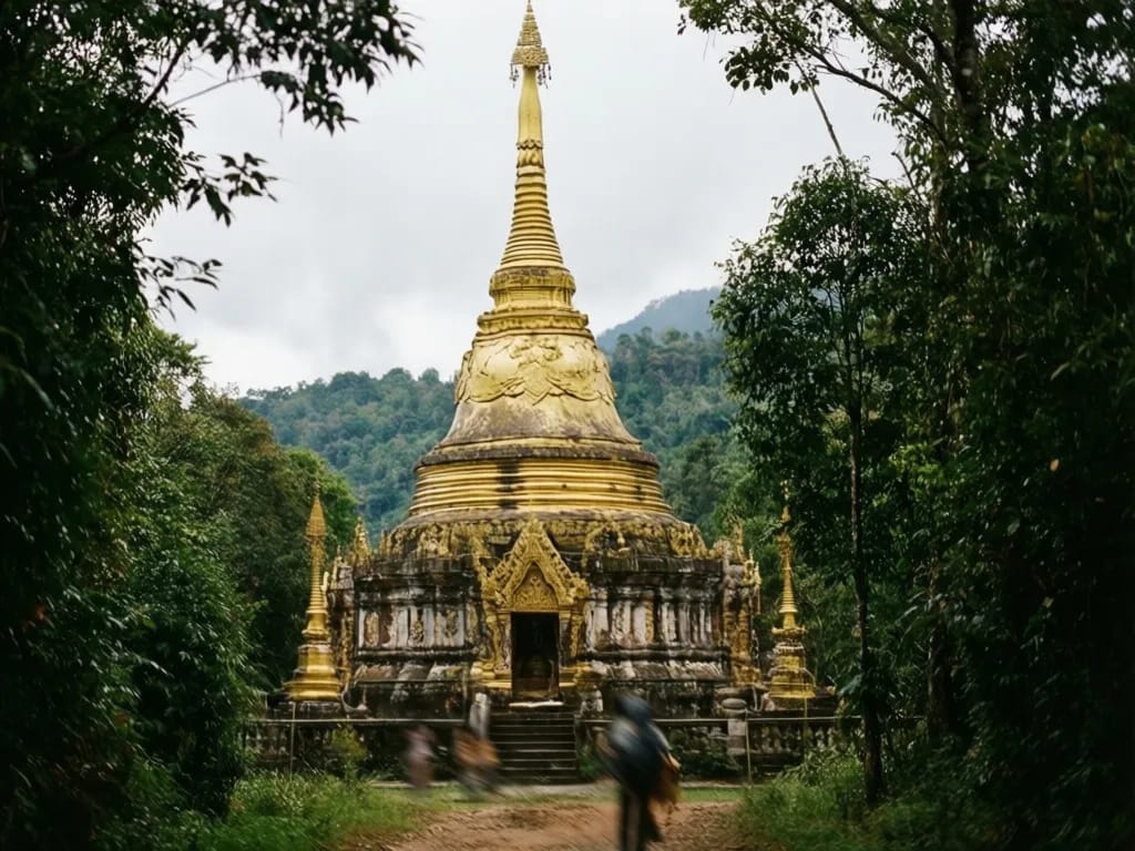
Most visitors combine the nature trail with the rest of the summit area on the same day. The full driving and sightseeing itinerary is covered in the Doi Inthanon sightseeing guide, including the twin royal chedis, the Mae Klang and Wachirathan waterfalls, and the Karen villages on the lower mountain. For a more challenging summit hike on the same massif, the Doi Lanka Noi loop climbs to 2,031 m in Khun Chae National Park about an hour north of Doi Inthanon. The flagship long-day hike near the city is the Doi Pui to Doi Suthep traverse. For an easier family day closer to Chiang Mai, the Huay Tung Tao circular hike is a flat 4 km loop. For the wider picture, browse the full hiking hub.
Photos

Frequently asked questions
Why do I need a guide for Kew Mae Pan?
The local Karen Pakanyaw community runs the trail as a community-based ecotourism project, in agreement with the national park. The guide programme provides income for the village, protects the fragile high-altitude vegetation by keeping groups on the marked path, and ensures the trail is properly maintained. The guide fee is 200 THB per party of up to seven hikers and is paid at the check-in hut at the trailhead. Guides speak basic English and Thai. The 360 m Ang Ka Luang boardwalk near the summit does not require a guide and can be walked at any time without booking. The Kew Mae Pan guide programme only applies November through May; the trail is closed June through October regardless.
Can I do this as a day trip from Chiang Mai?
Yes, and most visitors do, although the drive is the limiting factor. The summit area is 100 km from the Chiang Mai Old City by Highway 108 and Route 1009, a drive of two hours and 15 minutes in light traffic. A 06:30 departure puts you at the park gate at 09:00 and on the Kew Mae Pan loop by 10:00. Allow three to four hours at the summit area for the Kew Mae Pan loop, the Ang Ka Luang boardwalk, the twin royal chedis and a quick stop at the summit marker, and you are back in the city by 18:00. An overnight at the park bungalows lengthens the trip but is unnecessary for the trail itself.
Is the trail suitable for children?
Yes for both. The Ang Ka Luang boardwalk at the summit is a 360 m wooden walkway with handrails the whole length, suitable for any child who can walk independently and accessible to most strollers. The Kew Mae Pan loop is 2.5 km on a graded earth path with one short rocky section and one set of wooden steps; children aged six and up manage it comfortably. The guides are patient with families. The bigger constraint with children is the altitude (2,200 to 2,565 m) and the cold; in December and January temperatures at the summit can drop to 0 degrees at dawn, and even at midday the wind chill can drop the felt temperature into single digits.
What is the difference between Kew Mae Pan and the summit?
The summit of Doi Inthanon is the highest point in Thailand at 2,565 m, marked by a small concrete pillar and a shrine to King Inthawichayanon, the last king of Chiang Mai. It is a few steps from the car park and not a hike. The Kew Mae Pan trail is a 2.5 km loop along the cliff edge about 5 km below the summit by road, at 2,200 m, with the best views of the cloud-filled Mae Chaem valley in the park. The Ang Ka Luang boardwalk is a 360 m loop through cloud forest a few hundred metres from the actual summit. Most visitors do all three; they total about three hours and are within a 6 km stretch of summit road.
Why is the trail closed June through October?
The Kew Mae Pan ridge is a recognised nesting and breeding habitat for several rare and endemic bird species, most importantly the green-tailed sunbird, the spectacled barwing and several thrushes. The closure protects them during nesting season. The Ang Ka Luang boardwalk stays open because the boardwalk is elevated above the forest floor and the route does not pass through the most sensitive nesting areas. The closure is enforced; rangers turn back hikers and there is no alternative route. Plan summit visits for November through May only if you want the full ridge experience.
Can I see frost or even snow?
Frost is common at the summit between mid-December and early February. Most weeks of January will see ground frost on at least one morning and air temperatures of zero to four degrees at dawn. Snow is extremely rare; the last documented snowfall on Doi Inthanon was in January 1955. What you will see instead is hoarfrost on the ground vegetation and on the wooden railings of the Ang Ka Luang boardwalk, which the park rangers actively promote as a winter attraction. Dress as you would for a brisk autumn day in northern Europe: insulated jacket, hat and gloves. Most visitors arrive underdressed and regret it within ten minutes.
What about altitude sickness?
At 2,200 to 2,565 m, true altitude sickness is uncommon but not impossible, especially for visitors arriving directly from sea level the same day. Mild symptoms (headache, shortness of breath on the wooden steps, slight nausea) affect perhaps one in twenty visitors. Severe altitude sickness is essentially unheard of. Drink plenty of water, walk slowly on the climb to the Kew Mae Pan high point, and avoid heavy meals before the hike. If you are coming from a Bangkok flight the same morning, take it gently. The drive itself climbs gradually and gives the body some time to adjust.
What wildlife and plants will I actually see?
Birds are the headline attraction. Doi Inthanon holds the largest bird species count of any park in Thailand, more than 380 species, and the high-altitude trails are the only place in the country to see specialists like the green-tailed sunbird, the chestnut-tailed minla and the dark-sided thrush. February brings flocks of rufous-bellied niltava into the cherry blossom. Plants worth noticing include the Himalayan epiphytic orchids, several rhododendron species and the unusual saw-toothed oak which grows only above 1,800 m in northern Thailand. The Karen guides know the plant names in Thai and Karen and will point them out without asking.
How do I book the trail and the guide?
You cannot pre-book. The guide service is first-come first-served at the check-in hut at the Kew Mae Pan trailhead, open from 06:00 to 14:30 daily during the trail's open season. Pay your 200 THB guide fee for your party (up to seven hikers), sign the trail register, wait briefly for an available guide and walk. On peak weekends in December and January the wait can be 20 to 40 minutes at busy times but is rarely longer; on weekdays you usually walk immediately. You must already have paid the 300 THB park entry at the main gate at the bottom of the mountain. Bring small notes for both fees; change can be slow at the trail hut.
Are there places to eat near the trail?
Yes, three. The visitor centre near the summit has a basic canteen open 09:00 to 17:00 serving fried rice, noodles and instant coffee at modest prices, around 60 to 100 THB per dish. The twin royal chedis car park has a row of food stalls run by Karen vendors selling grilled corn, hot soy milk, sticky rice with mango (in season) and pork skewers at 20 to 50 THB. The lower park area at the Mae Klang waterfall complex has more substantial Thai food at around 100 to 150 THB per dish. Bring snacks if you are travelling with hungry children; the gap between the upper food stalls and the lower waterfall complex is about a 30 minute drive.
Related guides

Sight
Doi Inthanon
Doi Inthanon is the highest mountain in Thailand, rising to 2,565 m about 70 km south-west of Chiang Mai. The national park around it bundles twin royal pagodas, cloud forest boardwalks, tiered waterfalls, Karen and Hmong villages and the famous Kew Mae Pan ridge trail into a single full-day trip from the city.
Hike
Doi Lanka Noi Loop
An 8 km loop on the southern shoulder of the Doi Lanka range inside Khun Chae National Park, two hours north-west of Chiang Mai. Five hours, 700 m of climb through evergreen montane forest to a 2,031 m summit ridge, with two streams to refill from and a high meadow that holds the last of the morning mist until almost 10:00. Quiet, properly remote, and the best summit day inside a half-day drive of the city.
Hike
Doi Pui to Doi Suthep Traverse
A classic 13 km point-to-point traverse across the spine of Doi Suthep-Pui National Park, dropping from the Hmong village at Doi Pui (1,685 m) through pine and dipterocarp forest, past Wat Pha Lat, and finishing at the gilded chedi of Wat Phra That Doi Suthep. Six to eight hours, 850 m of climbing, 1,200 m of descent, a couple of springs, and one of the few hikes in northern Thailand where you finish at a working temple with songthaews waiting at the door.
Hike
Huay Tung Tao Circular Hike
A flat 4 km loop around the Huay Tung Tao reservoir at the foot of Doi Suthep, 20 minutes from the Chiang Mai Old City. Easy walking on dirt and grass, three swim spots, raft restaurants serving Northern Thai food on the eastern shore, and the only family-friendly hike near the city where strollers and small children manage the whole circuit. Year-round, ninety minutes door-to-door, 50 baht entry.