
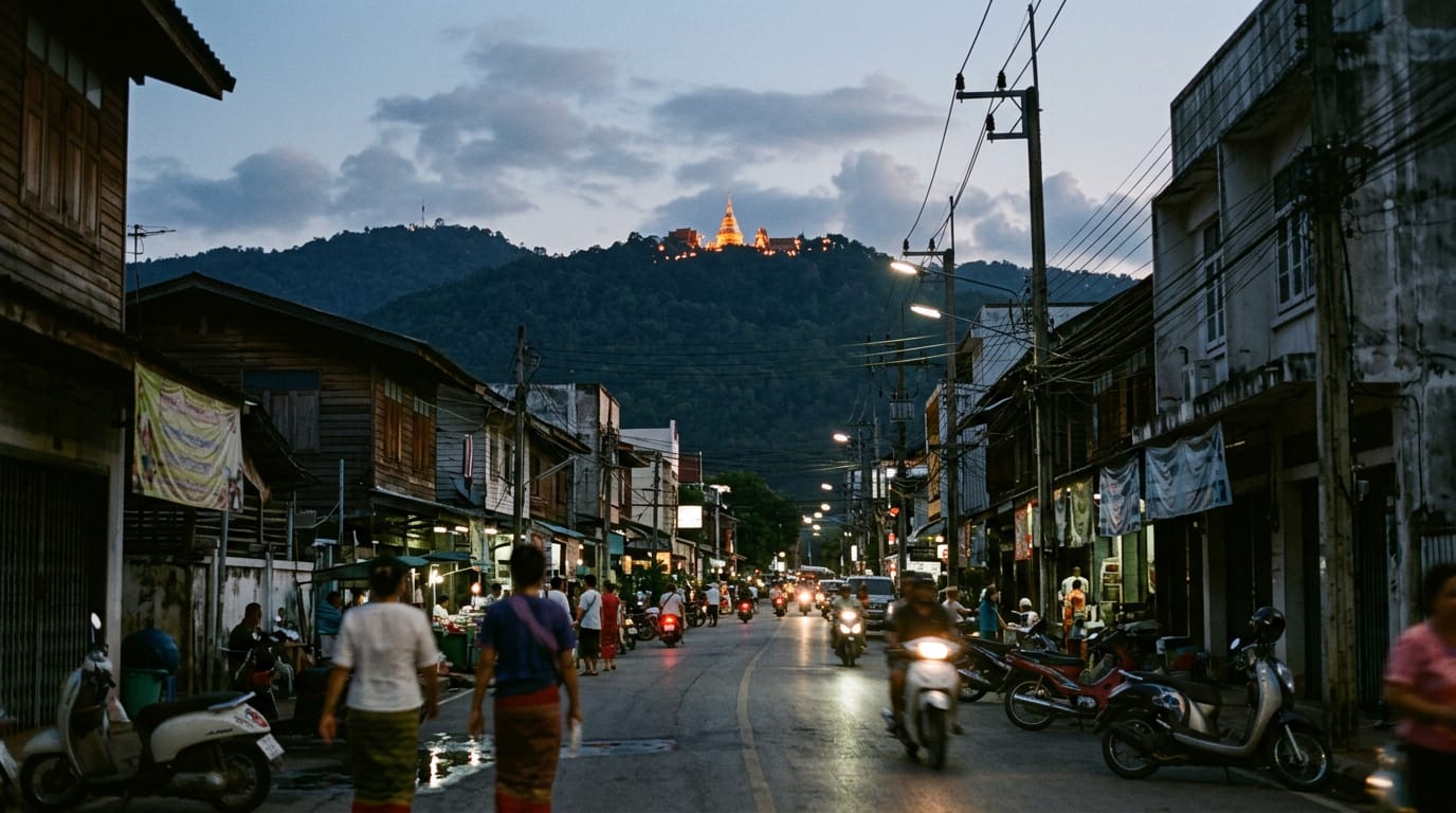
Doi Inthanon is the highest mountain in Thailand, rising to 2,565 m about 70 km south-west of Chiang Mai. The national park around it bundles twin royal pagodas, cloud forest boardwalks, tiered waterfalls, Karen and Hmong villages and the famous Kew Mae Pan ridge trail into a single full-day trip from the city.
Updated
What it is
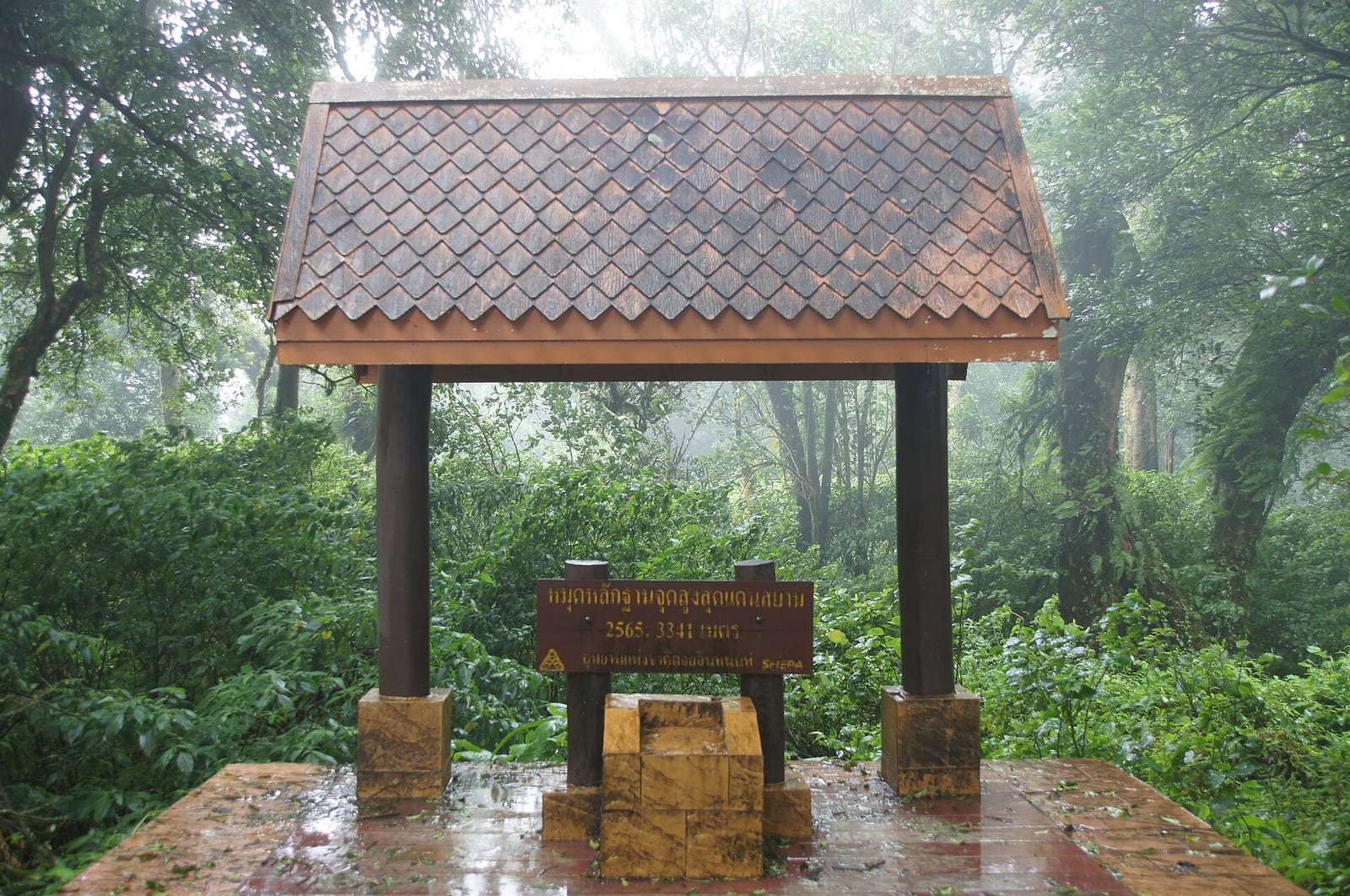
Doi Inthanon is the highest point in Thailand. The doi (mountain) crests at 2,565 m and sits about 70 km south-west of Chiang Mai inside Doi Inthanon National Park, a 482 km² protected area that covers most of the Chom Thong, Mae Chaem and Mae Wang districts. The park is the southern tail of the Shan Hills, the same range that runs north into Burma and east into Laos. It is named after the last independent king of Lanna, Chao Inthawichayanon, whose remains are buried in a small chedi near the summit.
The mountain is not a single dramatic peak. It is a broad, forested ridge that climbs steadily from the Mae Klang plain at 300 m through deciduous dry forest, then evergreen broadleaf, then upper cloud forest, then the mossy stunted oaks and rhododendrons of the summit zone. That gradient makes it the single best birding site in mainland South-East Asia: over 380 species have been recorded, including Himalayan endemics that occur nowhere else in Thailand. For the casual visitor it means the temperature drops from 30 °C at the gate to 12 °C at the top, often inside a single morning’s drive.
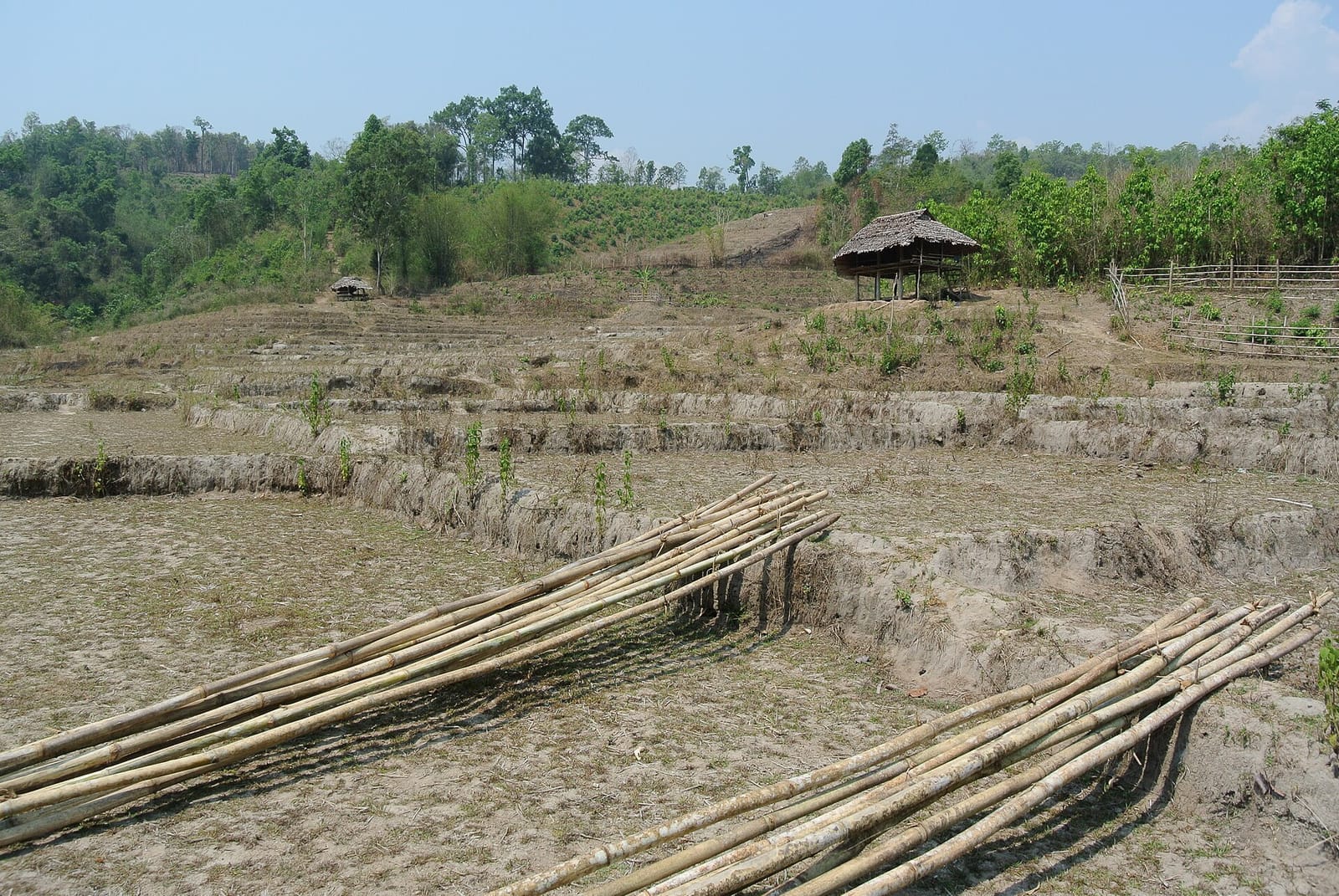
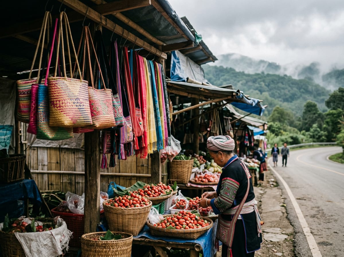
The park is also lived-in. Karen villages farm coffee and rice on the lower slopes, and Hmong villages grow strawberries, lychees and cool-climate vegetables in the upper valleys. Both communities have been here longer than the park, and their roadside stalls are part of the experience. The royal twin pagodas, the two showpiece chedis built in 1987 and 1992 to honour the king and queen, give the mountain its postcard image, but they are the polished end of a much wilder place.
Highlights
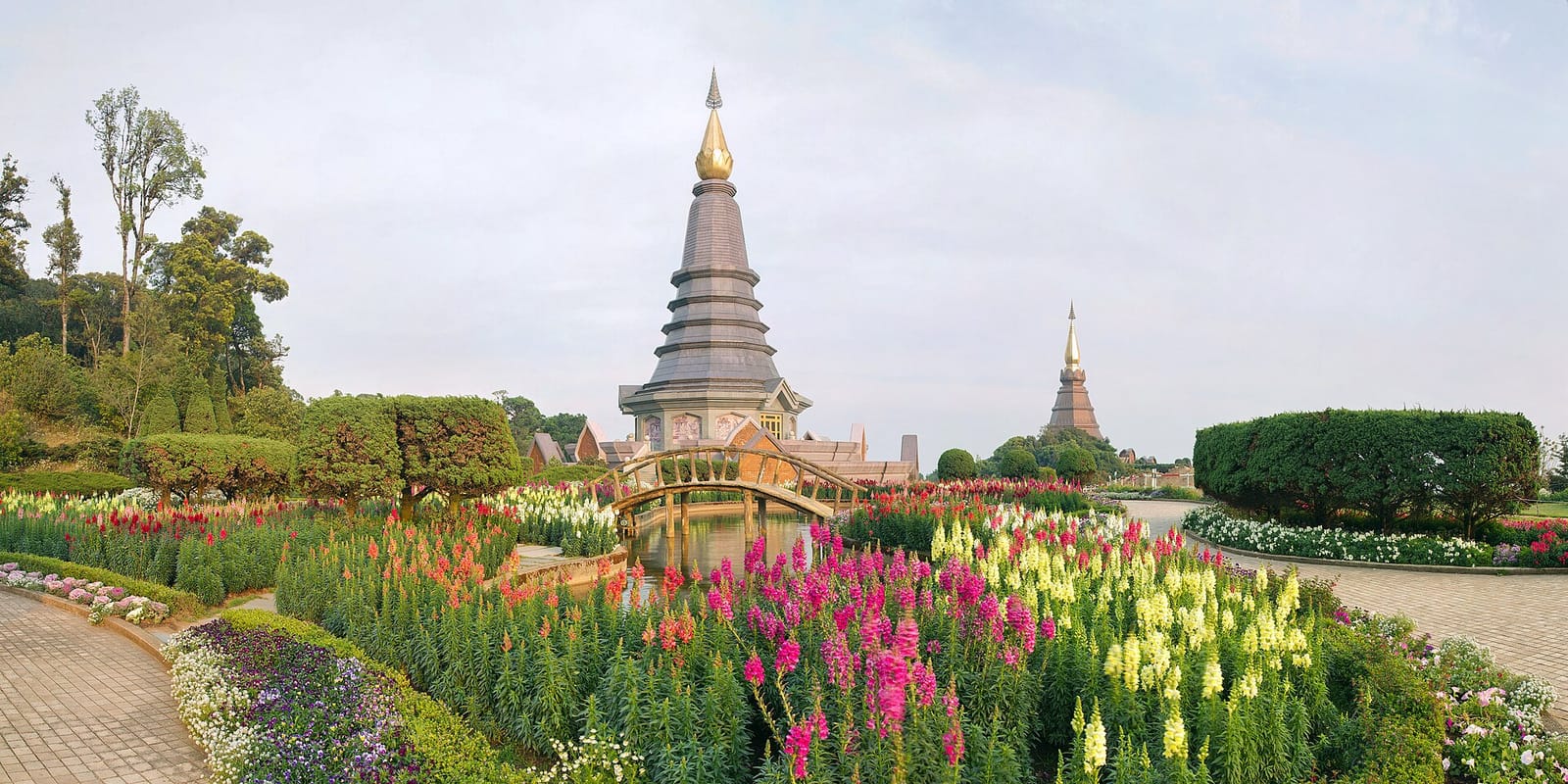
Twin royal pagodas
The two chedis, Phra Maha Thaht Naphamethanidon and Phra Maha Thaht Naphaphonphumisiri, sit on a ridge at 2,200 m about ten minutes’ drive below the summit. The first was built in 1987 for the king’s 60th birthday, the second in 1992 for the queen’s. They are paired across a hillside of terraced gardens that peak in colour from December to February, when the cool nights bring out salvias, marigolds and dahlias.
Inside each pagoda is a relic chamber with a Buddha image and mosaic panels showing the king’s life. The chedis are connected by a stepped path and a series of viewing platforms that look west over the Mae Wang valley. On a clear morning you can see all the way to the Burmese border, but the more common experience is to watch cloud filling the valleys below. Entry is 50 baht and includes the gardens.
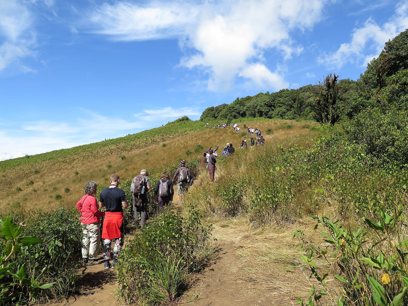
Kew Mae Pan nature trail
Kew Mae Pan is the only true ridge walk on Doi Inthanon. The trail is 2.5 km long, takes about 90 minutes and runs anticlockwise from a Karen-staffed trailhead at 2,200 m around an open grassy summit and back through dwarf cloud forest. The middle section is the reason to come: the path emerges onto a steep grassy slope facing west into the Mae Chaem valley, with cloud often pouring over the ridge from below.
The trail is open from November to May only. A Karen guide is required and is hired on the spot for 300–400 baht per group of up to ten; you do not need to book ahead. Wear shoes with grip: the path is muddy in patches and the descent has rough stone steps.
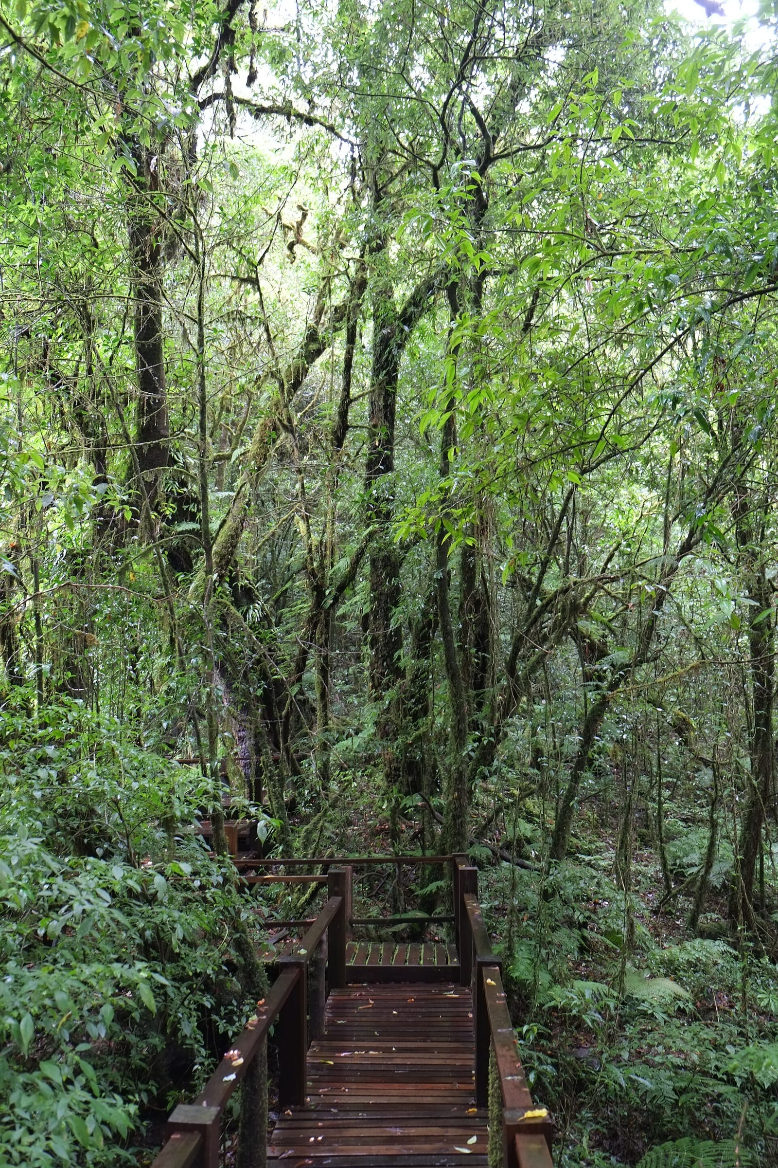
Ang Ka boardwalk
Ang Ka is the summit cloud forest: 360 metres of raised wooden boardwalk through a permanently misty stand of stunted oak draped in moss and lichen, with a small sphagnum bog at the lowest point. The walk is flat, takes 20 minutes at most, and is open every day. It is the easiest place in Thailand to feel like you are in a tropical montane cloud forest, which technically you are.
The boardwalk is reached from the summit car park via a short paved path that also passes the official Highest Point in Thailand marker, the small shrine to Chao Inthawichayanon, and the Royal Thai Air Force radar station fence.
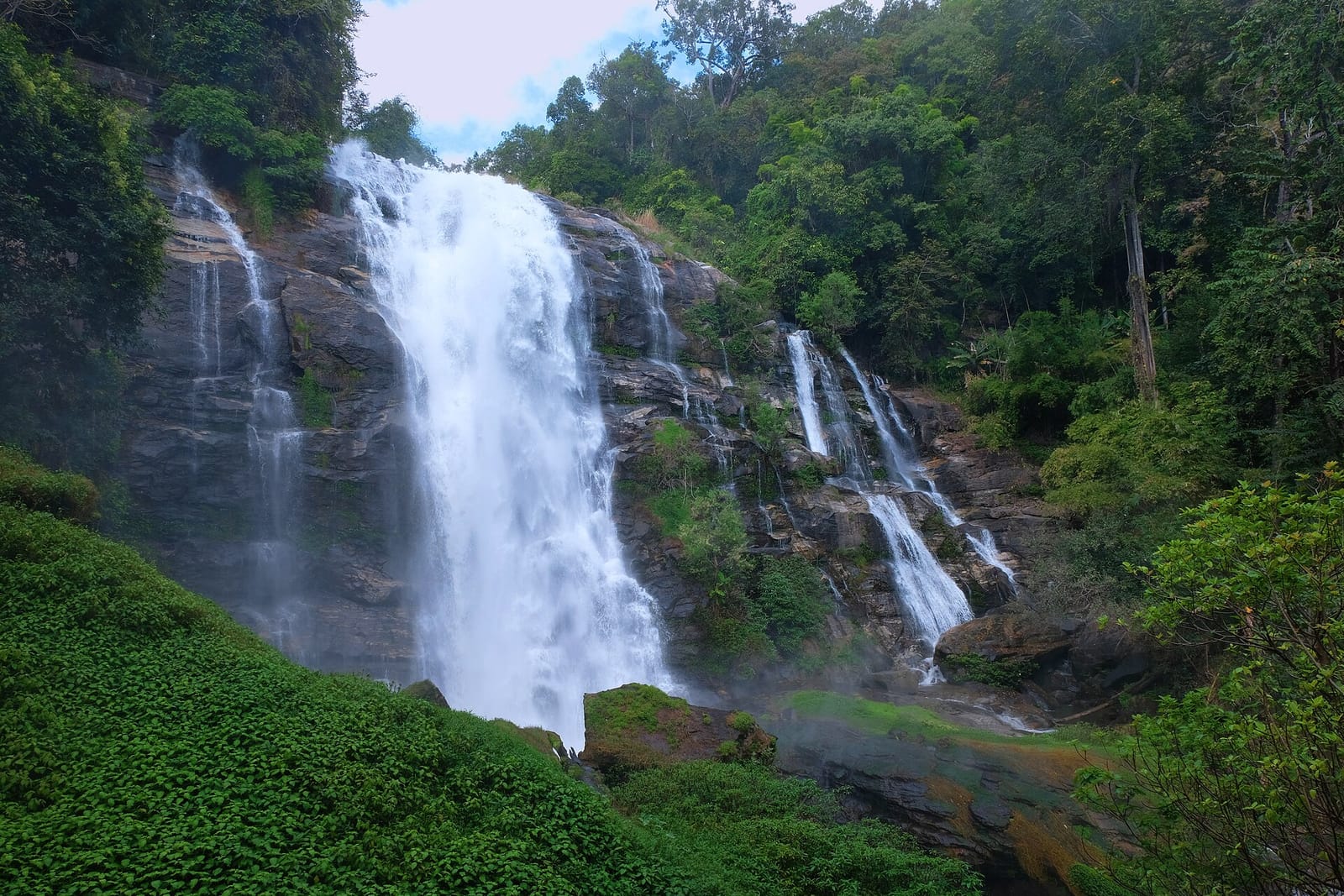
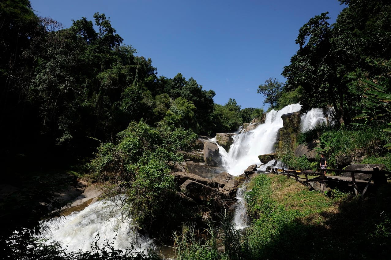
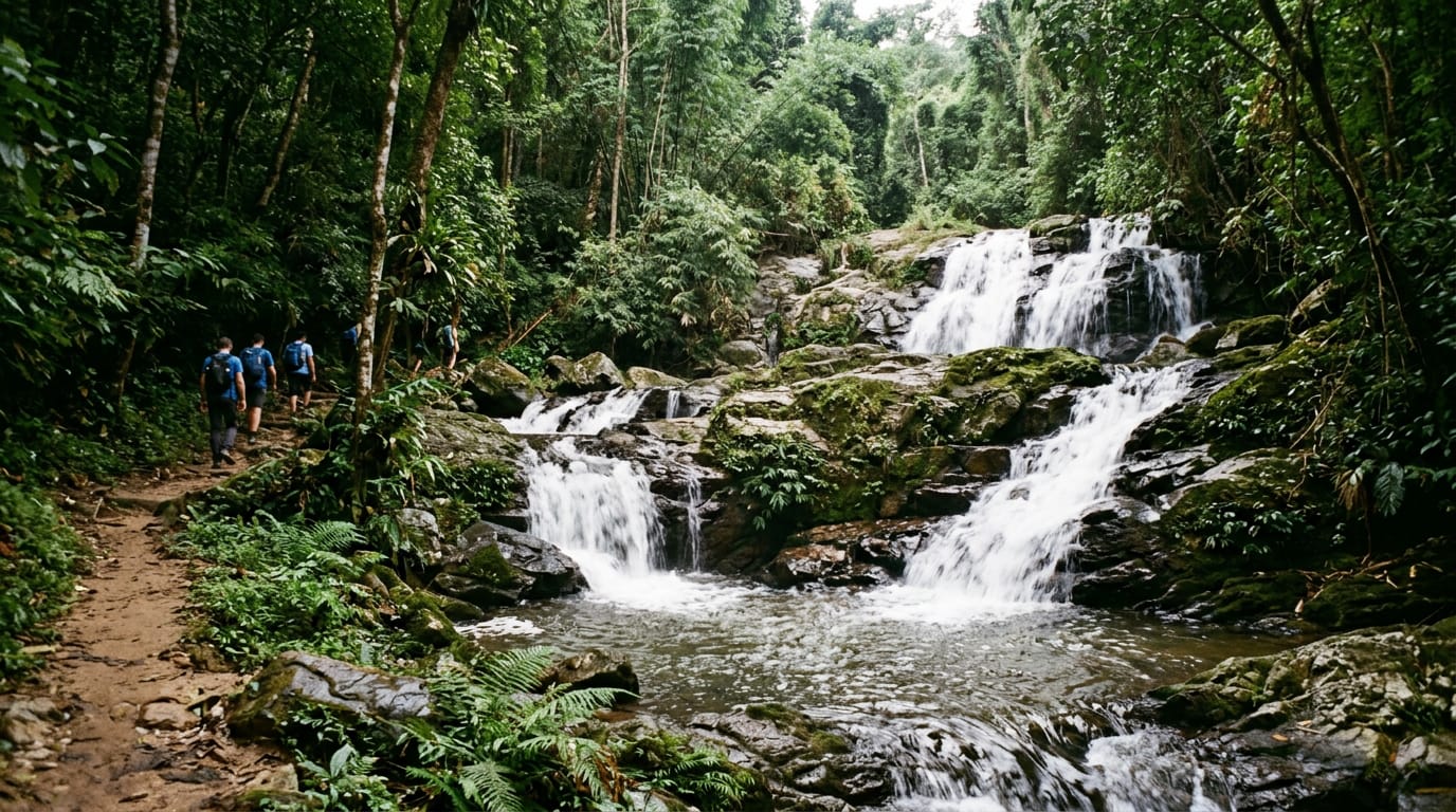
Wachirathan waterfall
Wachirathan is the most powerful waterfall in the park and the one you should not skip if pressed for time. The fall drops in a single 40 m curtain into a deep plunge pool and throws a constant mist 100 m downwind, which catches the late-morning light to produce reliable rainbows. The viewing platform is a two-minute walk from the car park; a steeper path goes down to a lower platform where the spray will soak you in seconds.
Mae Klang waterfall
Mae Klang is the first waterfall, just inside the lower gate. It is broader and lower than Wachirathan, dropping in a series of basalt steps that are popular for paddling. Several Thai restaurants line the access road. Pay the park fee here at the main checkpoint.
Karen and Hmong villages
The lower slopes belong to Karen villages; the upper slopes from about 1,200 m to the summit are Hmong. Both have shops on the road. The Hmong village of Khun Klang at the royal project sells fresh-roasted Arabica coffee grown on the mountain, strawberries in season (December–February), avocados and home-made jam. The Royal Project research station next to the village is open to visitors and produces some of the best cool-climate produce in Thailand.
How to visit
Most people visit Doi Inthanon as a long day trip from Chiang Mai. There are four ways to do it.
Private car or driver is the easiest. A rental car costs 800–1,200 baht per day with insurance; a car with driver from a hotel is 2,500–3,500 baht for the day. Drive south on Route 108 for 58 km to the town of Chom Thong, turn right onto Route 1009 at the signposted junction, and climb 31 km to the summit. The road is sealed, two lanes wide and well graded; second gear is needed for several long pulls but no special technique is required. Allow 1.5 to 2 hours each way without stops, 3 hours with the waterfalls.
Organised group tours run from every Old City guesthouse at 1,000–1,400 baht per person and cover the standard loop: Mae Klang waterfall, royal pagodas, Ang Ka boardwalk, summit marker, Wachirathan waterfall, Hmong village. They leave around 07:00 and return about 19:00. Park fees are usually extra (300 baht).
A private songthaew (red shared-pickup taxi) can be hired from Chang Phueak gate for 2,500–3,000 baht for the day for up to ten people. This works well for small groups and lets you set the schedule.
Scooter is possible but only sensible for confident riders. The climb is long, the descent demands continuous engine braking, and the road is busy with tourist vans. A 150 cc bike is the minimum; a 50 cc step-through will struggle. Allow extra time and start early.
Parking is free at every waterfall, the royal pagodas, the summit car park and the Hmong market. The waterfalls and the summit are not connected by a hiking path; you drive between them.
Entry is paid in cash at the main gate on Route 1009 about 8 km up from Chom Thong. The booth issues a paper ticket; keep it because some of the upper checkpoints will ask to see it. The royal pagoda fee (50 baht) is paid separately at that car park.
Fees and opening hours
The park is open 05:30 to 18:30 every day. The gate stays open later for those already inside; you can leave after 18:30.
Foreigner adult entry is 300 baht; foreigner child 150 baht. Thai adults pay 50 baht. Vehicles are charged separately: 30 baht per car, 20 baht per motorbike. The royal pagoda fee is 50 baht per person, paid at that car park. Kew Mae Pan guide is 300–400 baht per group, paid at the trailhead.
The Ang Ka boardwalk and the summit marker are included in the park fee. Mae Klang, Wachirathan and Siriphum waterfalls are also included.
A two-day camping permit costs 30 baht per person plus tent rental from 150 baht; sites are at Khun Klang near the Hmong village.
What to bring and wear
Layers. The base of the mountain can be 30 °C while the summit sits at 12 °C and a wet Kew Mae Pan ridge feels colder still. A light fleece and a packable waterproof are essential between November and February.
Closed walking shoes. The Ang Ka boardwalk is fine in sandals; Kew Mae Pan needs grip. The waterfalls have slippery rocks if you intend to swim.
Cash in baht for the gate, the pagodas, the guide and food. Card payment is not available anywhere inside the park.
A water bottle (refillable from village shops), sunscreen and a hat for the open ridge, and a head torch if you plan to camp.
Best season
November to February is the ideal window. Skies are clear, waterfalls still run high from the end of the rains, summit temperatures sit at 8–15 °C and the royal-pagoda gardens are at their peak. December and January are the busiest months; book a driver or tour a day or two ahead at weekends and over Christmas / New Year.
March to May is hotter, drier and hazier; the lowlands can hit 38 °C while the summit stays cool, but burning-season smoke between mid-February and late April can flatten the views. Kew Mae Pan is open until May.
June to October is the rainy season. Waterfalls are at their most spectacular, the cloud forest is dripping and beautiful, but Kew Mae Pan is closed, the upper road can be foggy and waterfall trails are slippery.
Where to eat nearby
Inside the park, the Hmong village of Khun Klang has the widest choice: noodle shops, fresh-brewed coffee at the Royal Project café, strawberry shakes in season and a clutch of family-run rice-and-curry restaurants. The royal pagoda car park has a small food court with the same standard menu. The Wachirathan car park has a single noodle stall and a coffee kiosk.
On Route 1009 at the lower park boundary, Krua Doi Inthanon serves northern Thai classics (khao soi, nam phrik num, fried local catfish) under a thatched roof; mains 80–150 baht. Just below the gate in Chom Thong, Khao Soi Mae Sai is a long-standing local favourite for breakfast on the way up.
Combine with…
Doi Inthanon pairs naturally with the Doi Inthanon nature trail hike, which extends the Kew Mae Pan loop with the Pha Dok Siew waterfall trail through Karen coffee plantations on the way down. Both can be done in a single day if you leave Chiang Mai by 06:30.
For visitors with a second day in the area, stop at Op Luang Gorge on the drive back to Chiang Mai — the Mae Chaem river squeezes through a 30 m slot canyon 25 km west of Chom Thong on Route 108 and the short walk down to the suspension bridge is one of the best free attractions in northern Thailand. The road also passes the Inthanon Highland Resort, which is the only mid-range accommodation inside the park boundary.
If you have a third day, the Doi Suthep mountain above Chiang Mai is a complementary trip: a much shorter drive, the famous summit temple, the royal winter palace and a Hmong village at the top, all reachable in half a day from the Old City.
Photos
Frequently asked questions
What is the highest point in Thailand?
The summit of Doi Inthanon at 2,565 metres above sea level is the highest point in Thailand. A stone marker, a small shrine and a sign reading Highest Point in Thailand sit at the top, reachable by a short paved walk from the upper car park.
How much is Doi Inthanon entry?
Foreign adults pay 300 baht and children 150 baht at the main park gate, plus 30 baht per car or 20 baht per motorbike. Thai nationals pay 50 / 20 baht. The ticket covers all sites inside the park boundary except the royal pagodas, which cost an extra 50 baht per person.
Can I drive to the summit of Doi Inthanon?
Yes. A sealed road runs all the way from Route 108 at Chom Thong up to a car park 200 metres below the summit. Cars and motorbikes are allowed; the gradient is steep in places but well maintained. From the upper car park a paved path leads to the summit marker and the Ang Ka boardwalk.
Are the nature trails open year-round?
The Ang Ka boardwalk at the summit is open every day. The Kew Mae Pan ridge trail is open only from November to May because it cuts through breeding habitat for rare birds; a Karen guide is required and is hired at the trailhead for 300–400 baht per group.
How long is the drive from Chiang Mai to Doi Inthanon?
Around 70 km via Route 108 to Chom Thong, then Route 1009 up the mountain. Allow 1.5 to 2 hours each way in a car, longer in a songthaew or on a scooter. Most tours leave the Old City at 07:00 and return after dark.
What waterfalls are inside the park?
The three main waterfalls are Mae Klang at the base, Wachirathan halfway up (the most powerful, with constant mist) and Siriphum just below the royal pagodas. All three are signposted and have car parks within 100 metres of the falls themselves.
Is it cold at the summit?
Yes. The summit averages 8–12 °C between November and February and can drop below freezing overnight in December and January, when frost on the grass is a local attraction. Bring a fleece or windproof jacket year-round; daytime temperatures rarely exceed 20 °C even in April.
Can I visit the royal pagodas?
Yes. The two chedis, Naphamethanidon and Naphaphonphumisiri, sit on a ridge at 2,200 m with terraced flower gardens. Entry is 50 baht. The pagodas are open 07:00–17:00. A short flight of steps connects the two; the gardens are at their peak from December to February.
Do I need a guide for Kew Mae Pan?
Yes, a Karen guide from the village at the trailhead is mandatory. The loop is 2.5 km, takes about 90 minutes and costs 300 baht per group of up to ten people. Guides do not speak much English but the path is the attraction, not commentary.
Are there places to eat inside the park?
Yes. Simple Thai noodle stalls and rice restaurants cluster around the royal pagoda car park, the Wachirathan waterfall, the Mae Klang entrance and a couple of viewpoints on the way up. Karen and Hmong villages sell coffee, strawberries and grilled corn from roadside stalls.
Related guides
Sight
Doi Suthep
Doi Suthep is the 1,676 m mountain that rises straight out of the western suburbs of Chiang Mai. The mountain holds the city's most photographed temple at 1,073 m, the king's winter palace, a Hmong village near the summit and several waterfalls — and is a separate destination from the temple of the same name, which sits on its flank.
Sight
Mae Sa Valley
Mae Sa Valley is the green corridor that runs north-west of Chiang Mai along Route 1096, the first leg of the Samoeng loop. The 30 km stretch packs in a ten-tier waterfall, orchid farms, a botanic garden, ziplines and ethical elephant sanctuaries — most notably Elephant Nature Park, the country's best-known refuge for retired working elephants.