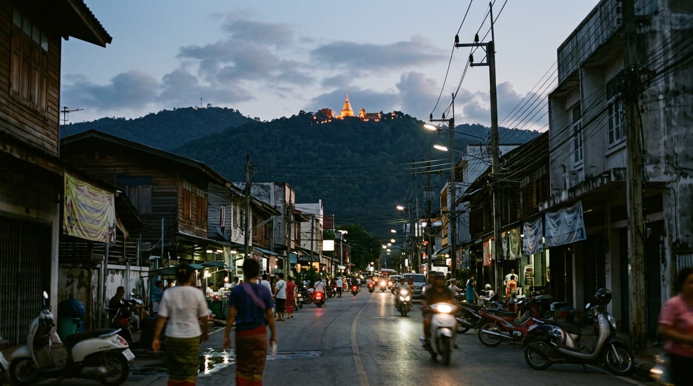
Doi Suthep is the 1,676 m mountain that rises straight out of the western suburbs of Chiang Mai. The mountain holds the city's most photographed temple at 1,073 m, the king's winter palace, a Hmong village near the summit and several waterfalls — and is a separate destination from the temple of the same name, which sits on its flank.
Updated
What it is
Doi Suthep is the mountain that walls off the west side of Chiang Mai. From almost anywhere in the Old City you can look up Ratchadamnoen Road and see a long forested ridge rising 1,400 m straight out of the suburbs to a summit of 1,676 m. The same ridge gives the city its weather: the prevailing south-westerly winds dump their rain on the western slope, which is why the mountain is wrapped in evergreen broadleaf forest while the plains below are dry deciduous.
The first thing to be clear about is the name. Doi Suthep is the doi (mountain). Wat Phra That Doi Suthep is the famous gilded temple on the mountain’s flank, two-thirds of the way up at 1,073 m. The two get confused constantly. Both belong on a Chiang Mai itinerary, but they are separate places, and the mountain has plenty above the temple: the king’s winter palace, a Hmong village at the summit, several waterfalls, and the most accessible cloud forest in the country.
The entire mountain and its neighbour Doi Pui sit inside Doi Suthep–Pui National Park, 261 km² declared in 1981. The park boundary starts on the western edge of the city, roughly at the entrance to Chiang Mai University grounds. The road that climbs the mountain, Route 1004, was built in 1934 by villagers carrying their pickaxes up the trail of the wandering monk Khruba Srivichai. There is a bronze statue of him at the foot of the mountain where the climb begins.
For visitors, Doi Suthep is the easiest big nature trip from Chiang Mai. You can be at the temple from the Old City in 35 minutes and back in time for lunch, or string the temple, palace, summit and a waterfall into a full half-day with a driver.
Highlights
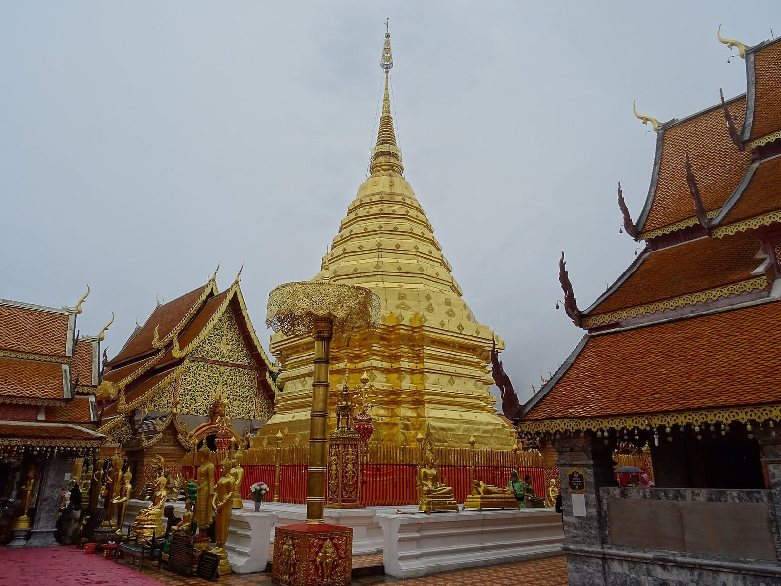
Wat Phra That Doi Suthep
The temple at 1,073 m is covered in detail on its own page, so a short summary here. It was founded in 1383, climbed via a 306-step naga-balustrade staircase (or by funicular for 30 baht), and centres on a gilded chedi that contains a relic of the Buddha. The terrace beside it is the most-photographed viewpoint in northern Thailand, looking east over Chiang Mai. Foreigner admission 30 baht.
Bhubing Palace
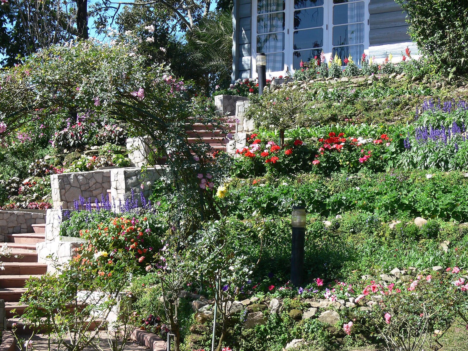
Bhubing Palace, four kilometres above the temple on the road to the summit, is the official winter residence of the Thai royal family. It was built in 1961 and is used annually from January to early March, when the gardens are closed to the public. For the rest of the year the formal gardens are open 08:30–11:30 and 13:00–15:30 for 50 baht.
The gardens are the reason to visit: a 50-hectare formal landscape with roses, ferns, hydrangeas and a small bamboo collection laid out on terraces with the residence buildings behind. The buildings themselves are never open. Dress code is enforced at the gate: shoulders and knees covered, no leggings, no see-through fabric. Sarongs can be rented for 15 baht.
Doi Pui Hmong village
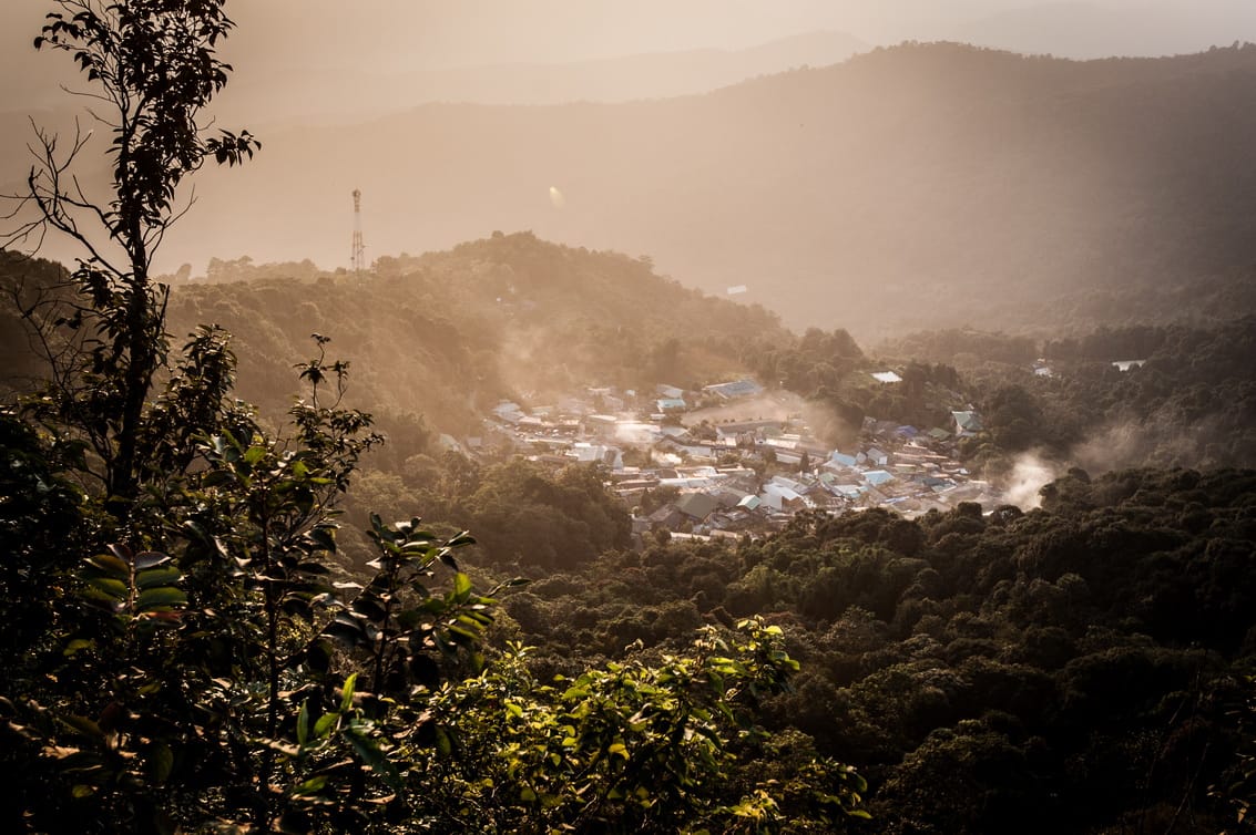
At the end of Route 1004, eight kilometres above the palace, the Hmong village of Ban Doi Pui sits in a saddle between Doi Suthep proper and Doi Pui peak at 1,685 m. The village is touristy in the practical sense (most of the main street is craft stalls selling Hmong embroidery, indigo cloth and silver jewellery), but the families are local and the textiles are the real thing.
A small museum behind the school has displays on Hmong agriculture and traditions (20 baht). A short signposted trail leads from the village to a viewpoint above the cloud, and a longer path drops back to the temple via the ridge; see the Doi Pui to Doi Suthep hike. The village also has good cool-climate fruit in season: strawberries from December to February, peaches in May.
Viewpoints
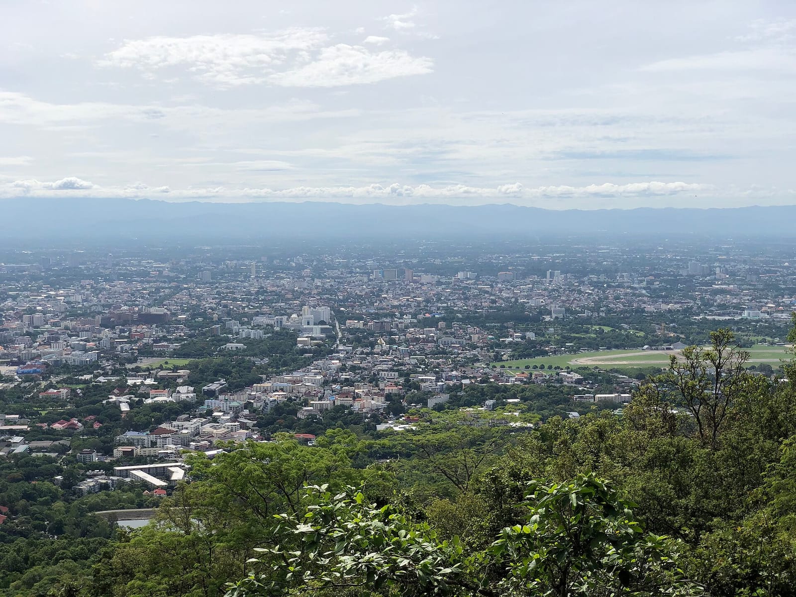
The temple terrace is the famous viewpoint, looking east over Chiang Mai. From up here you can pick out the moat of the Old City as a square 700 m on a side, the Ping river snaking south past the airport, and on a clear day the rim of the Mae Tha valley 30 km east.
The second viewpoint sits on the ridge above Bhubing Palace, signposted San Ku, at 1,400 m. It looks south-east over the same plain but from twice the height; the air is usually cooler and clearer. A third sits at the Doi Pui village on the western ridge and looks the other way, into the Samoeng valley.
Waterfalls
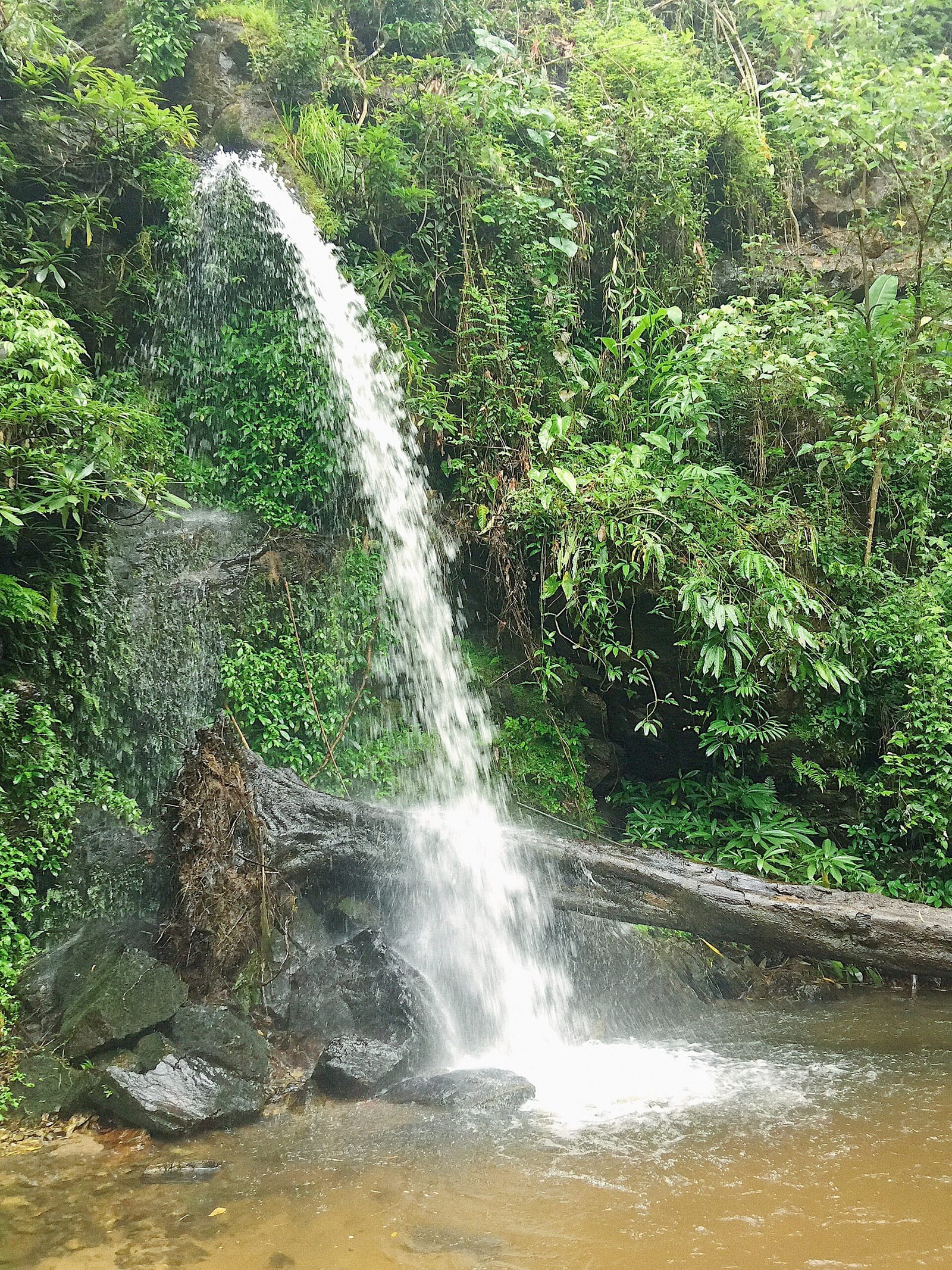
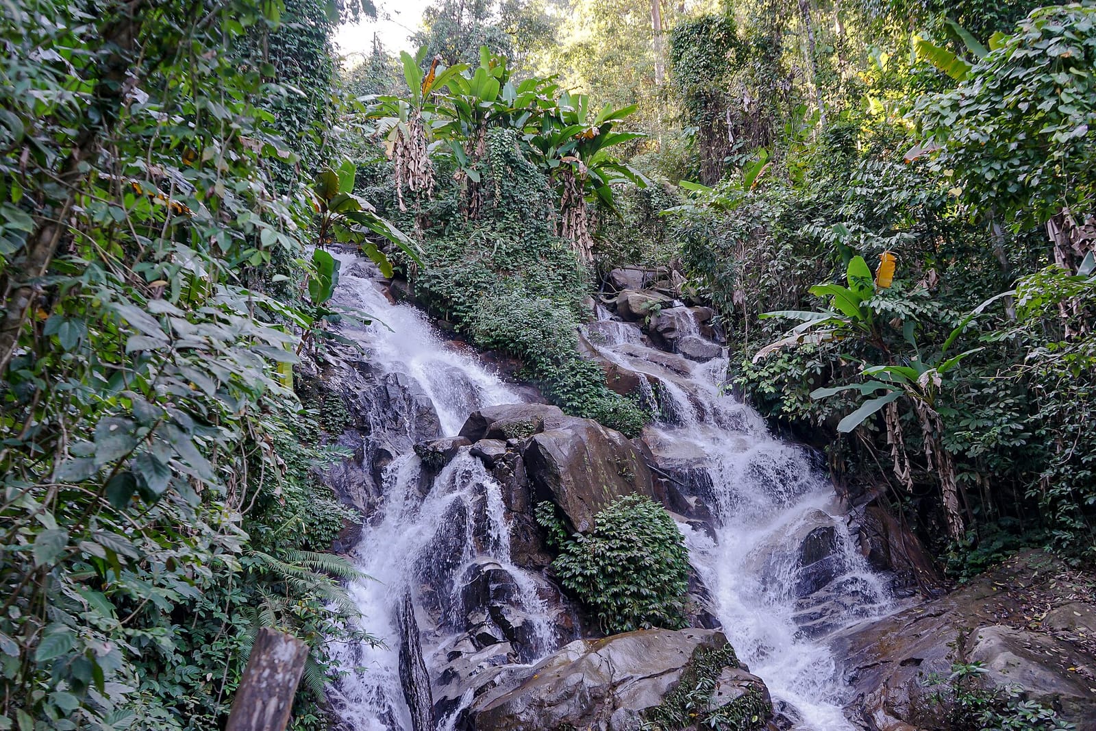
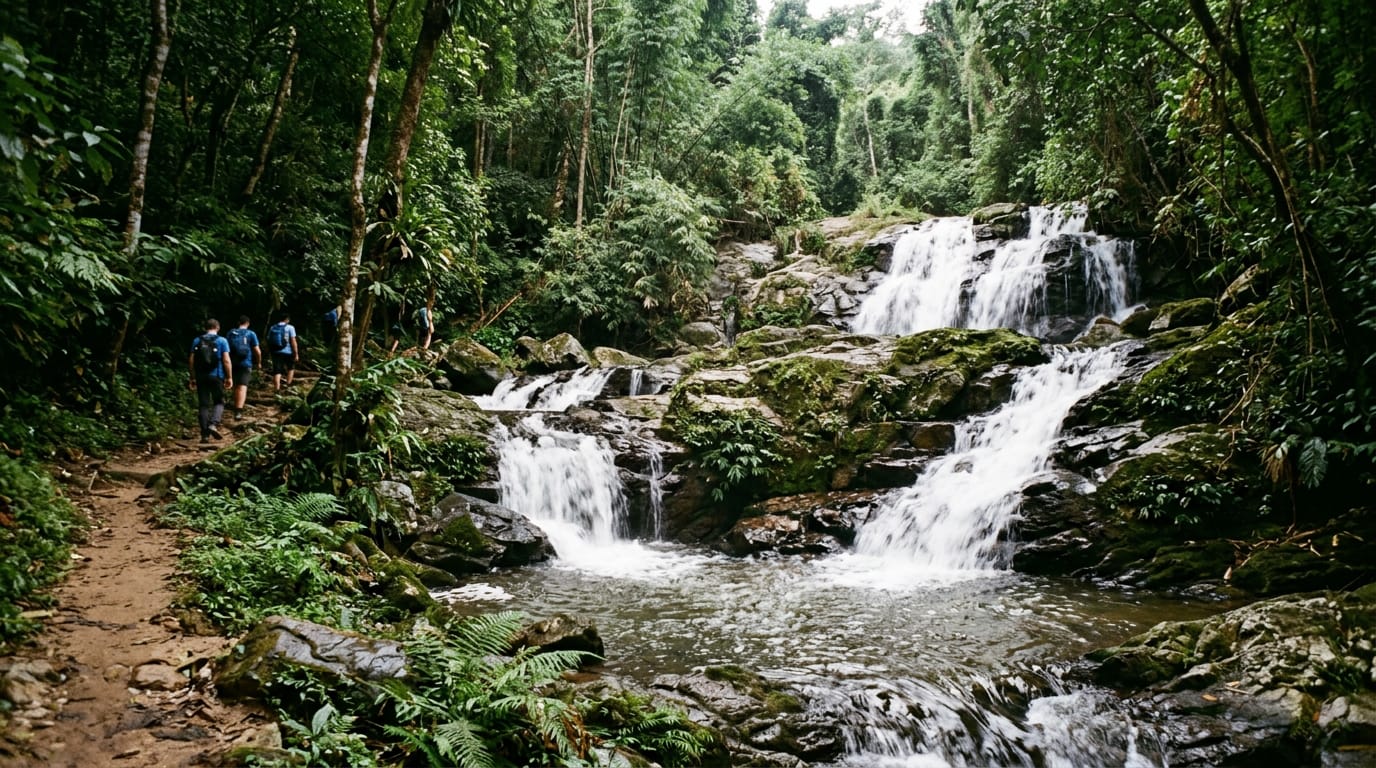
Three waterfalls on the mountain are worth a stop. Huay Kaew is the easiest: a 10 m fall at the base of the mountain, accessed from a small car park off Huay Kaew Road one kilometre west of the zoo, free entry. Monthathan is the prettiest, halfway up, a 30 m drop in evergreen forest reached by a 500 m forest walk; included in the 200 baht national park fee. Sai Yoi sits inside the park boundary near the summit and is smaller but uncrowded.
Wat Pha Lat
Wat Pha Lat is the forgotten middle temple of Doi Suthep, halfway up the Monk’s Trail at about 600 m. It is small, quiet, mossy and built into the side of a stream that flows over a flat rock platform. The Burmese-influenced naga staircase and chedi feel like a different temple from the gold-plated wat above; the monks here run a meditation programme and ask visitors to keep voices low. Free entry.
How to visit
The mountain is 15 km west of the Old City via Huay Kaew Road, past Chiang Mai University and the zoo, then up Route 1004’s switchbacks. There are five ways to get up.
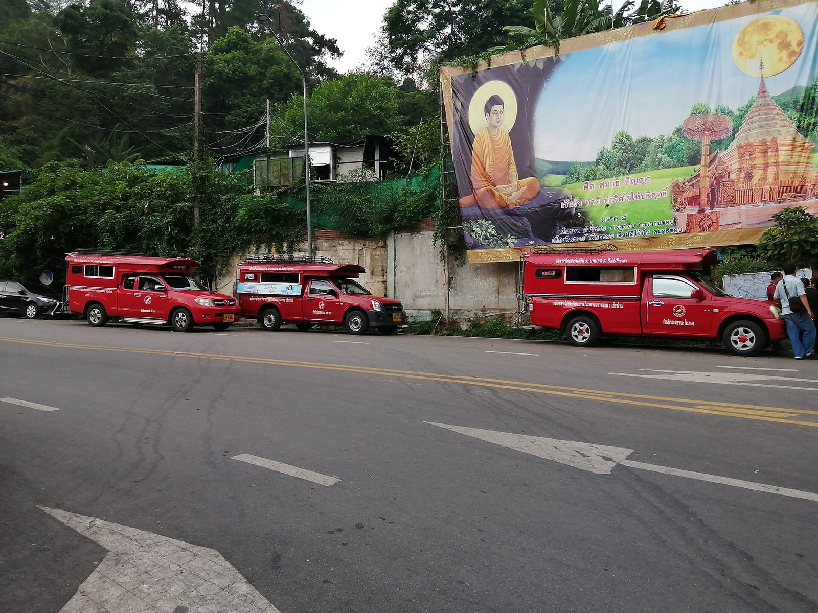
Red songthaew from Chang Phueak gate or the zoo entrance is the cheapest. The drivers run a shared service to the temple for 50 baht per person (minimum 8 passengers, fills quickly during the day) or a private hire for 600 baht return. To go all the way to Doi Pui village, expect 800–1,000 baht private return with two hours at the top.
Grab or Bolt private hire is reliable from the Old City to the temple for 250–400 baht one way; many drivers will not wait at the top, so book a separate return.
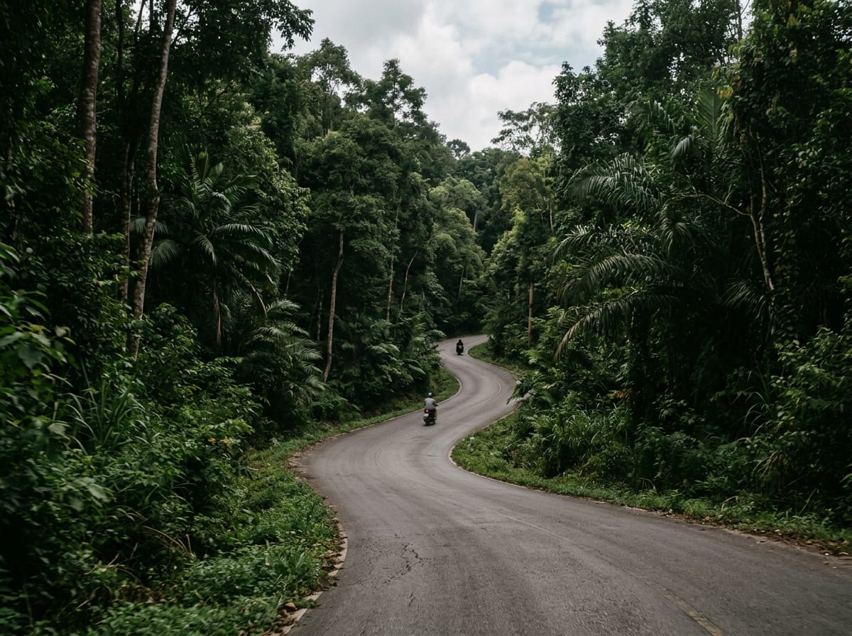
Private car or motorbike rental gives the most flexibility. Cars 800–1,200 baht per day; 150 cc scooter 250–350 baht per day. The road is sealed, two lanes wide and busy. Confident scooter riders manage the climb without issue; use engine braking on the long descent.
Organised tours combine the mountain with elephant camps, Mae Sa Valley or Doi Inthanon. Half-day Doi Suthep–only tours run from 600 baht per person.
The Monk’s Trail (1.5 hours one way to the temple) starts behind the back gate of Chiang Mai University on Suthep Road. Look for orange cloth tied to trees marking the path. The standard plan is to walk up and take a songthaew down.
Parking is paid at the temple (20 baht for cars, 10 baht for bikes), free at Bhubing Palace, paid at Doi Pui village (40 baht).
The 200 baht national park entrance fee is collected at a single gate on Route 1004 about 800 m above the temple, on the way to the palace. If you visit only the temple you do not pay it. The temple itself takes a separate 30 baht. Bhubing Palace is a further 50 baht at its own ticket office.
Fees and opening hours
Park gates 05:00 to 18:00; the road technically stays open later for those already inside but the palace and summit gates close at sunset.
Wat Phra That Doi Suthep is open 06:00 to 20:00 every day. Foreigner admission 30 baht. The funicular costs 30 baht each way.
Bhubing Palace gardens are open 08:30–11:30 and 13:00–15:30 daily, year-round except when the royal family is in residence (usually 5 January to 25 March, dates vary; check before going). Entry 50 baht.
The national park gate above the temple charges 200 baht foreigner adult, 100 baht child, plus 30 baht per car. Doi Pui Hmong village has a separate 40 baht parking charge.
What to bring and wear
The temple and palace require shoulders and knees covered. A sarong or light long-sleeved shirt over a t-shirt works for both; sarongs are rented at both gates for 15–20 baht. Shoes come off at the temple, so slip-on sandals are easier than laced shoes.
The summit is 10–15 °C cooler than the Old City. In November to February evenings at Doi Pui village can drop to 8 °C; bring a fleece. The road can be foggy and damp; a light waterproof is useful in the rainy season.
Cash in baht for the gates, food and the songthaew. Card readers exist at the temple shops but are unreliable.
A water bottle, sunscreen for the viewpoints, and a small torch if you stay for sunset and walk down to a waiting car park.
Best season
The mountain is good year-round. November to February is the prime window: cool, clear, dry, with the cleanest views down to the city. December–January nights at the summit can drop below 10 °C.
March to mid-May is hot in the city but cooler on the mountain; burning-season haze between mid-February and late April can reduce visibility from the temple to a few hundred metres. Check air quality before driving up for the view.
June to October is the rainy season. Afternoons bring heavy showers; mornings are usually clear. The forest is at its lushest, the waterfalls are at full flow and the cloud forest above the palace lives up to its name. The road is well drained but be cautious on the descent in heavy rain.
Where to eat nearby
At the temple, a string of stalls and small restaurants opposite the staircase serves khao soi, fried rice and noodle soup for 60–100 baht. Better food is found just down the road at Khao Soi Mae Sai Doi Suthep (an outpost of the famous noodle shop) and at the cluster of Lanna-style restaurants on the right as you climb out of the city near the Suthep Road junction.
At Bhubing Palace, the only option is a coffee kiosk in the car park. At Doi Pui village, several Hmong-run noodle and rice shops cluster on the main street; Khao Phad Bpu fried-crab rice is the local recommendation. Strawberries and strawberry shakes are everywhere in season.
For a proper meal after coming down, Rustic & Blue on Nimmanhaemin Road (15 minutes’ drive from the temple) serves farm-to-table northern Thai food made from produce grown on the mountain itself.
Combine with…
The obvious pairing is the mountain plus its famous temple: Wat Phra That Doi Suthep sits a third of the way up the same road. Most visitors do both in a single half-day; the gate for the national park (and the palace) is only 800 m above the temple, so the marginal cost of carrying on to the summit is small.
The serious option is to walk the ridge: the Doi Pui to Doi Suthep hike takes about four hours one way along the spine of the mountain, with a finish back at the temple’s funicular station. A driver drops you at the Hmong village in the morning and picks you up at the temple in the afternoon.
For a flatter second half of the day, Chiang Mai Zoo sits at the foot of the mountain on the way back into town and adds the two giant pandas if children are part of the trip. For a full nature day in the area, Mae Sa Valley is the parallel valley over the back ridge, reached via the Samoeng loop road.
Photos
Frequently asked questions
Is Doi Suthep the same as Wat Phra That Doi Suthep?
No. Doi Suthep is the mountain west of Chiang Mai, rising to 1,676 m. Wat Phra That Doi Suthep is the famous gilded temple at 1,073 m on the mountain's eastern flank — about two-thirds of the way up. The mountain has plenty more above the temple: the king's winter palace, a Hmong village at the summit and several waterfalls.
How far is Doi Suthep from Chiang Mai Old City?
The temple is 15 km west of the Old City; the summit and Hmong village are about 22 km. Driving the winding road takes 30–40 minutes to the temple and another 30 minutes to the summit.
Can I hike up Doi Suthep?
Yes. The Monk's Trail starts behind Chiang Mai University and climbs through forest to Wat Pha Lat (about 45 minutes), then continues to the main temple (another 60–90 minutes). For the summit itself, the Doi Pui ridge trail starts at the Hmong village. See our [Doi Pui to Doi Suthep hike](/hiking/doi-pui-to-doi-suthep/) page for the full route.
Is the palace open to the public?
Bhubing Palace gardens are open 08:30–11:30 and 13:00–15:30 when the royal family is not in residence — usually closed January to early March. The residence buildings themselves are never open. Entry is 50 baht; dress code is strict (no shorts above the knee, no sleeveless tops).
How much does it cost to enter Doi Suthep National Park?
The national park entrance fee of 200 baht for foreign adults applies at the gates above the temple — on the road up to Bhubing Palace and the summit. The temple itself is in a separate enclave below the gate and only charges its own 30 baht admission for foreigners.
What is the elevation of Doi Suthep?
The true summit of Doi Suthep is 1,676 m. The neighbouring peak Doi Pui, where the Hmong village sits, is 1,685 m and is technically a few metres higher. The famous temple is at 1,073 m, two-thirds of the way up.
Can I see Chiang Mai from Doi Suthep?
Yes. The viewpoint terrace beside the temple has the iconic view east over the city, the airport and the Ping river. Mornings give the clearest air; sunset is the best light but can be hazy in the dry season. There is a second viewpoint at the Doi Pui ridge above the summit.
What is the best time of day to visit Doi Suthep?
For the temple, arrive before 09:00 to beat the tour buses or after 16:00 for the sunset crowd. For the palace, mornings on a clear day. For the summit and Hmong village, any time between 09:00 and 16:00.
Are there waterfalls on Doi Suthep?
Yes. Huay Kaew is the closest — a 10 m fall at the base of the mountain just off Huay Kaew Road, free entry. Monthathan, halfway up, is the prettiest, with a 30 m drop in evergreen forest; entry is included in the 200 baht national park fee.
Do I need to dress conservatively for the mountain?
Conservative dress is required only at the temple and the palace: shoulders and knees covered, no see-through fabric. The viewpoints, the Hmong village and the trails have no dress code. Carry a sarong or light shirt if you plan to visit the temple later in the day.
Related guides

Sight
Doi Inthanon
Doi Inthanon is the highest mountain in Thailand, rising to 2,565 m about 70 km south-west of Chiang Mai. The national park around it bundles twin royal pagodas, cloud forest boardwalks, tiered waterfalls, Karen and Hmong villages and the famous Kew Mae Pan ridge trail into a single full-day trip from the city.
Sight
Mae Sa Valley
Mae Sa Valley is the green corridor that runs north-west of Chiang Mai along Route 1096, the first leg of the Samoeng loop. The 30 km stretch packs in a ten-tier waterfall, orchid farms, a botanic garden, ziplines and ethical elephant sanctuaries — most notably Elephant Nature Park, the country's best-known refuge for retired working elephants.
Sight
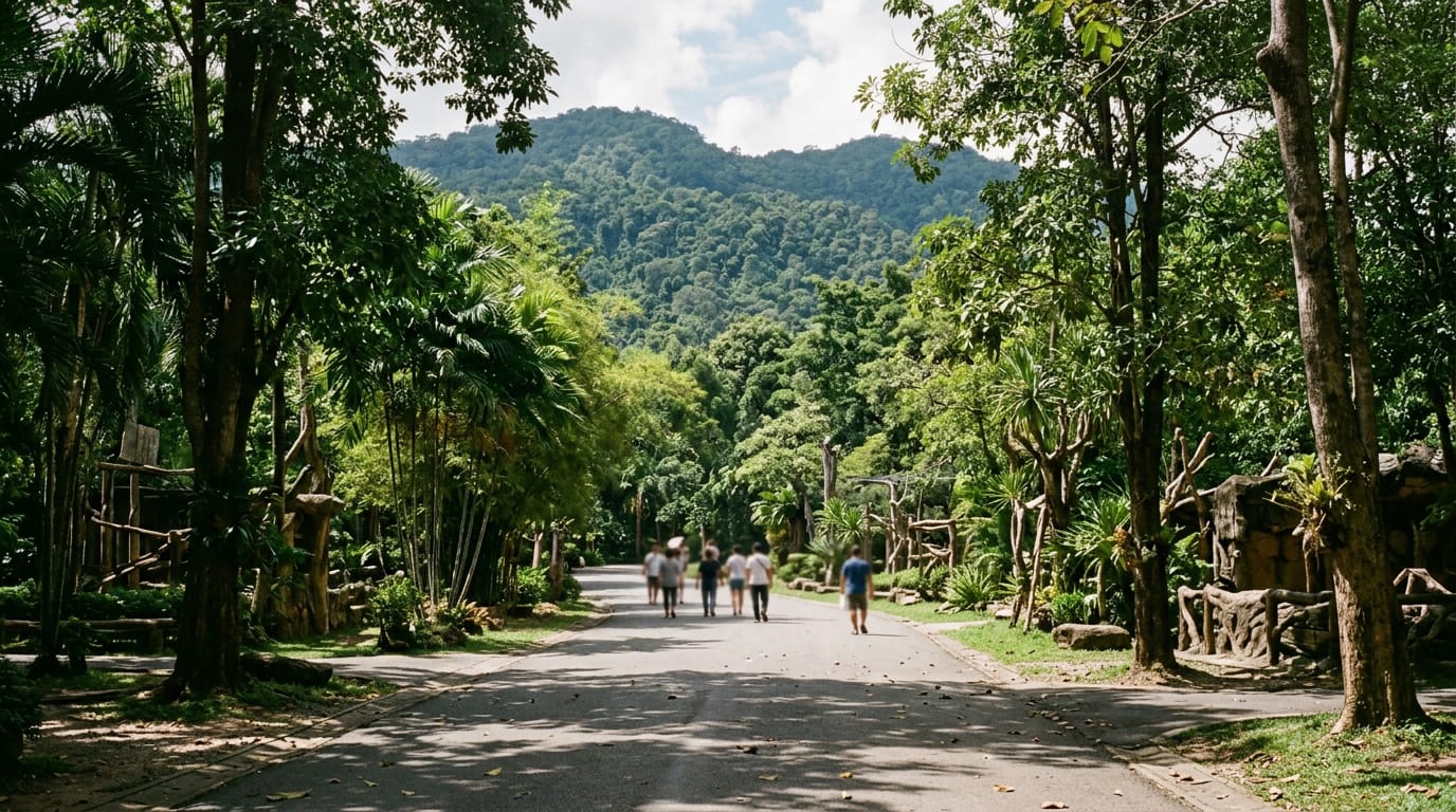
Chiang Mai Zoo
Chiang Mai Zoo sits at the foot of Doi Suthep, just outside the Old City, and is one of only a handful of zoos outside China to host giant pandas. The 81-hectare site sprawls up a forested hillside with around 400 species, an aquarium, a panda house and a tram service that handles the climb between the lower and upper enclosures.